$85.00 CAD
– Sold Out| /
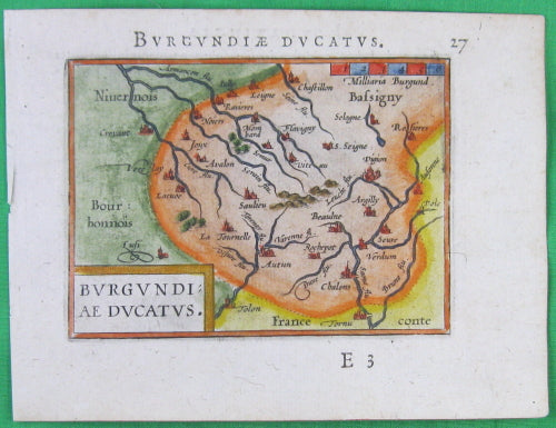
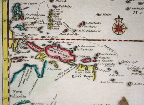
Originale carte,gravure de cuivre colorée, par Abraham Ortelius de l'Atlas de poche:'Épitome theatri Orteliani. Nova...


$625.00 CAD
| /
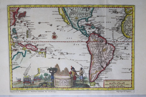
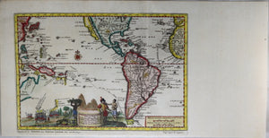
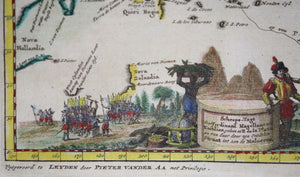
Visually appealing map illustrating the voyage of Magellan from Spain, through the Straits of Magellan...

$40.00 CAD
| /
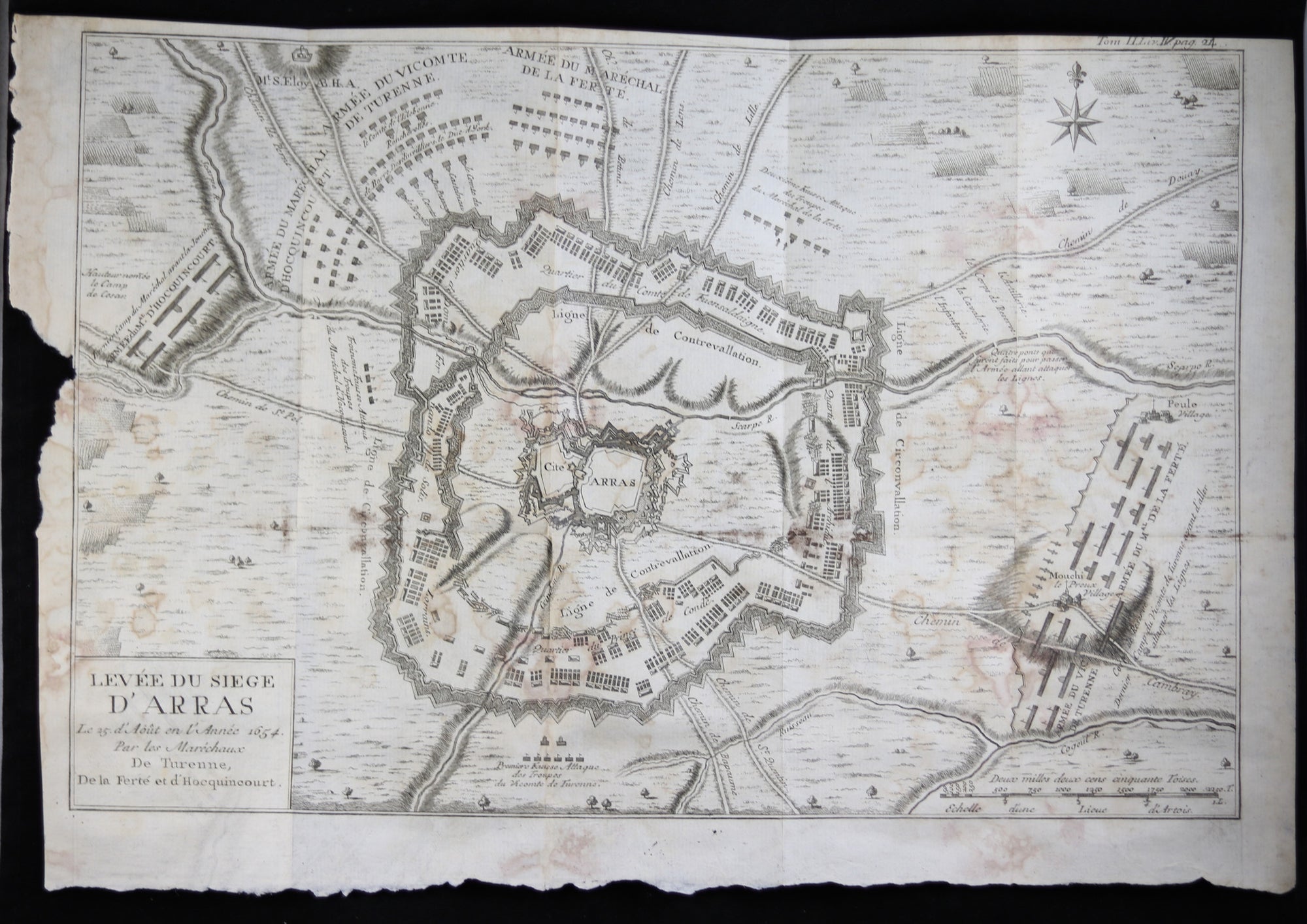
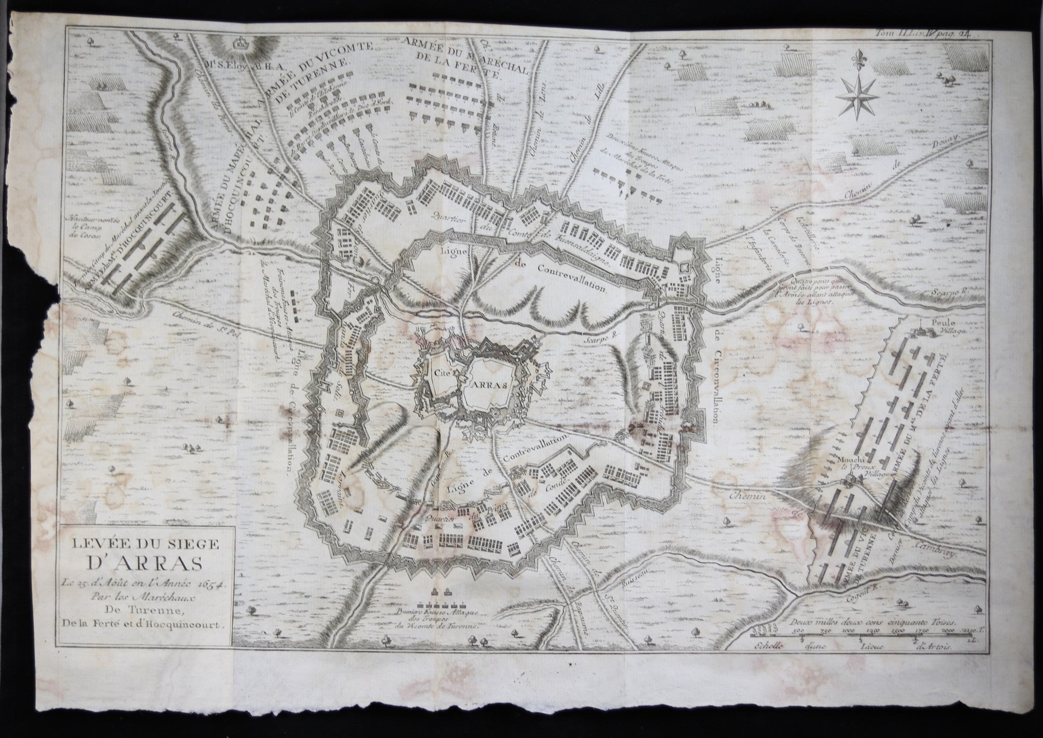
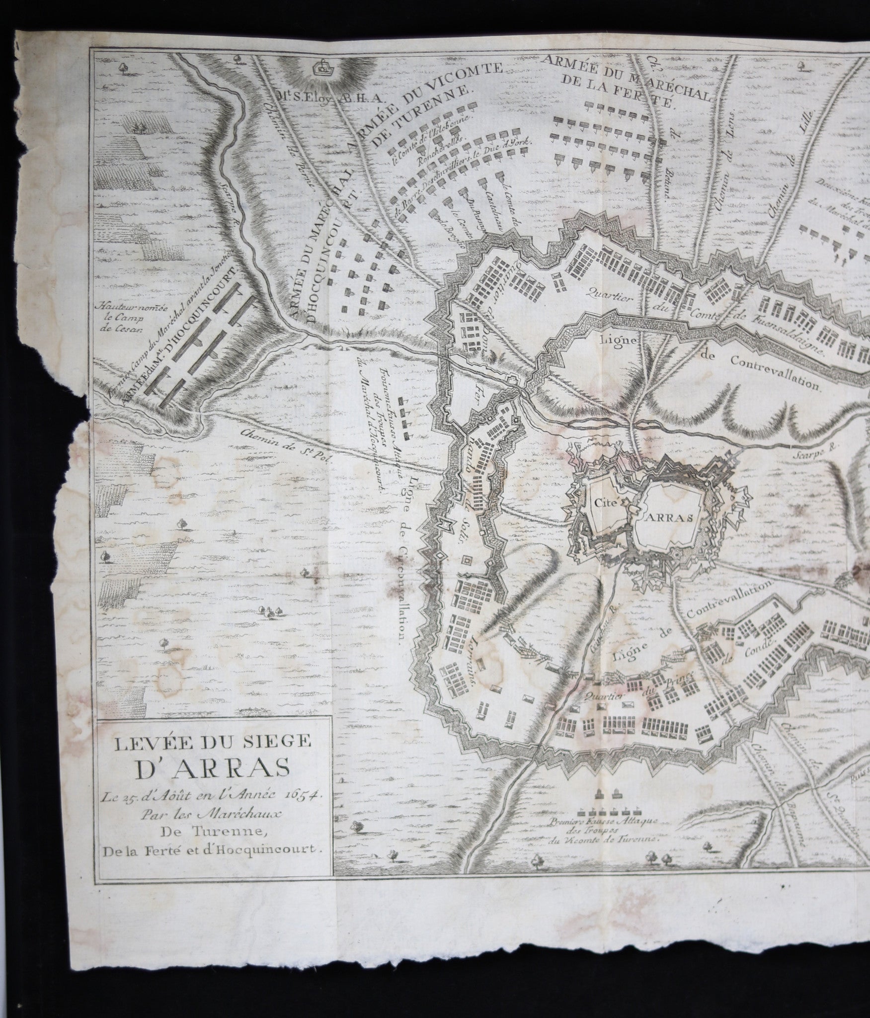
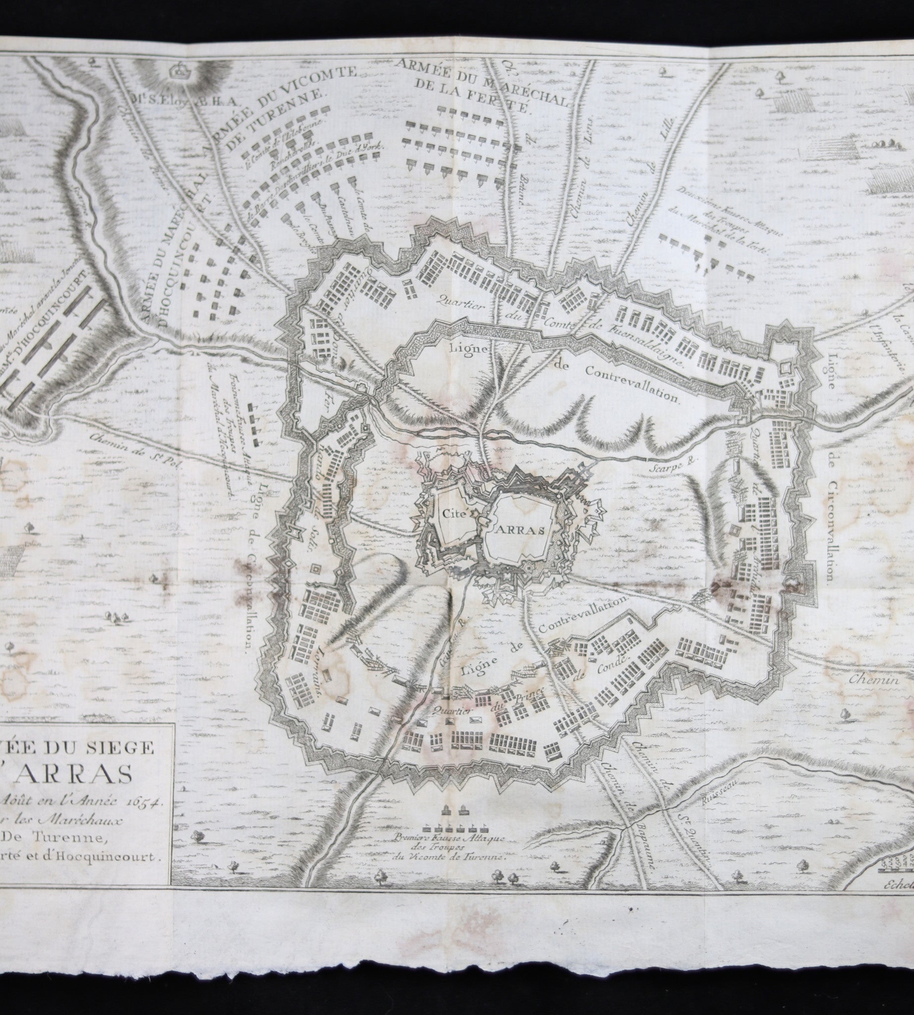
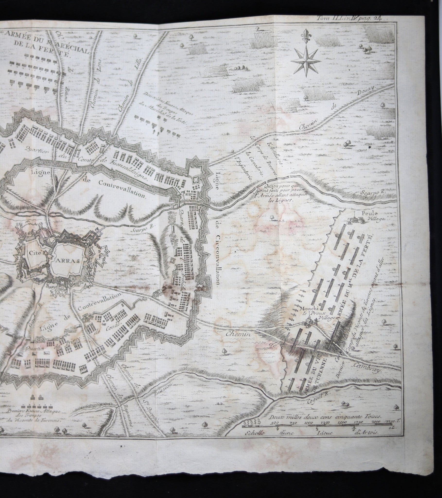
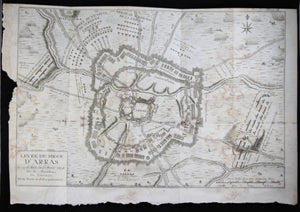
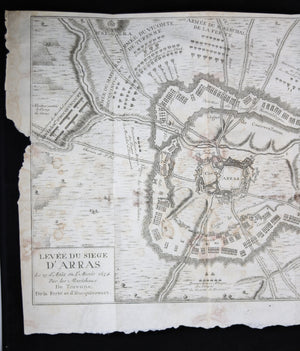
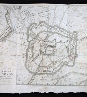
'Levée du Siege d'Arras Le 25 d'Août en l'Année 1654, par les Marécheaux DeTurenne, De...
$40.00 CAD
| /
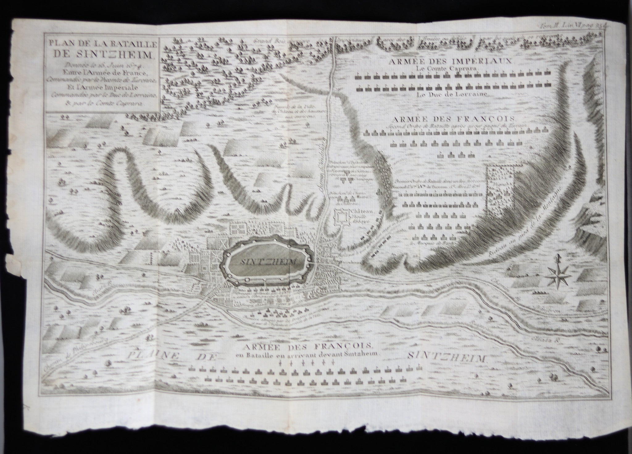
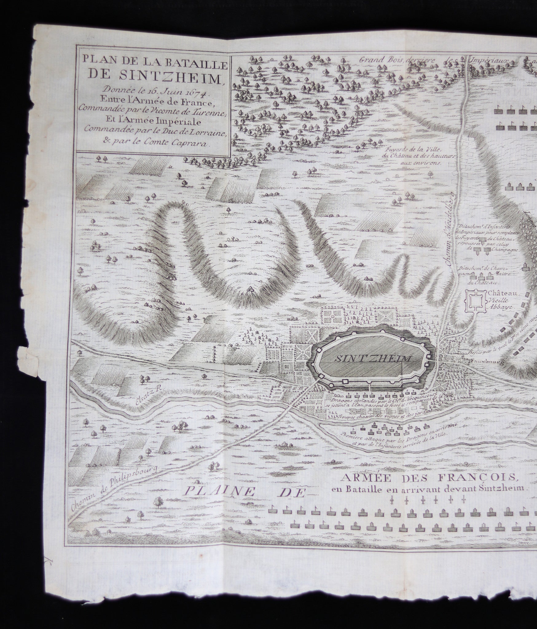
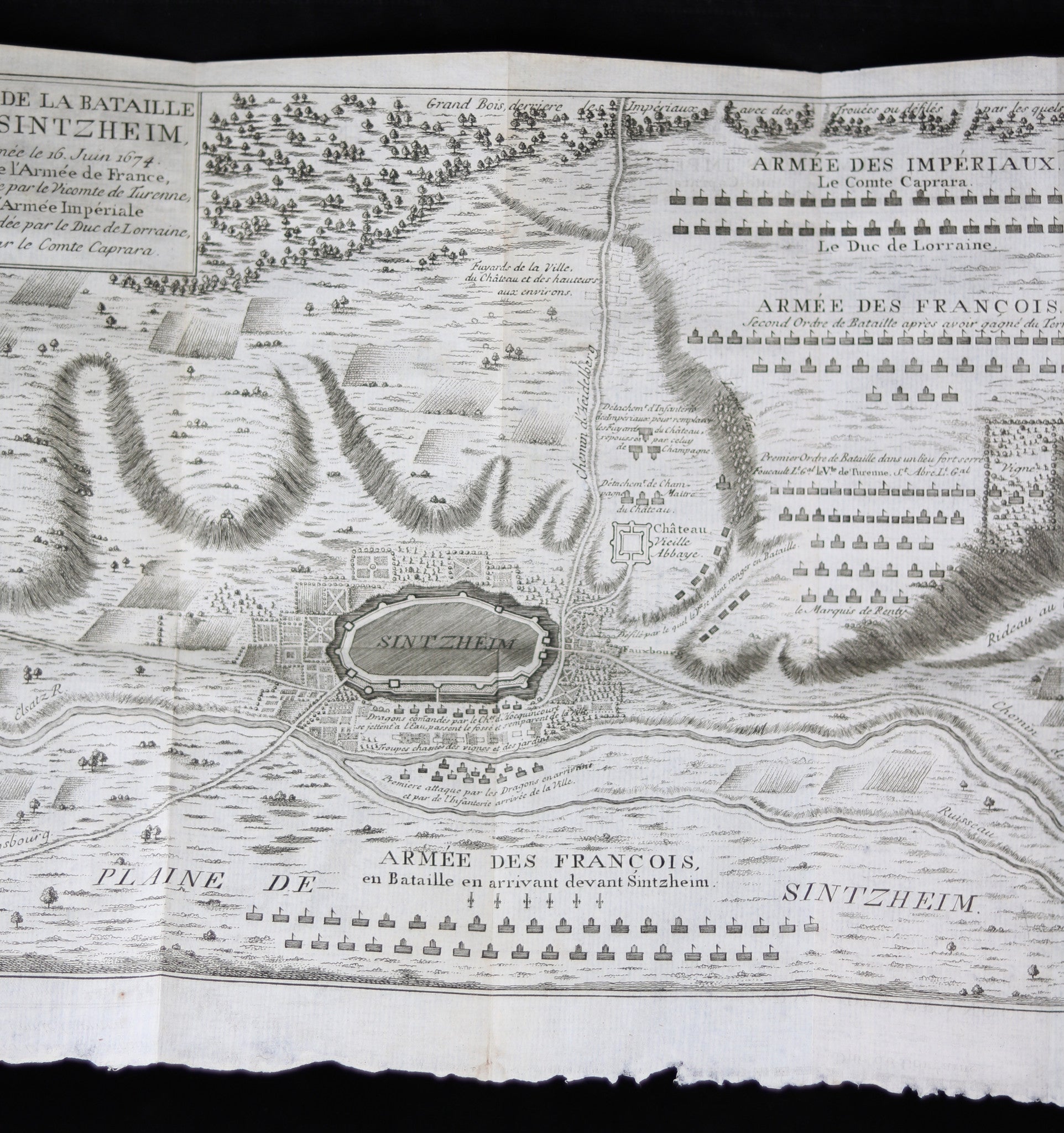
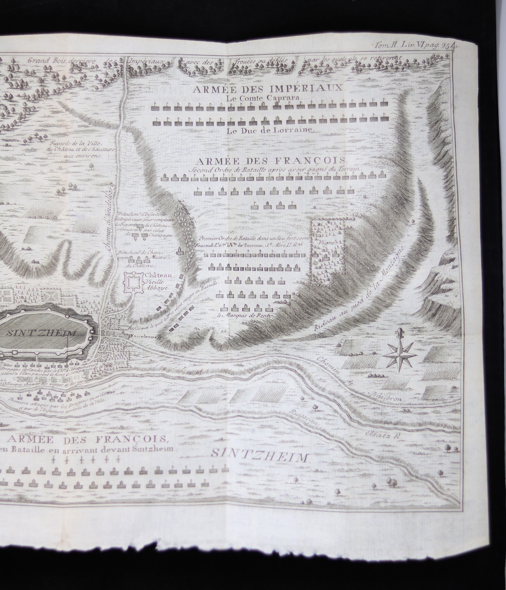
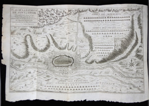
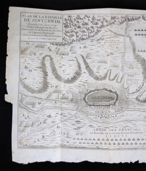
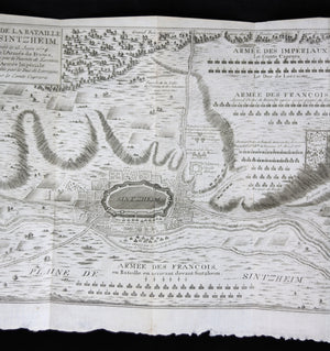
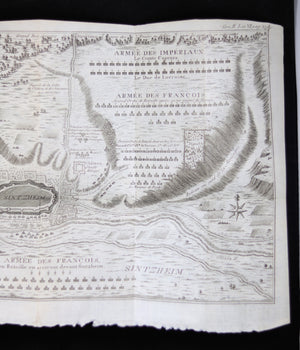
'Plan de la bataille de Sintzheim donnée le 16 juin 1674, Entre l'Armée de France,...

$40.00 CAD
| /
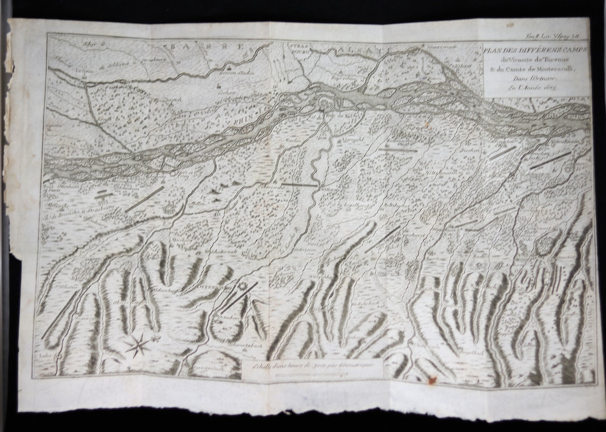
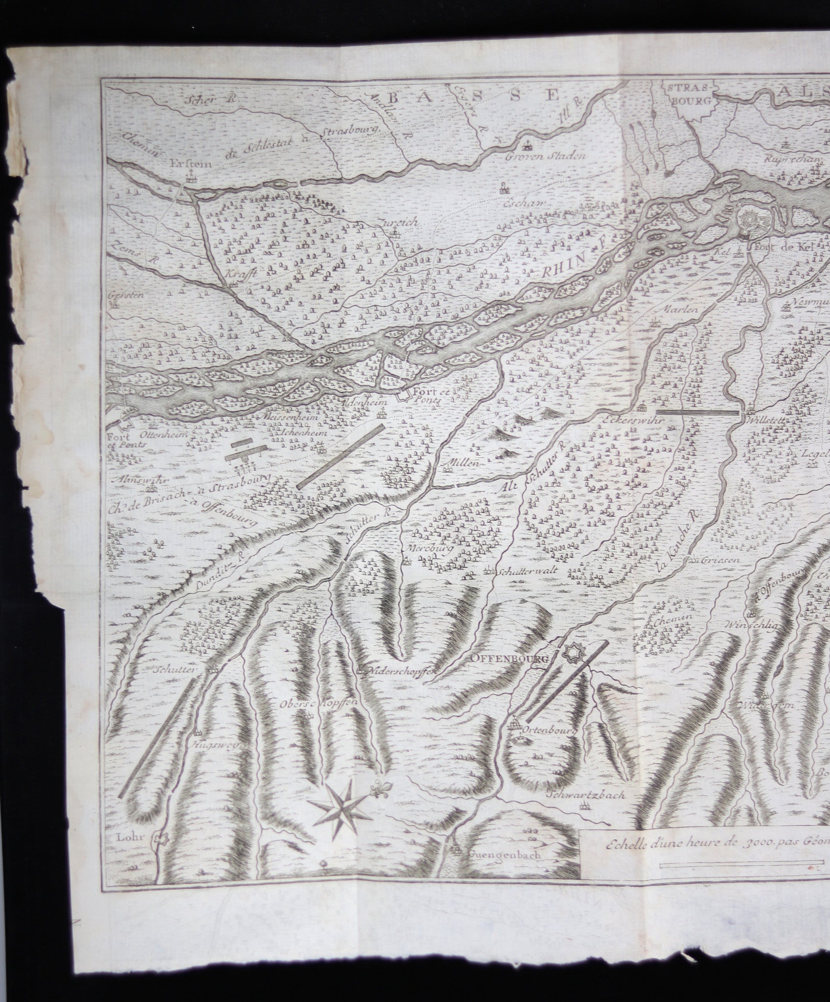
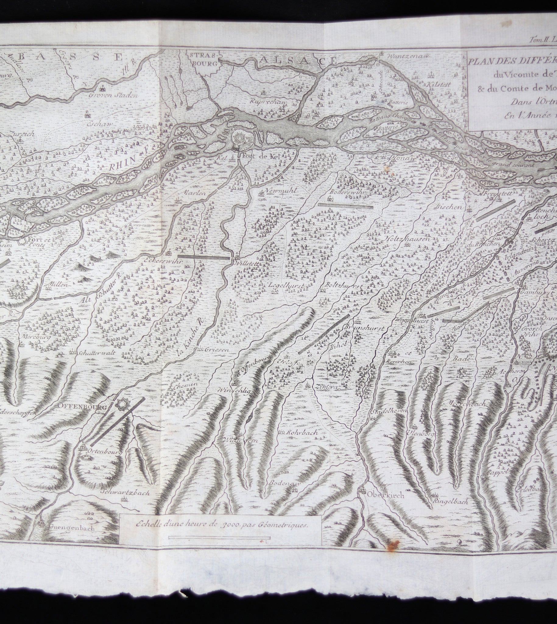
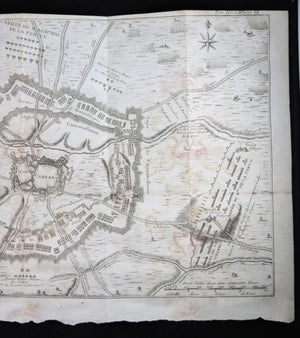
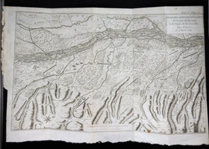
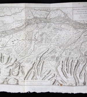
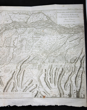
'Plan des Différens Camps du Vicomte de Turenne & du Comte de Montecuculli Dans l'Ortnaw,...


$325.00 CAD
| /
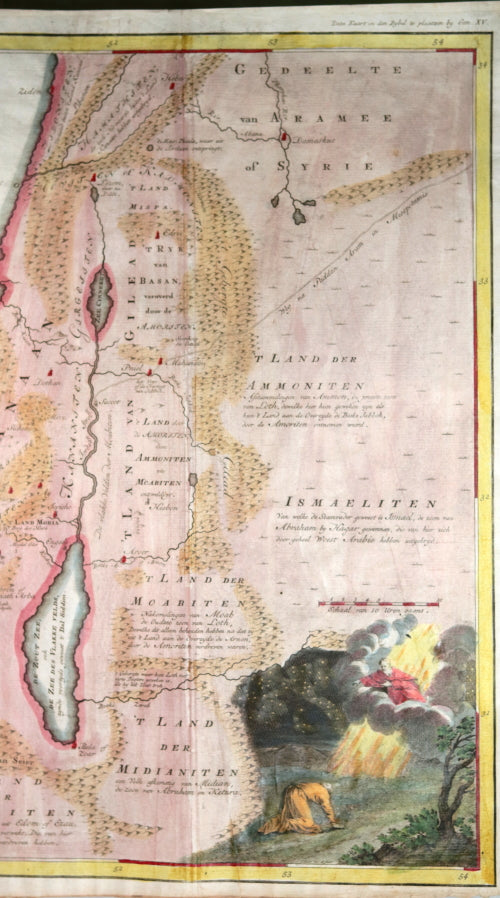
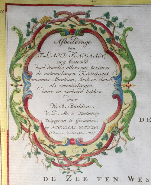
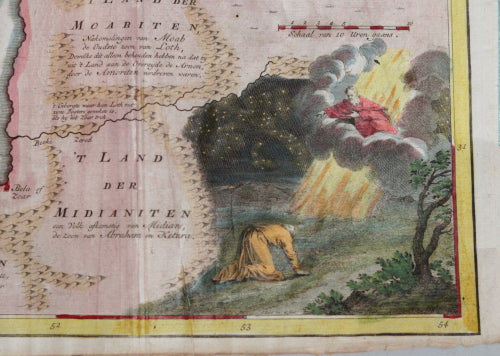
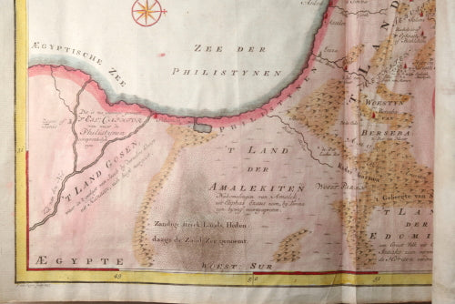
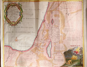
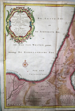
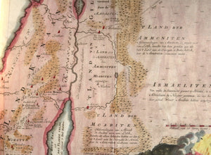
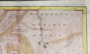
Large-size hand-colored map of Canaan before its conquest by the Israelites. Created by Willem Bachiene,...

$125.00 CAD
| /
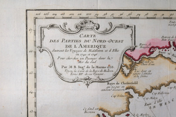
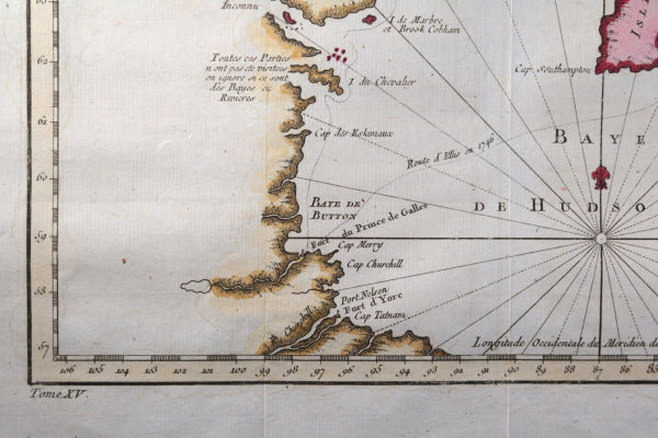
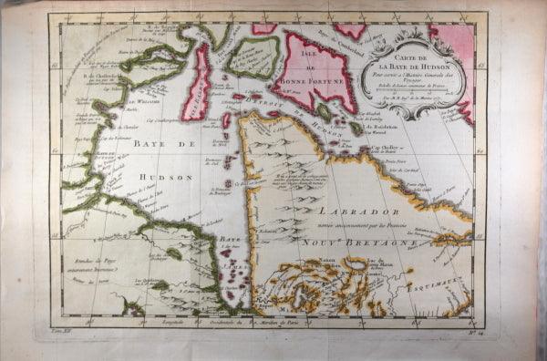
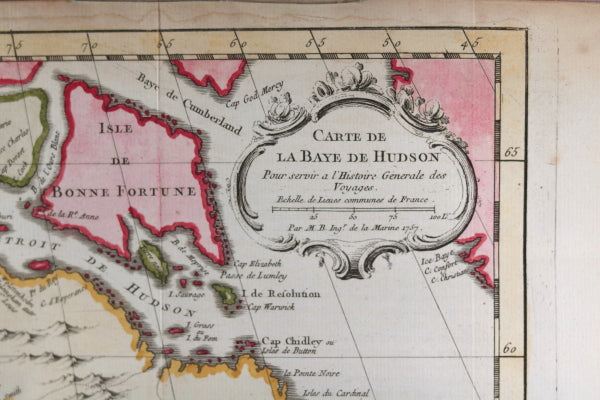
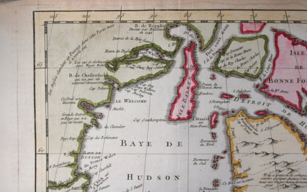
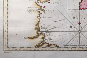
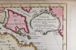
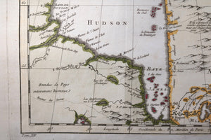
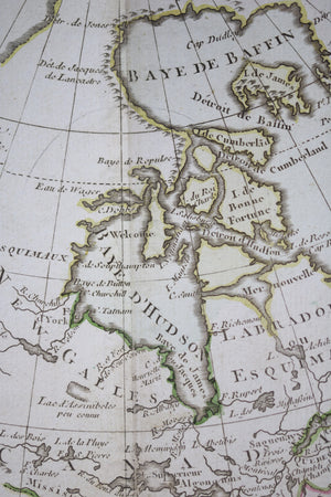
Hand-coloured map of the Hudson Bay area of Northern Canada. Shows Fort Prince of Wales...

$250.00 CAD
| /
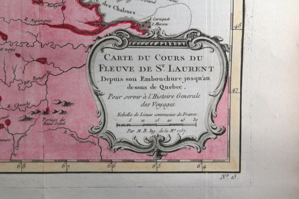
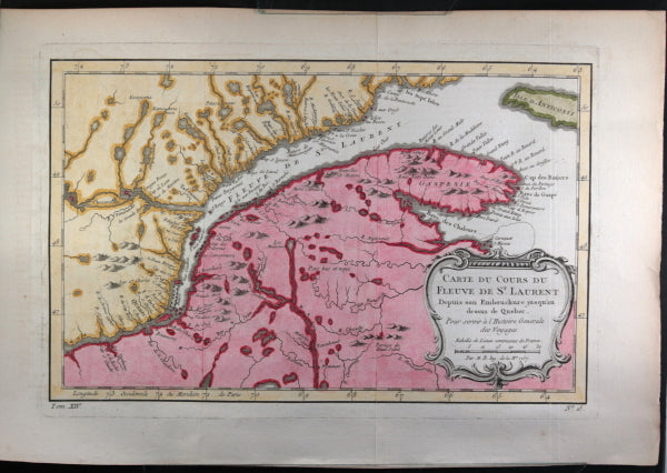
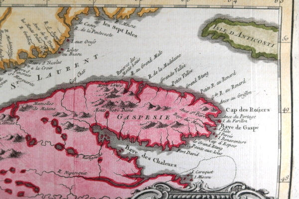
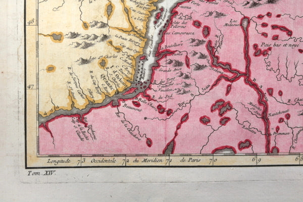
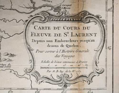
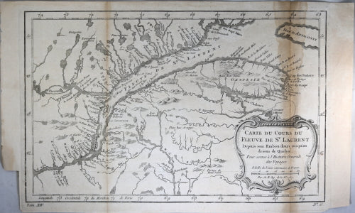
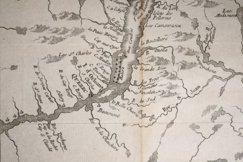
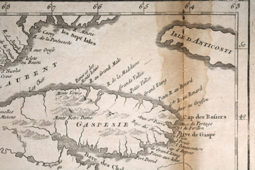
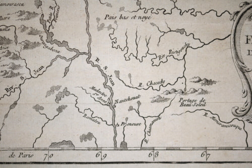
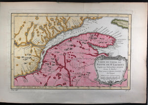
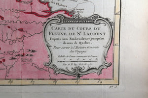
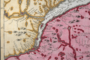
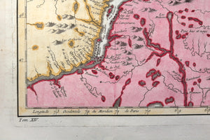
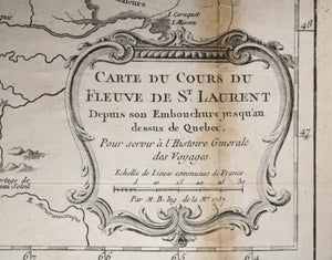
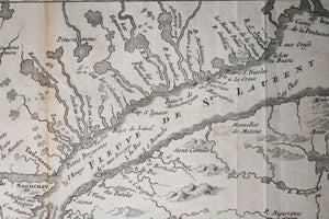
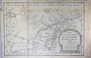
Hand-coloured map of the St. Lawrence river from Anticosti Island and Gaspé peninsula to Quebec...


$200.00 CAD
| /
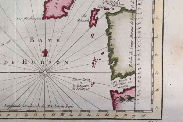
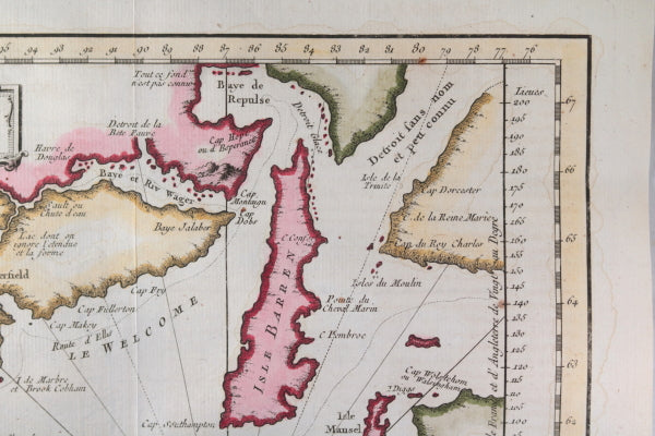
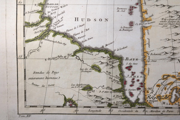
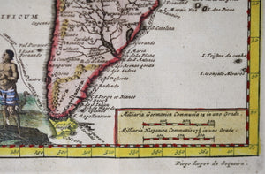
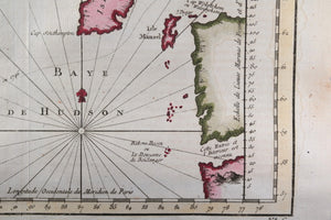
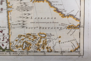
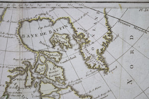
Hand-coloured map of the Hudson Bay area of Northern Canada. Shows Hudson Bay, James Bay,...

$245.00 CAD
| /
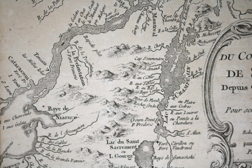
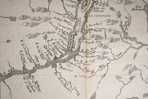
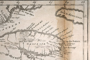
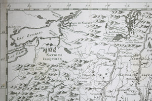
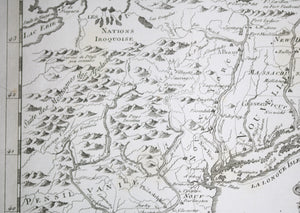
Map of the St. Lawrence river from Anticosti Island and Gaspé peninsula to Quebec City....


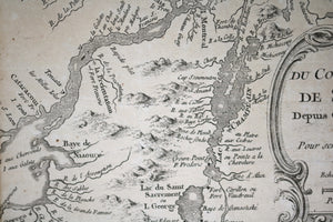
$250.00 CAD
| /
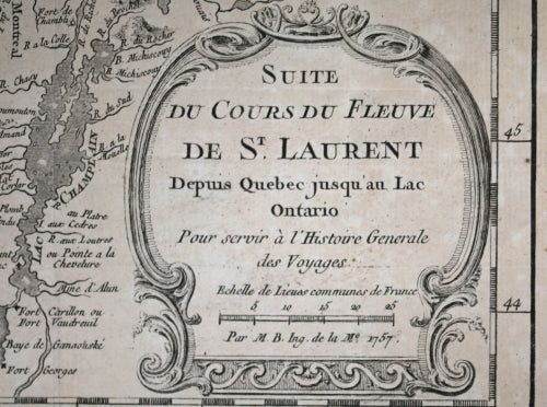
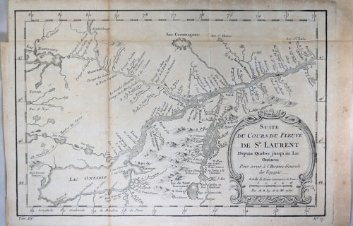
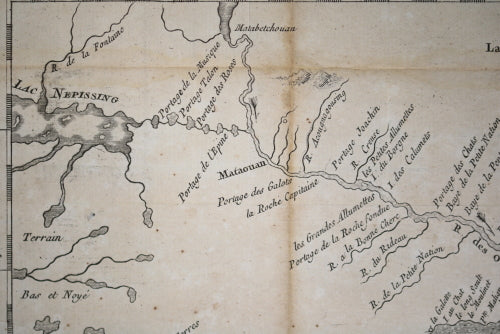
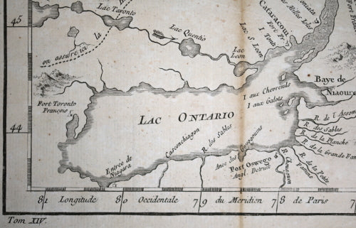
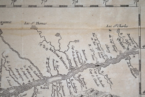
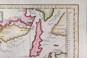
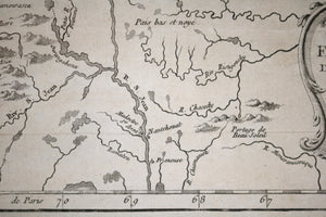
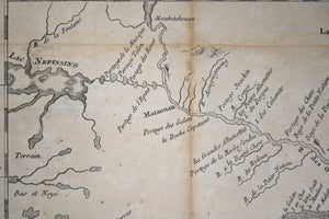
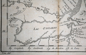
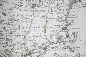
Map of the St. Lawrence river from Quebec City to the west end of Lake...
$375.00 CAD
| /
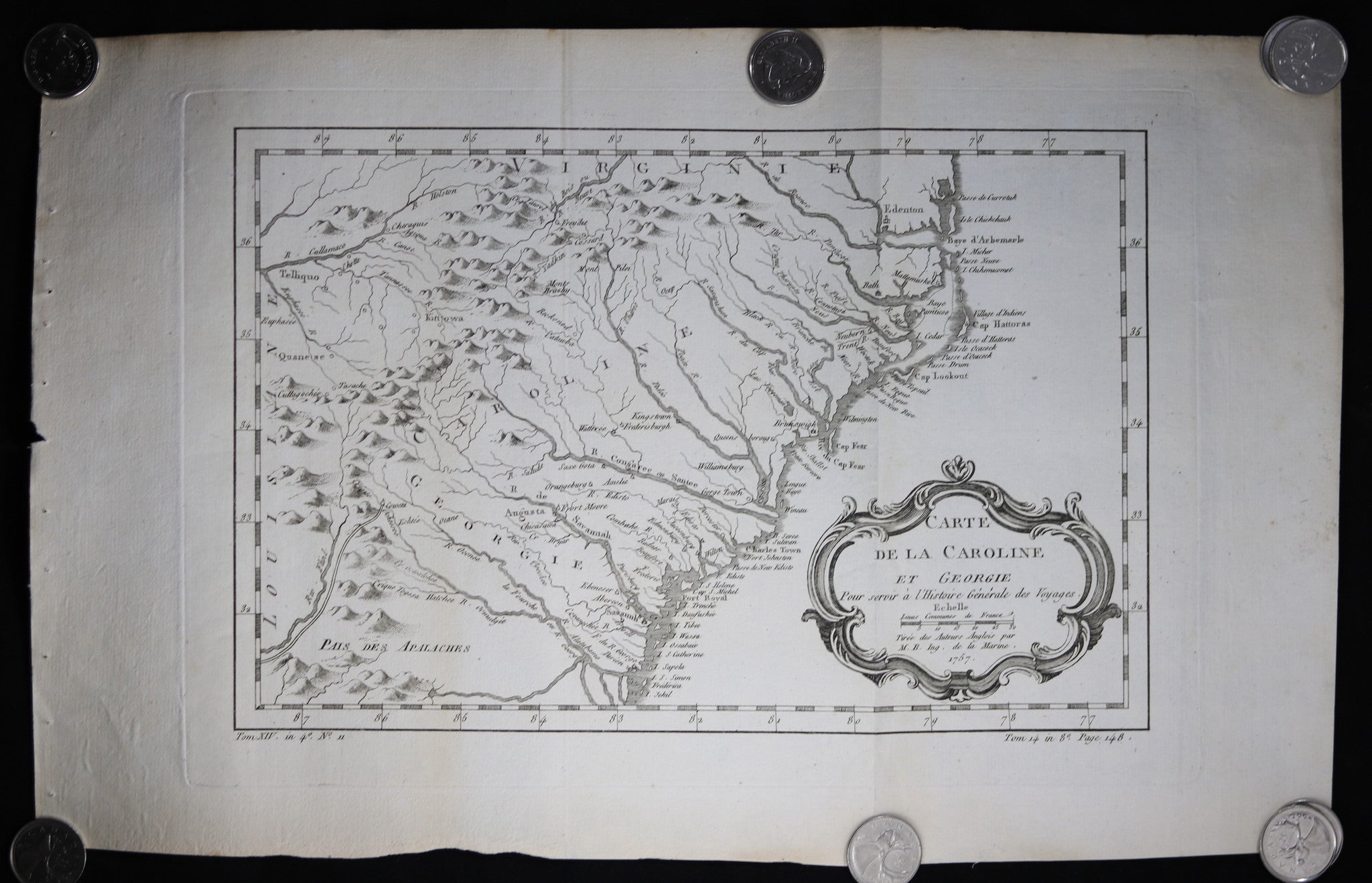
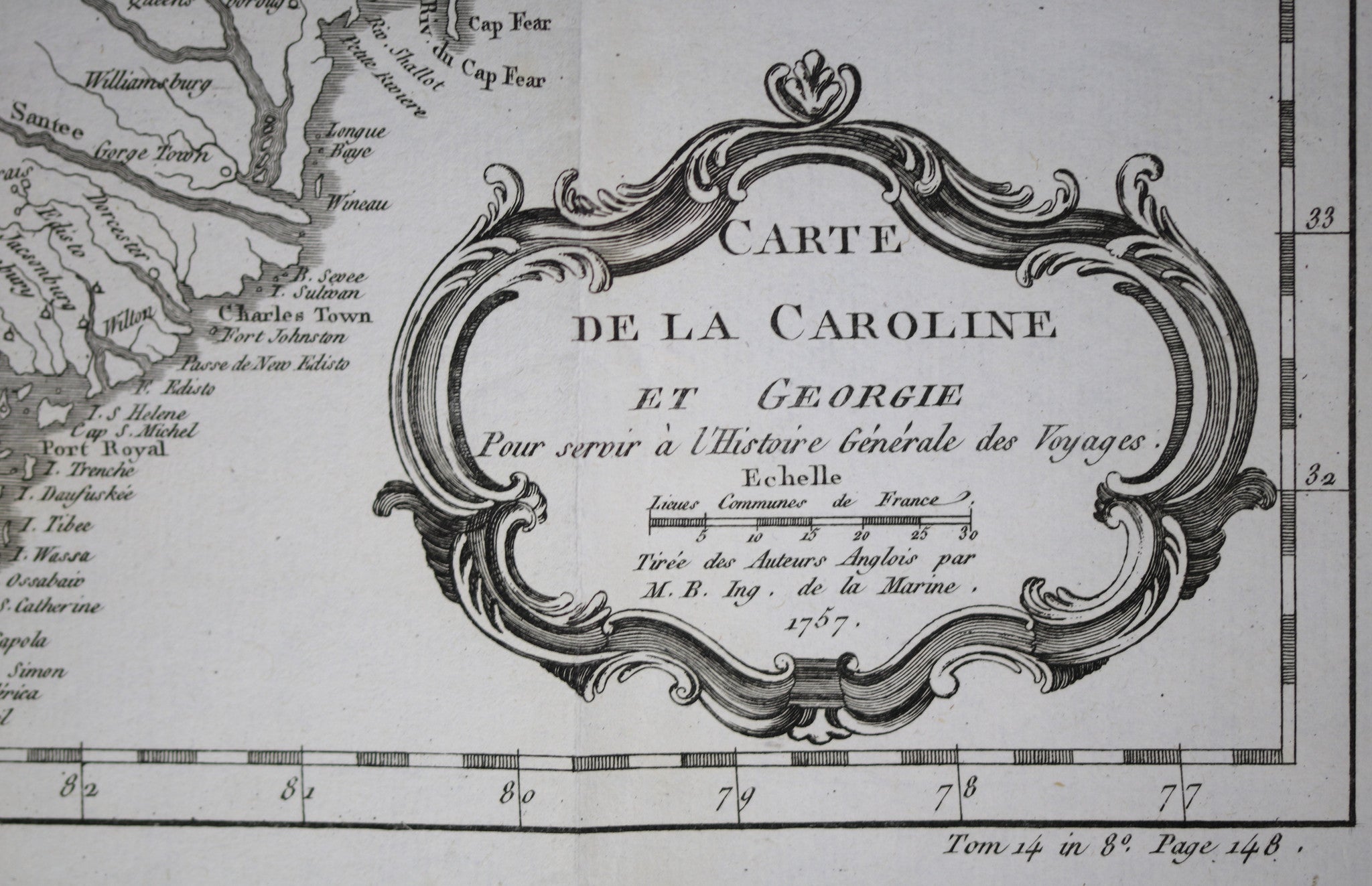
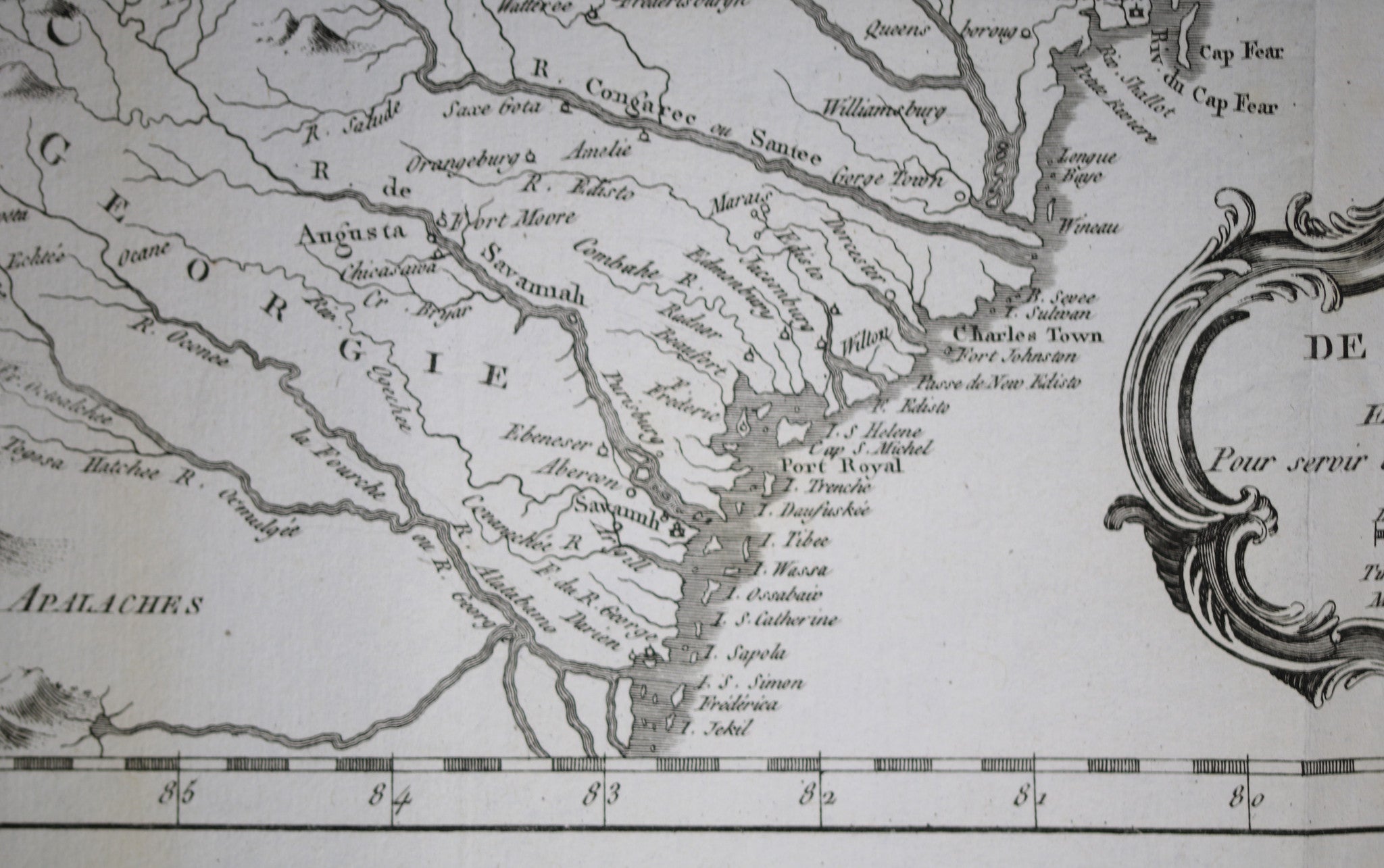
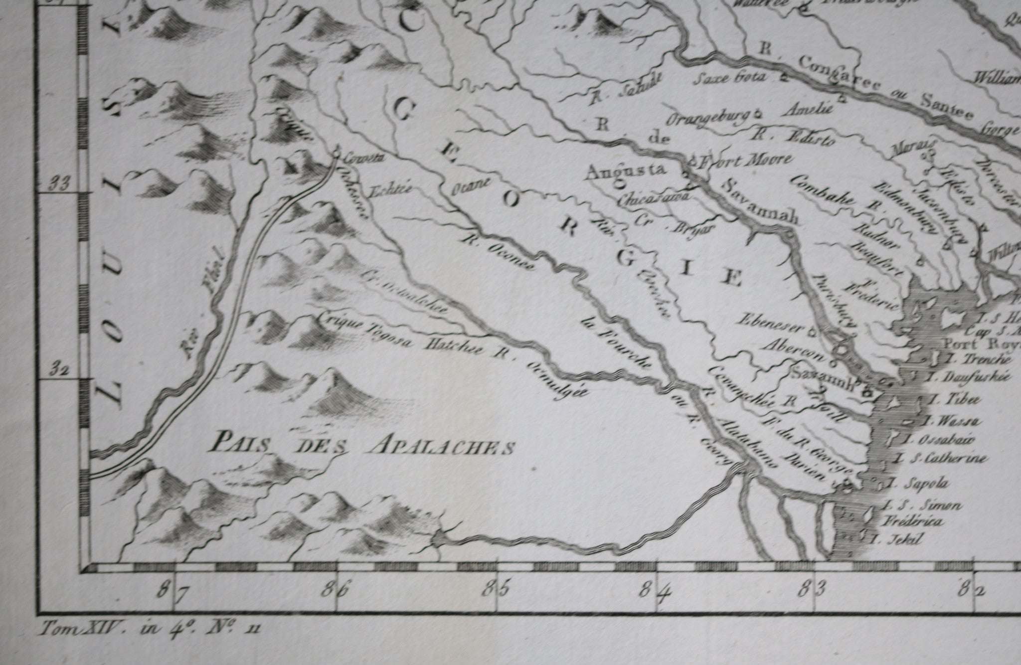
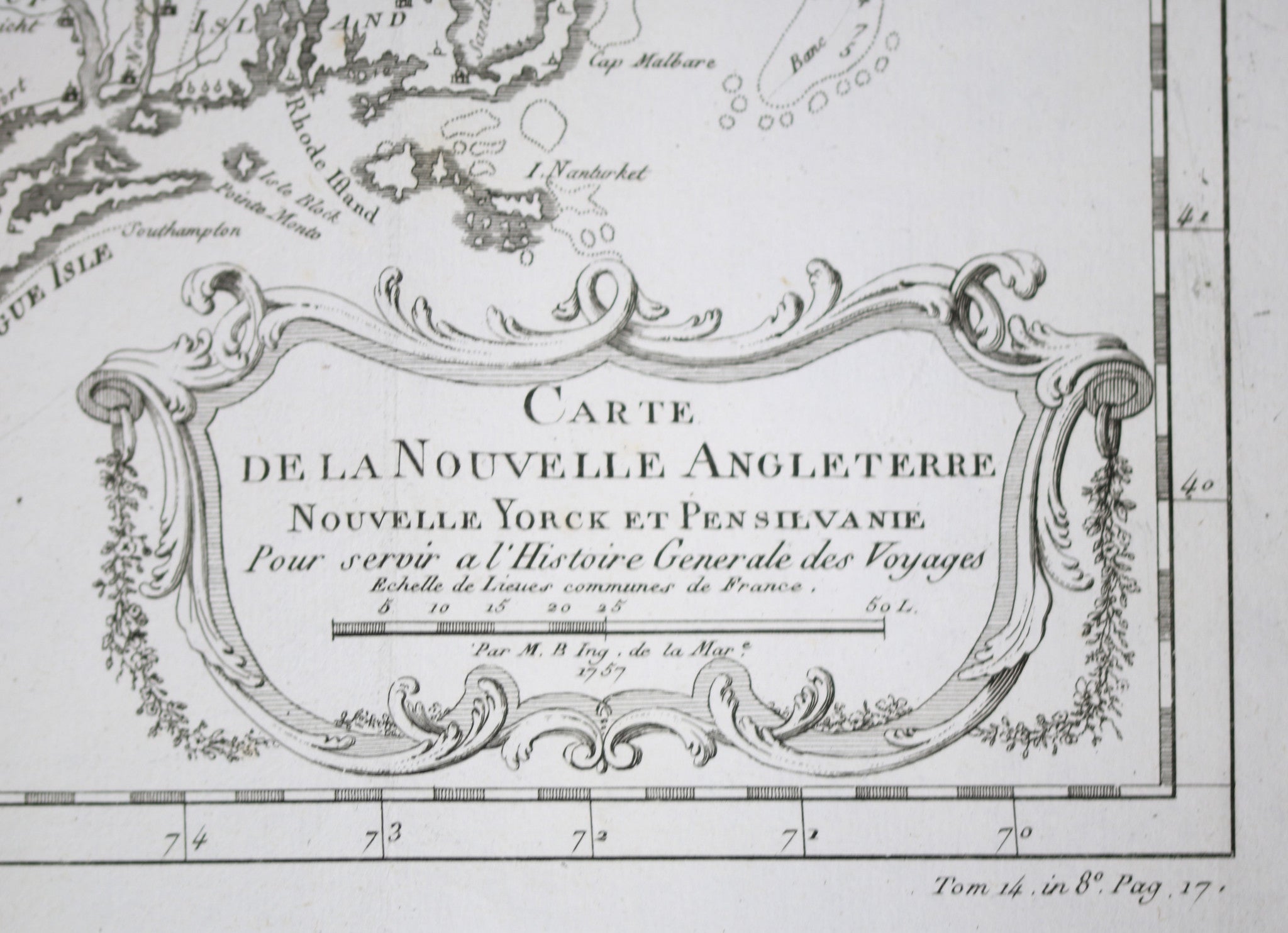
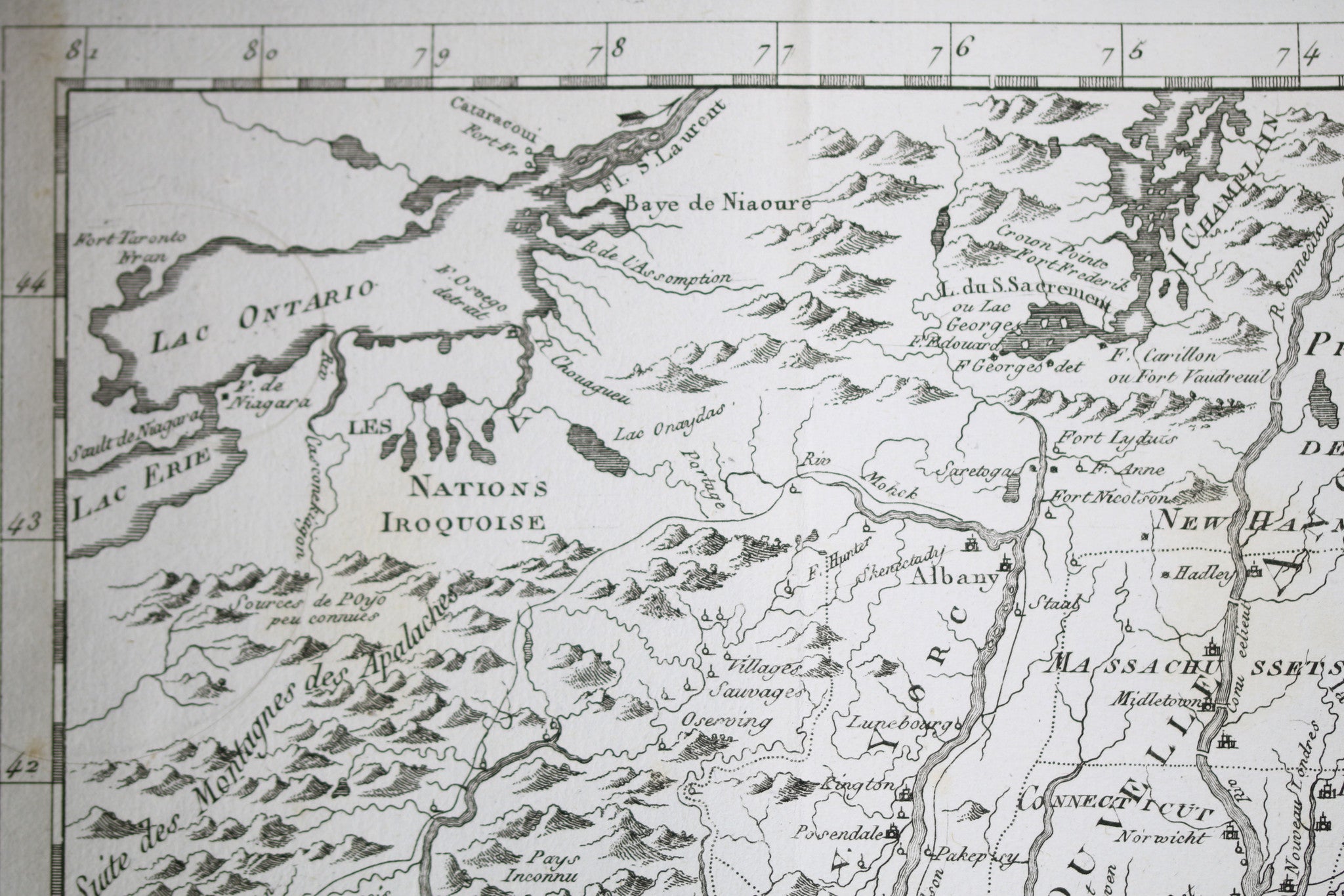
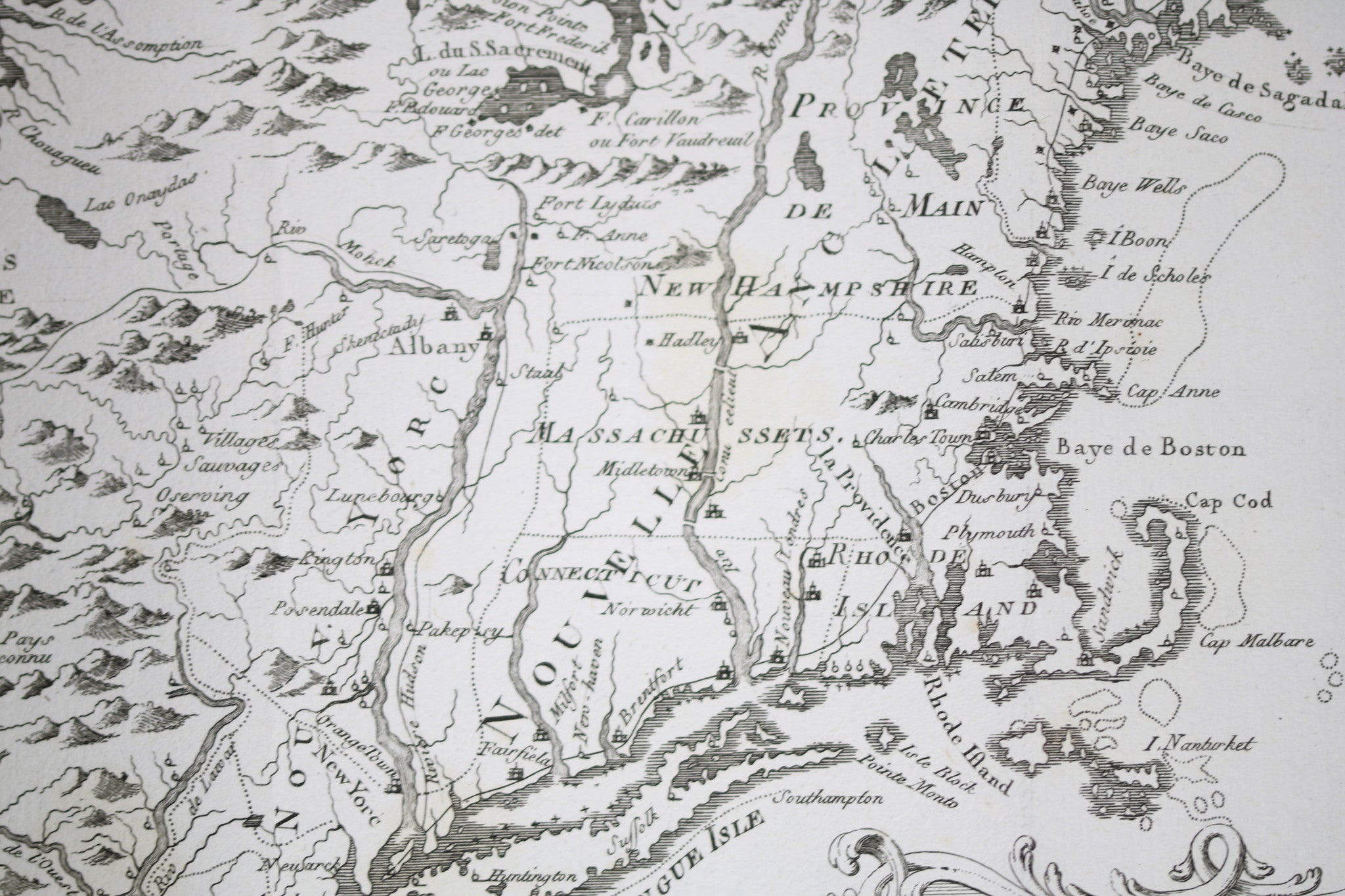
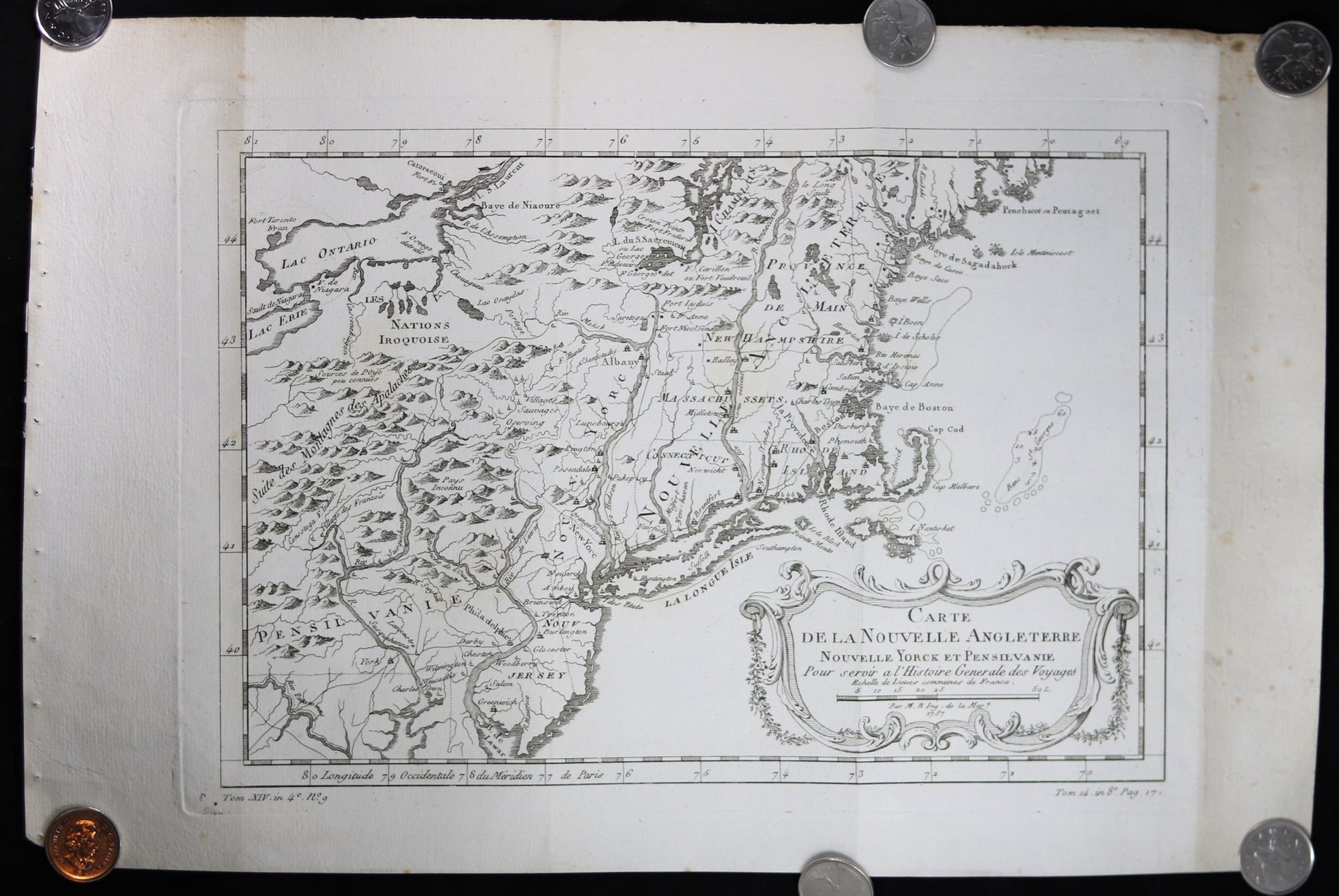
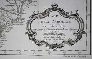
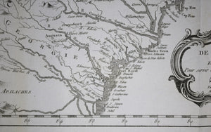
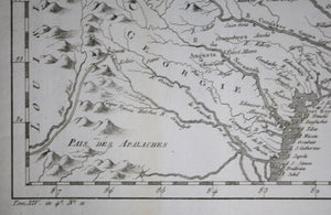
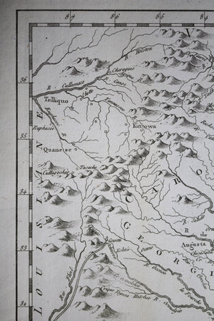
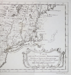
Inside decorative cartouche: ...


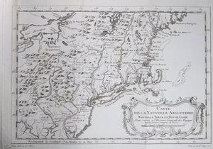


$375.00 CAD
| /
Inside decorative cartouche: ...
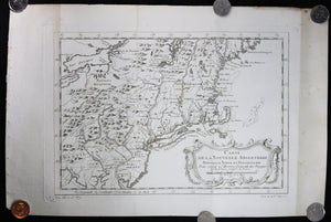


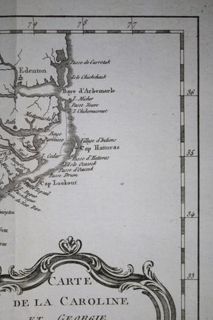
$325.00 CAD
| /
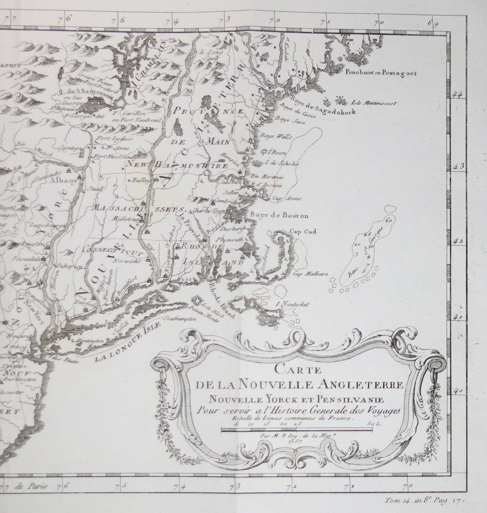
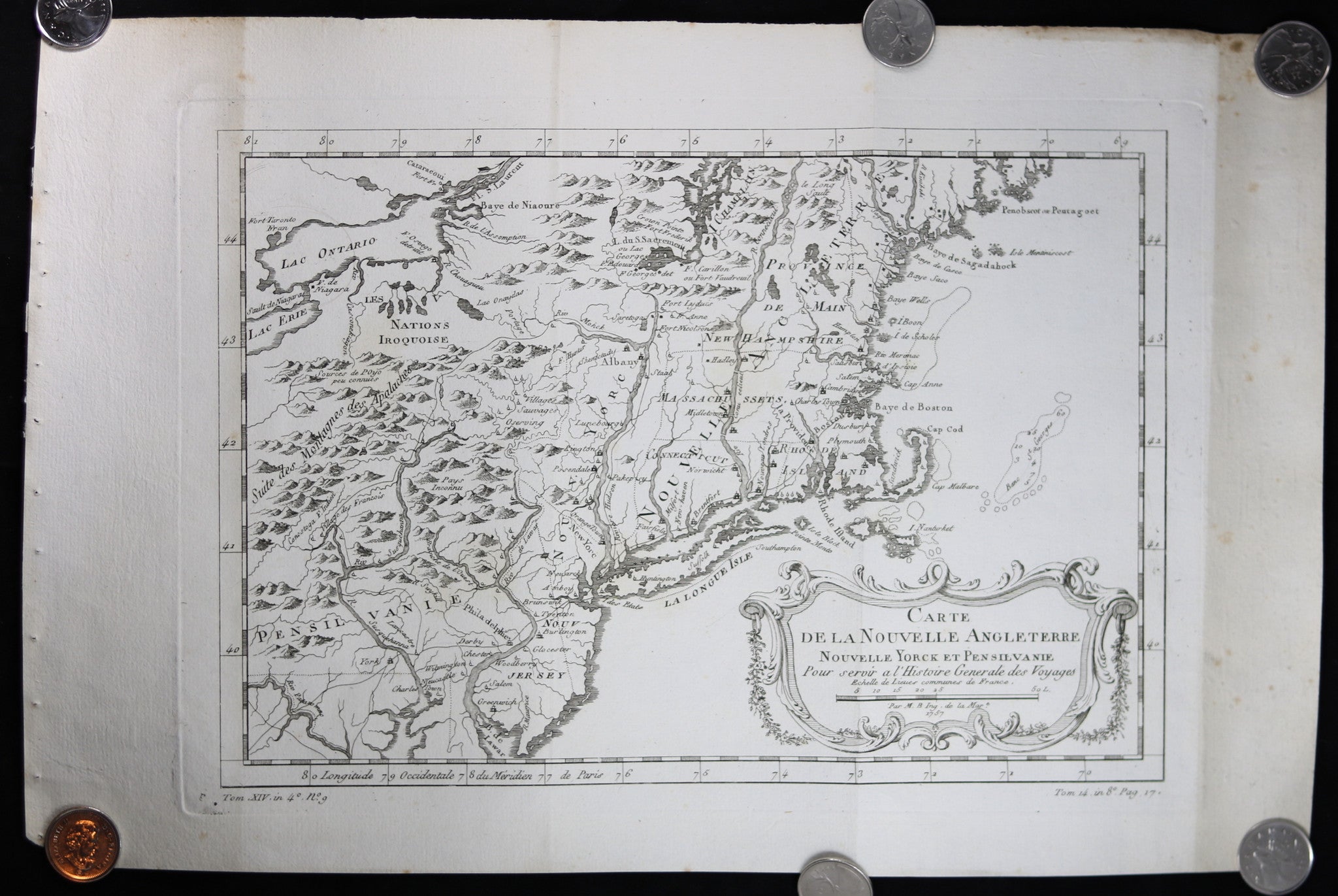
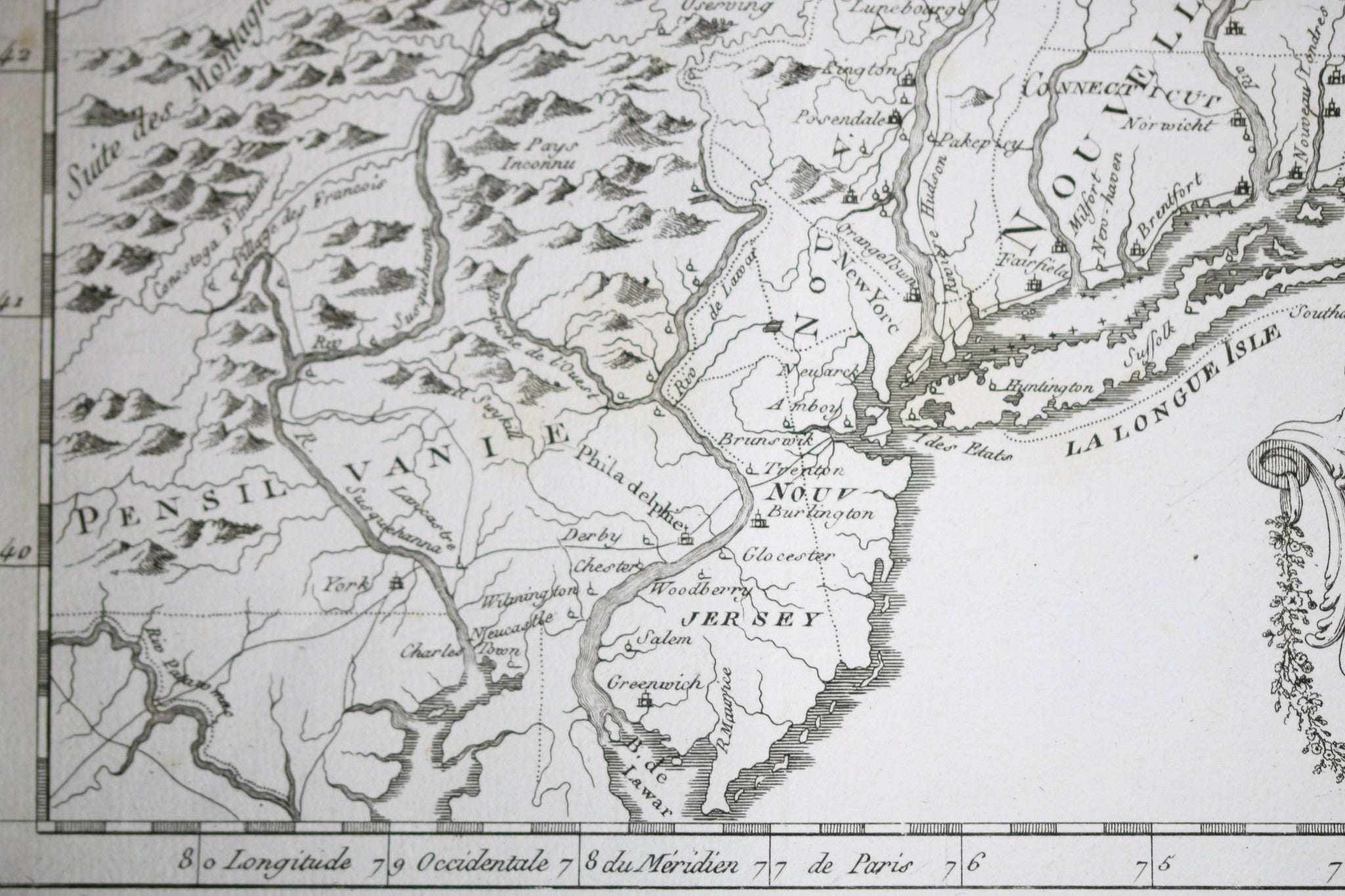
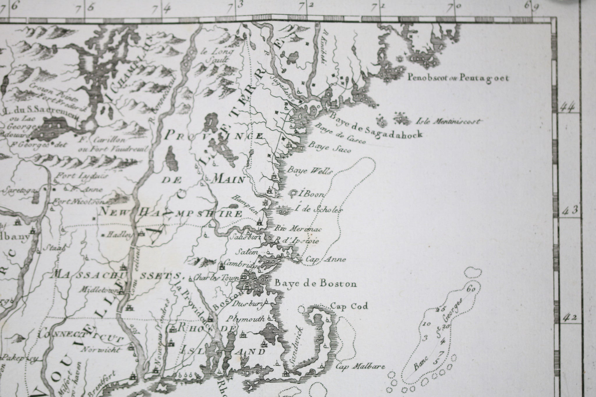
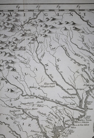
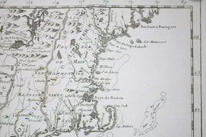
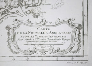
Inside decorative cartouche: Carte de...


$300.00 CAD
| /
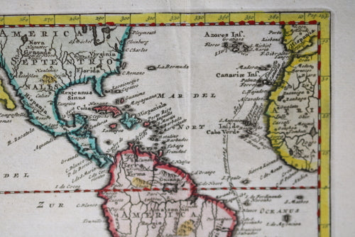
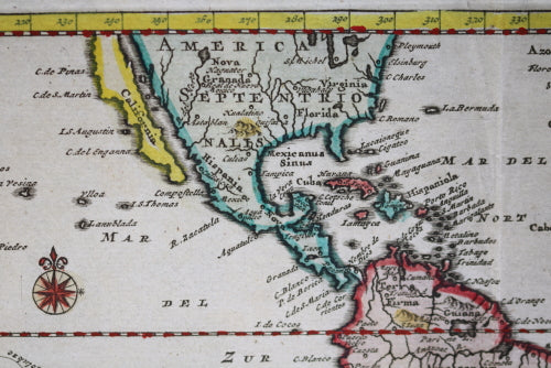
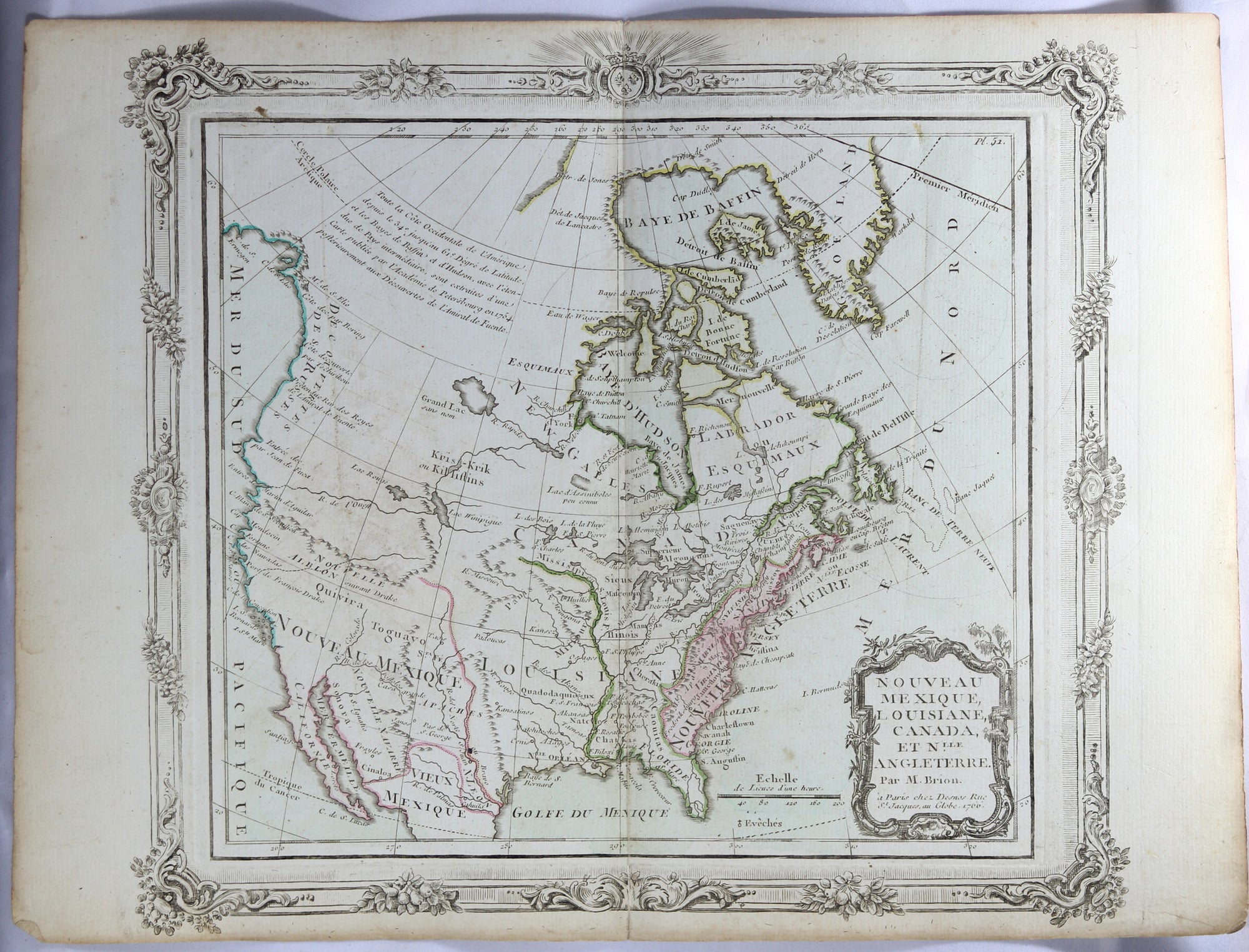
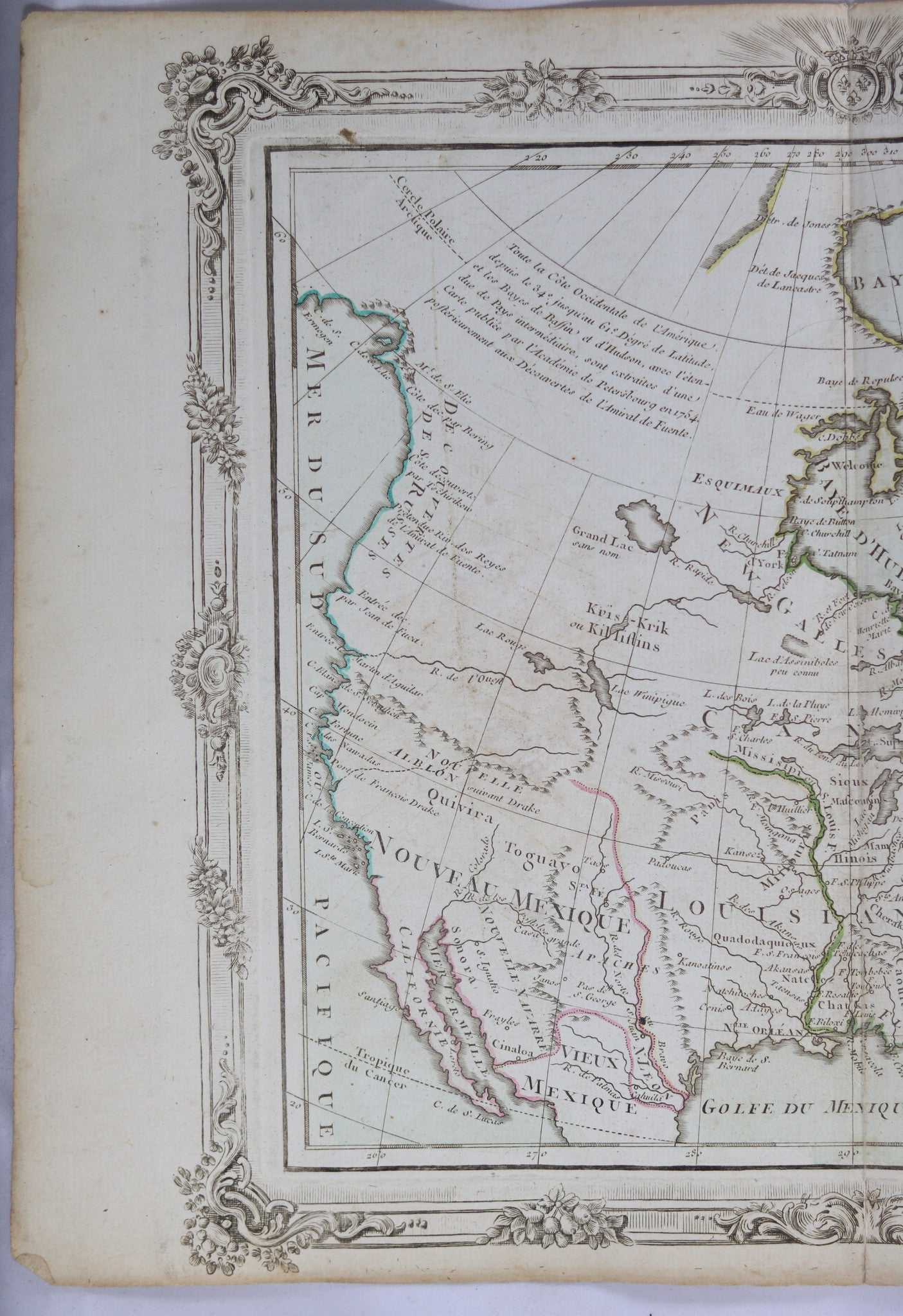
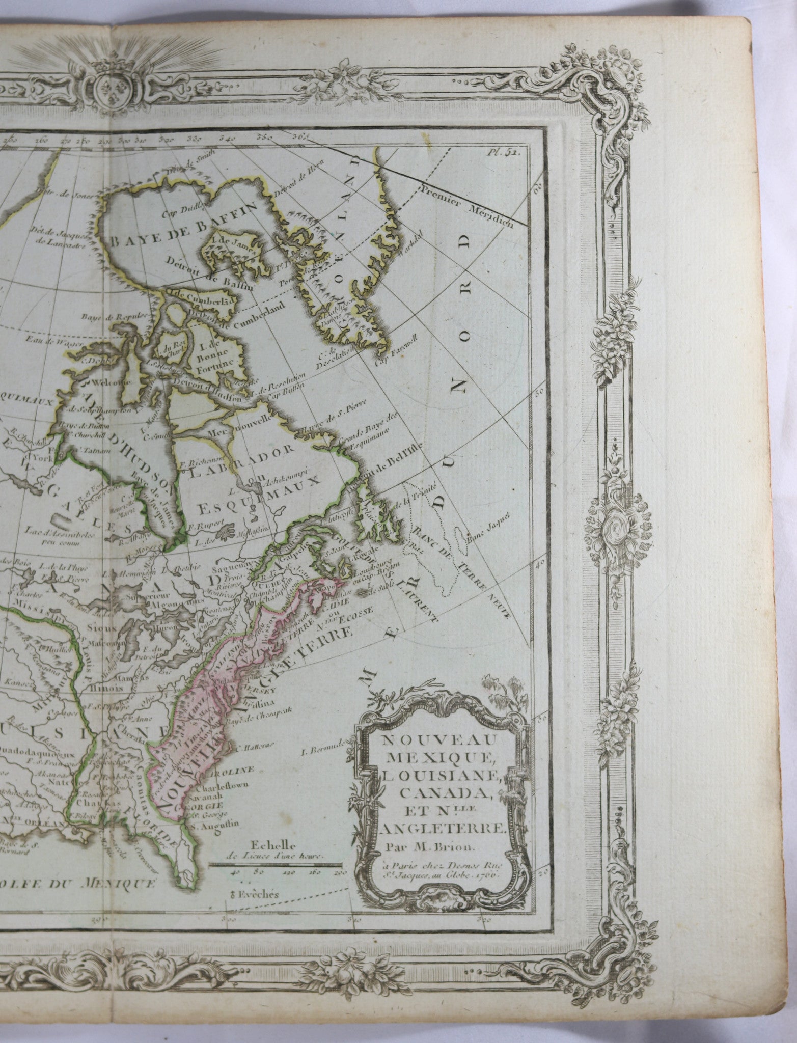
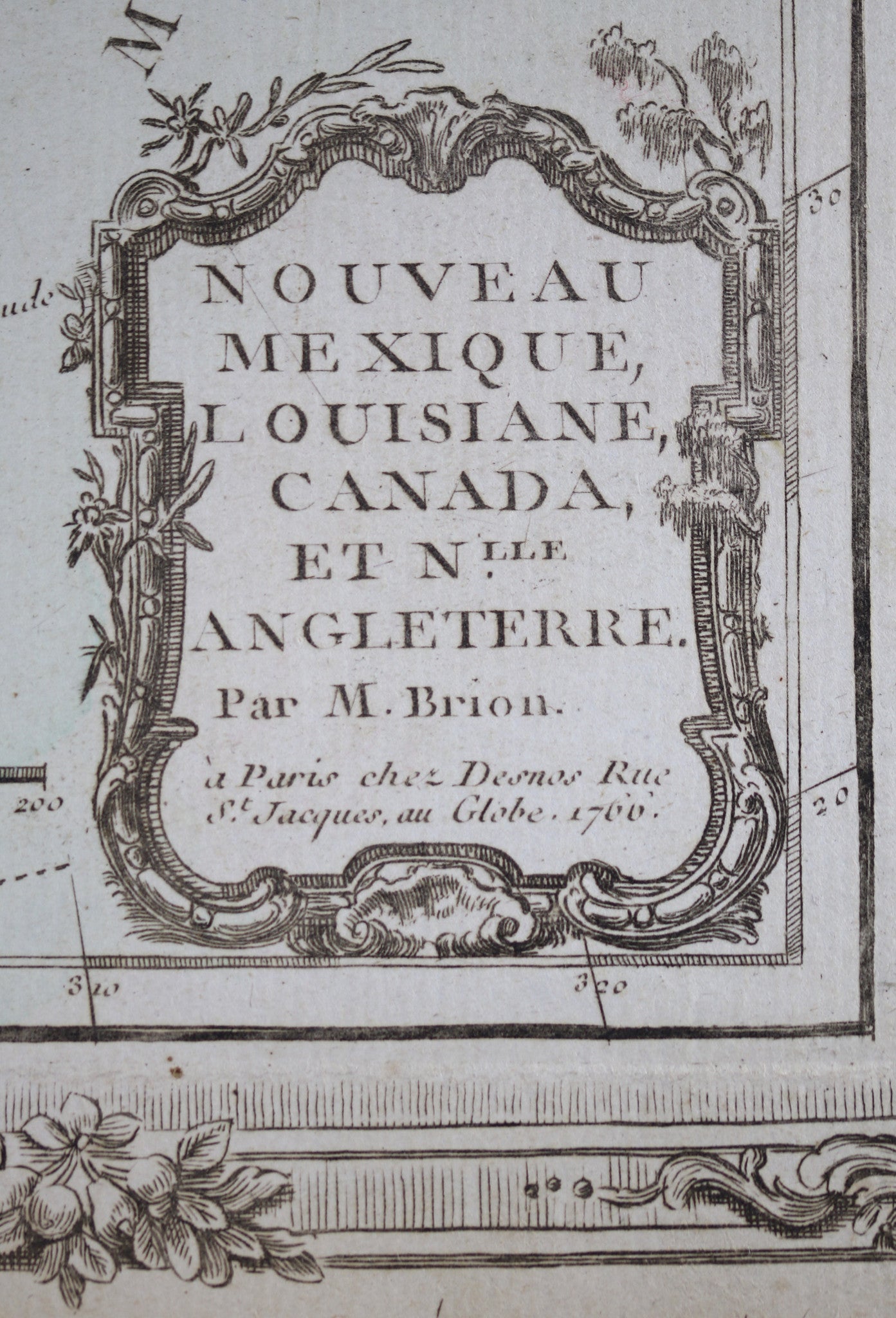
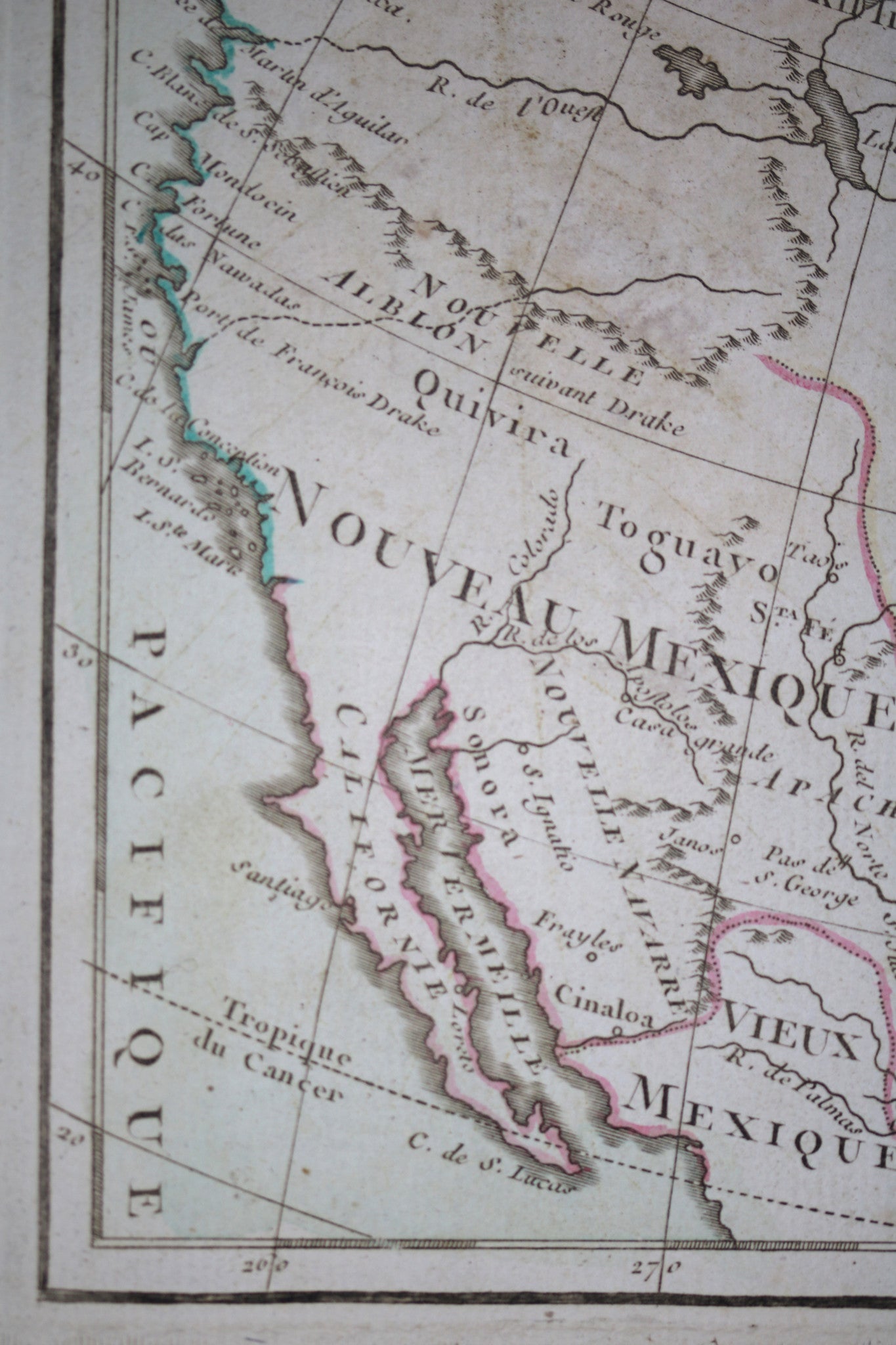
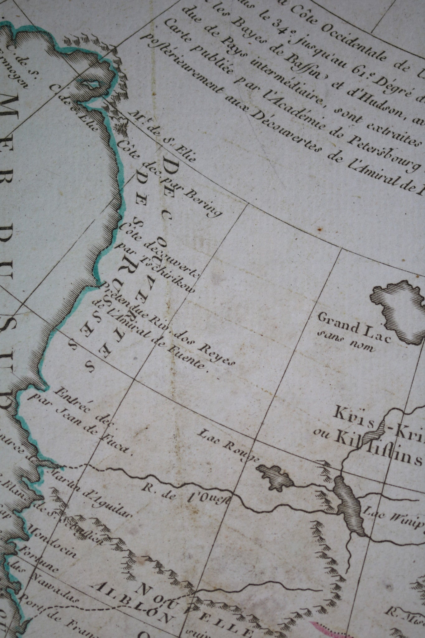
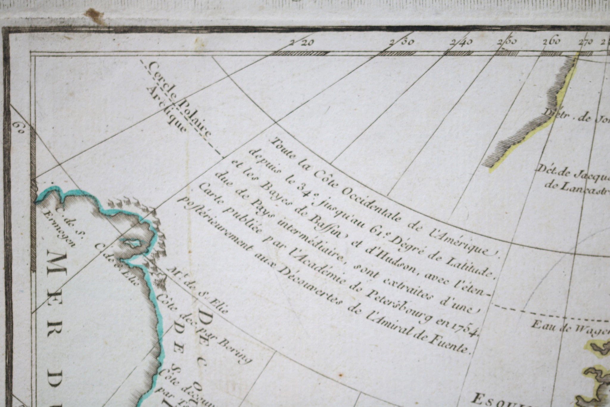
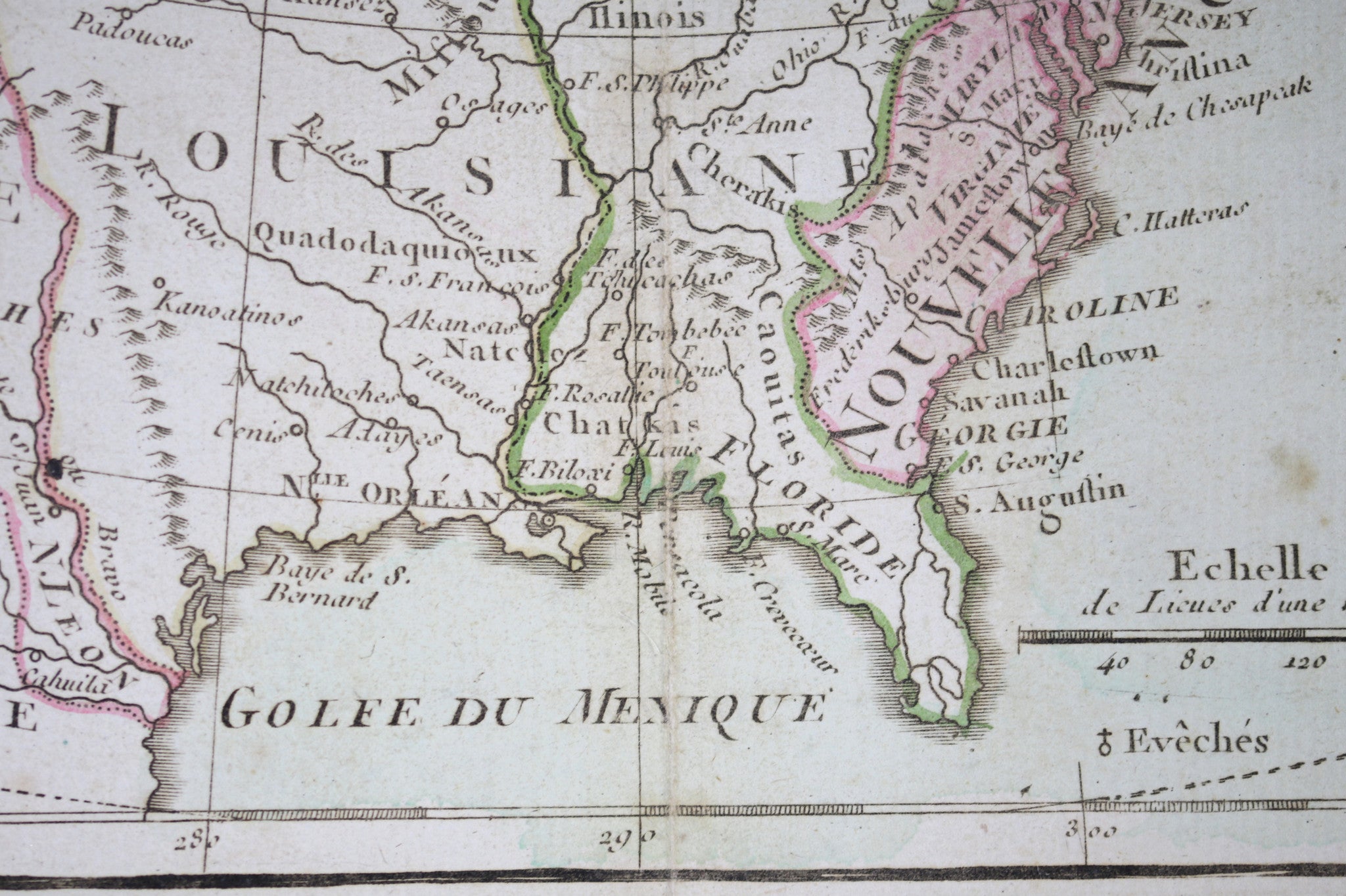
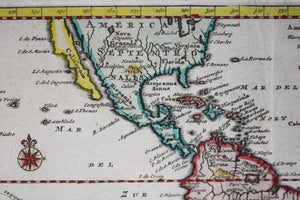
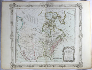
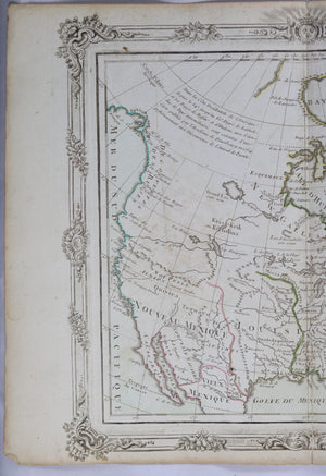
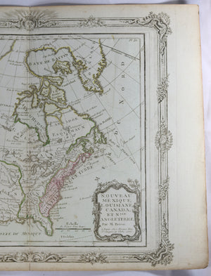
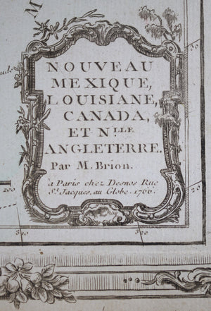
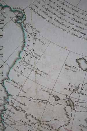
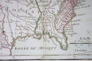
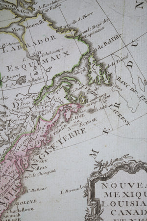
Copper engraved French map of North America, first edition of 1766. Nouveau Mexique, Louisiane,...
$40.00 CAD
| /
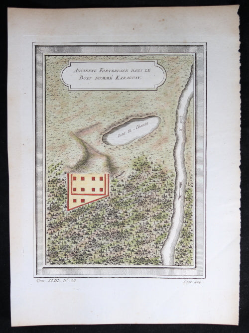
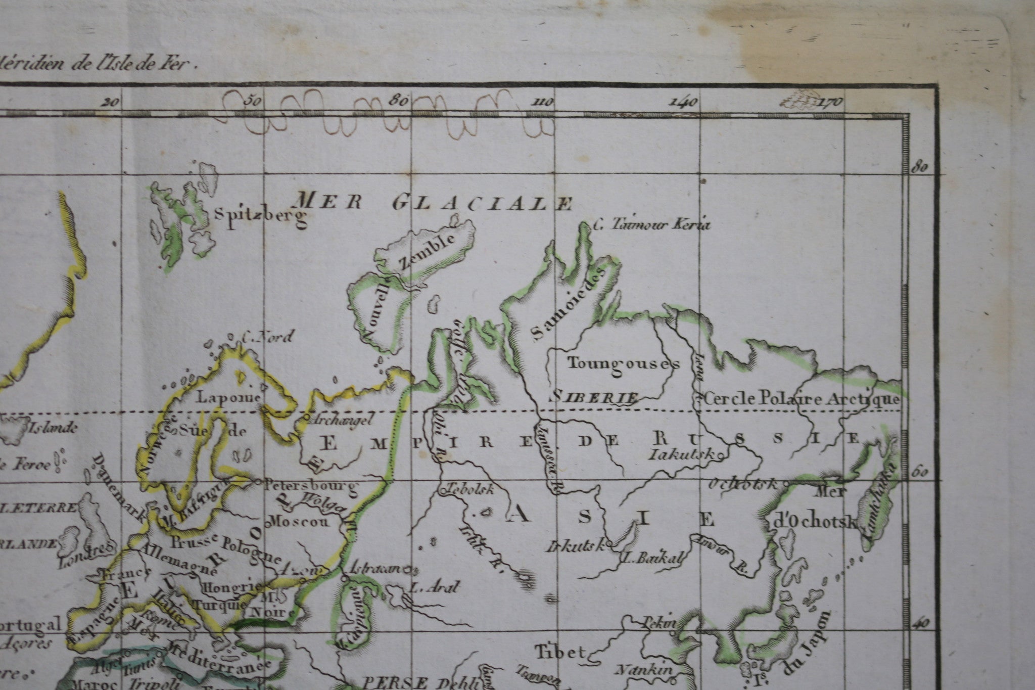
‘Ancienne Forteresse dans le bois nomme Karaguay’ (Ancient fortress in woods named Karaguay). Tom XVIII...


$400.00 CAD
| /
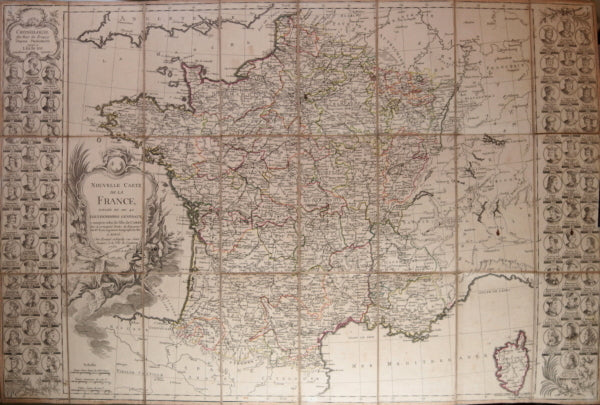
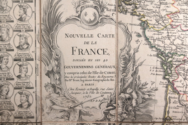
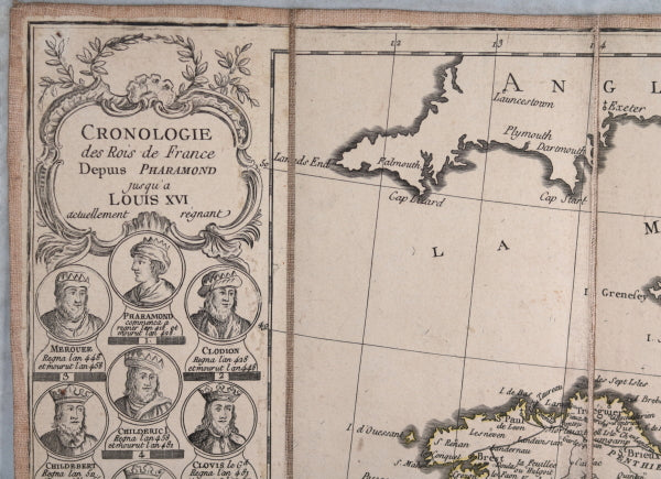
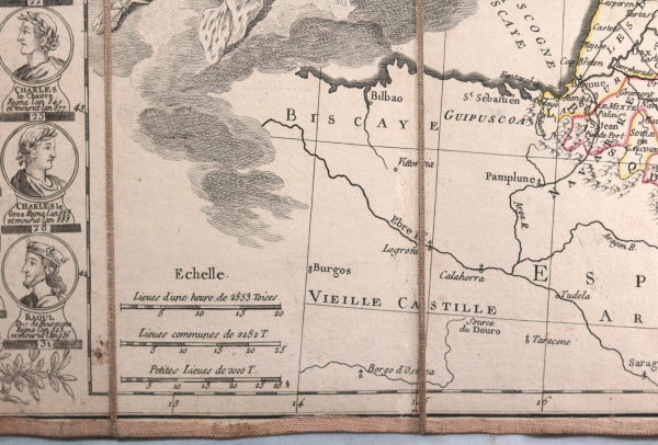
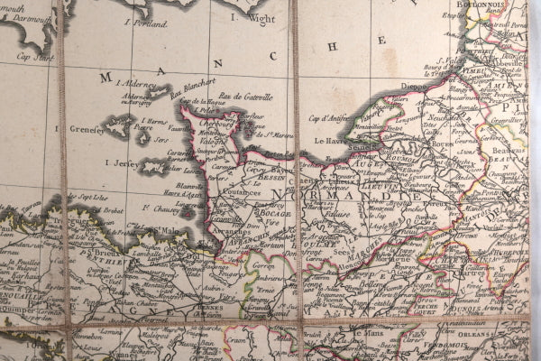
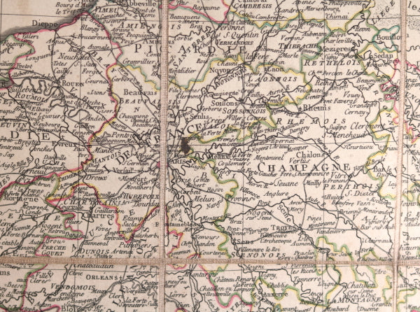
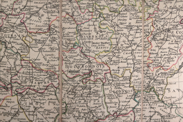
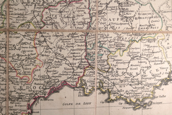
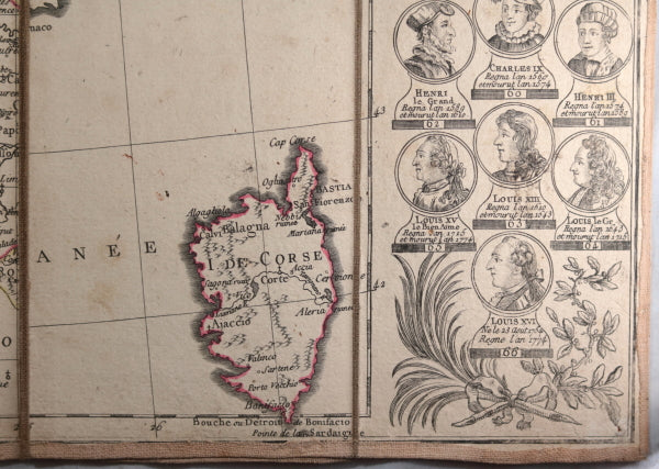
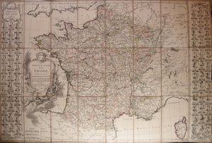
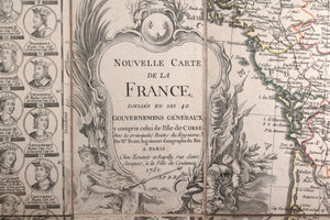
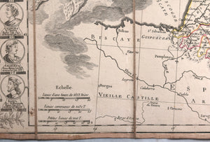
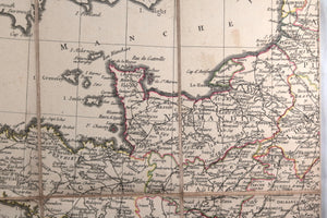
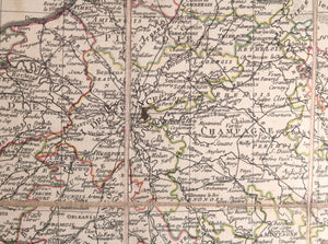
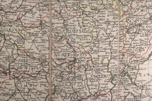
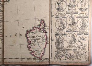
Très jolie carte de la France et de Corse. Sur les bords, Chronologie des Rois...
$250.00 CAD
| /
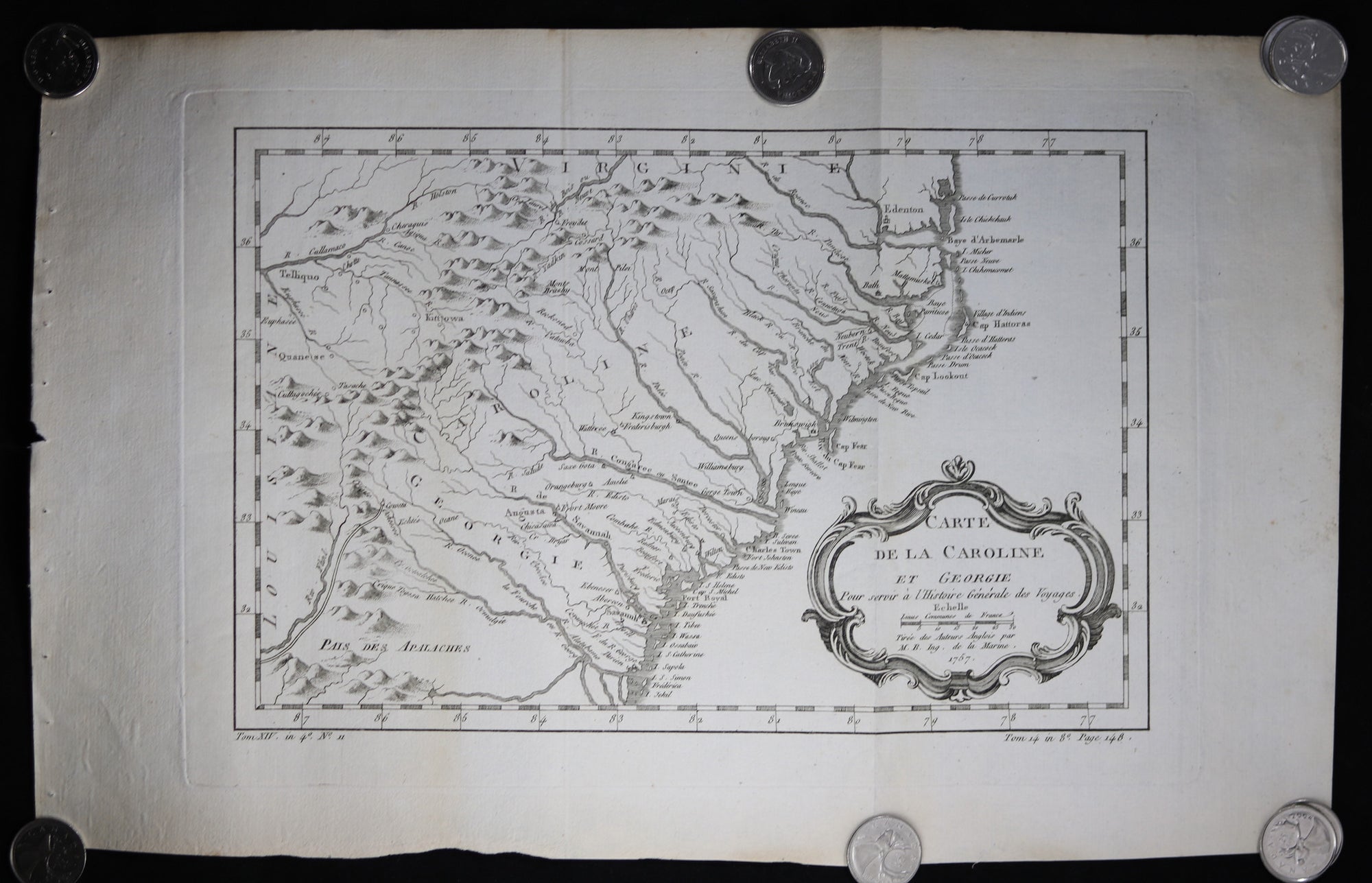
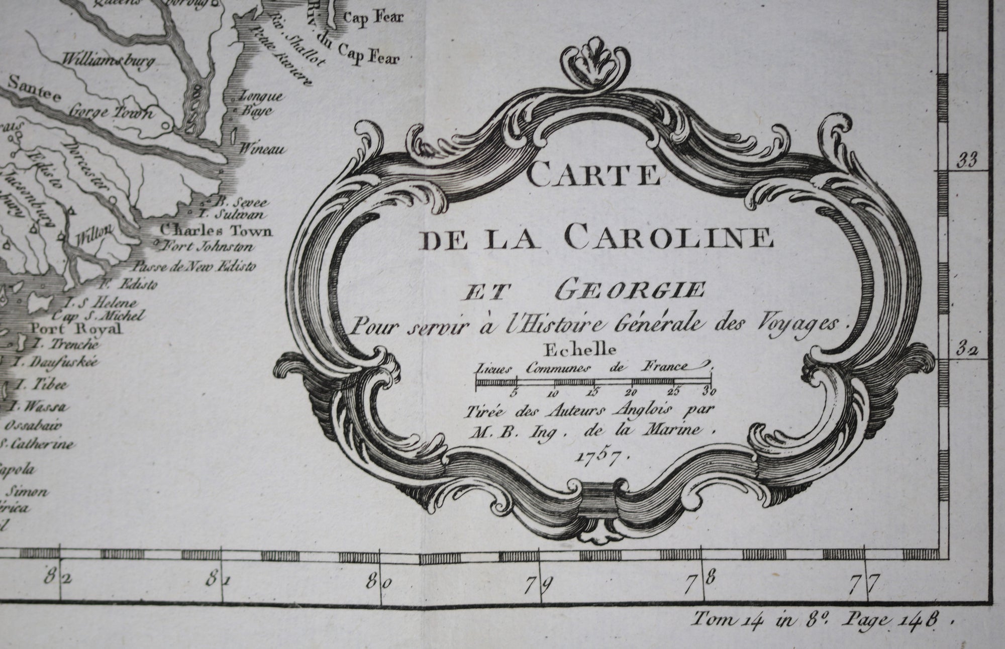
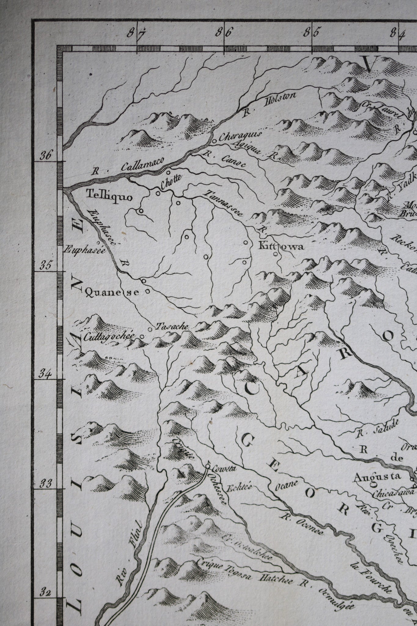
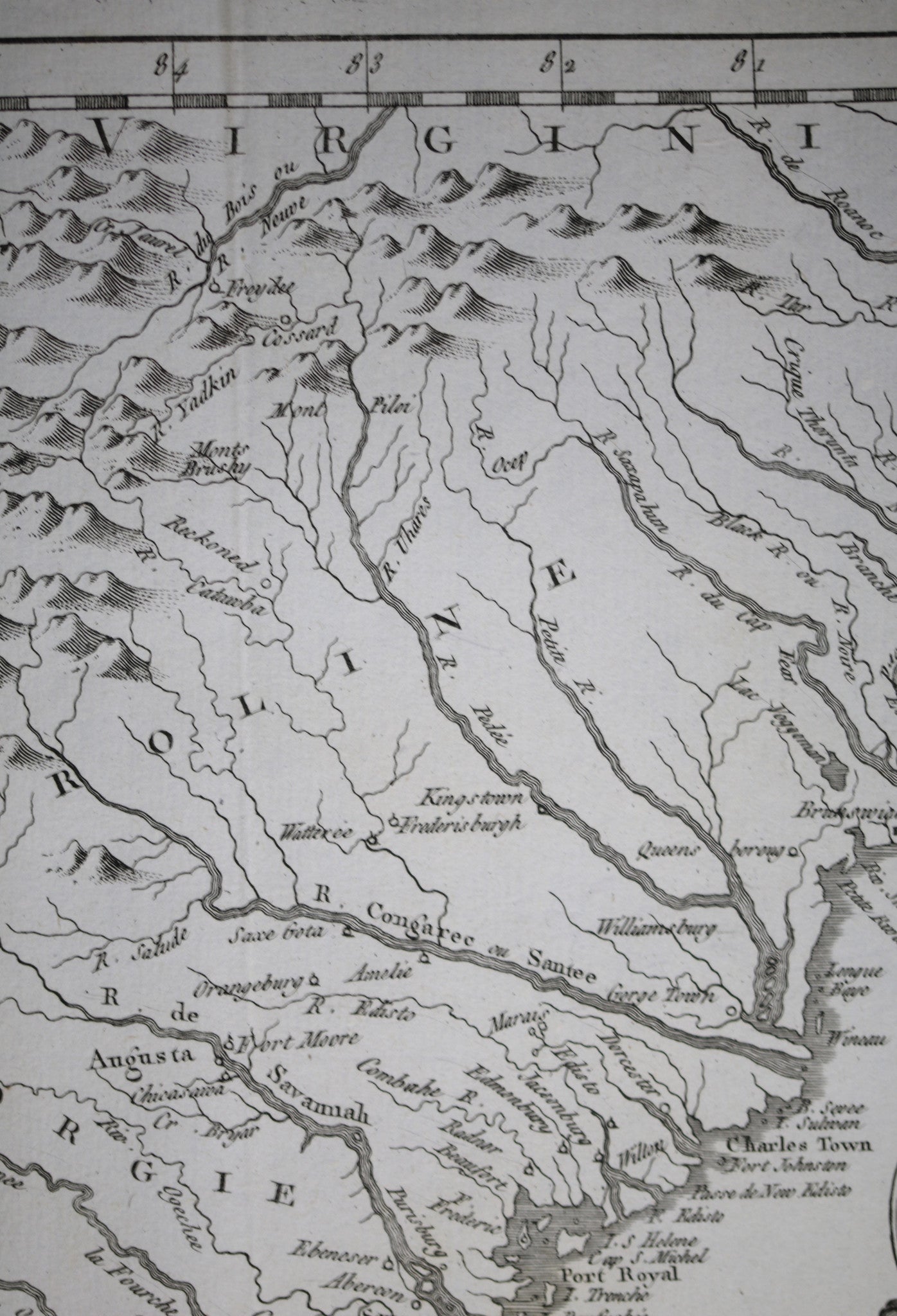
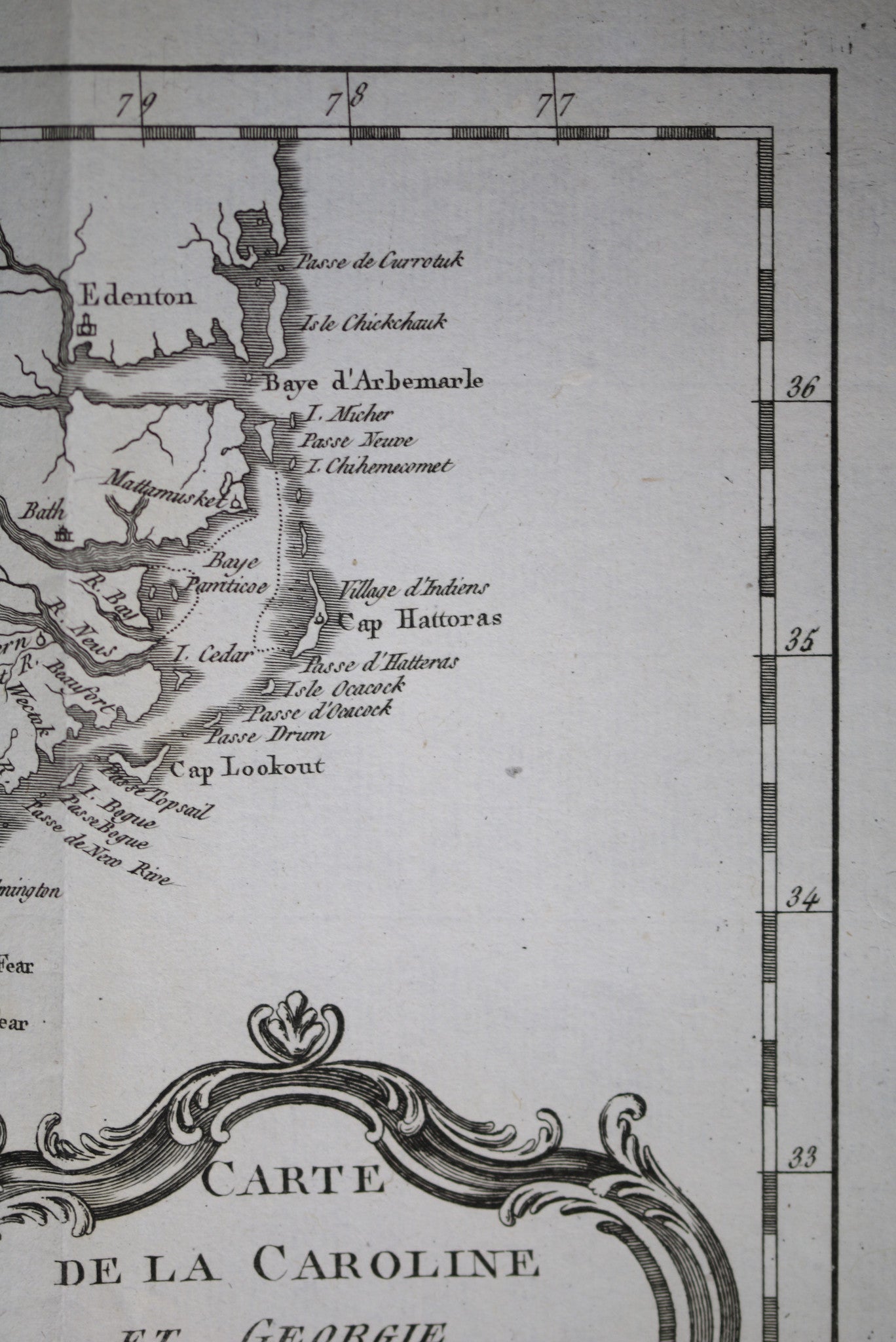
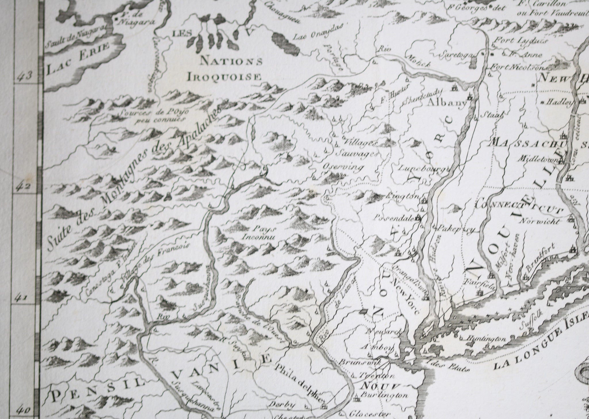
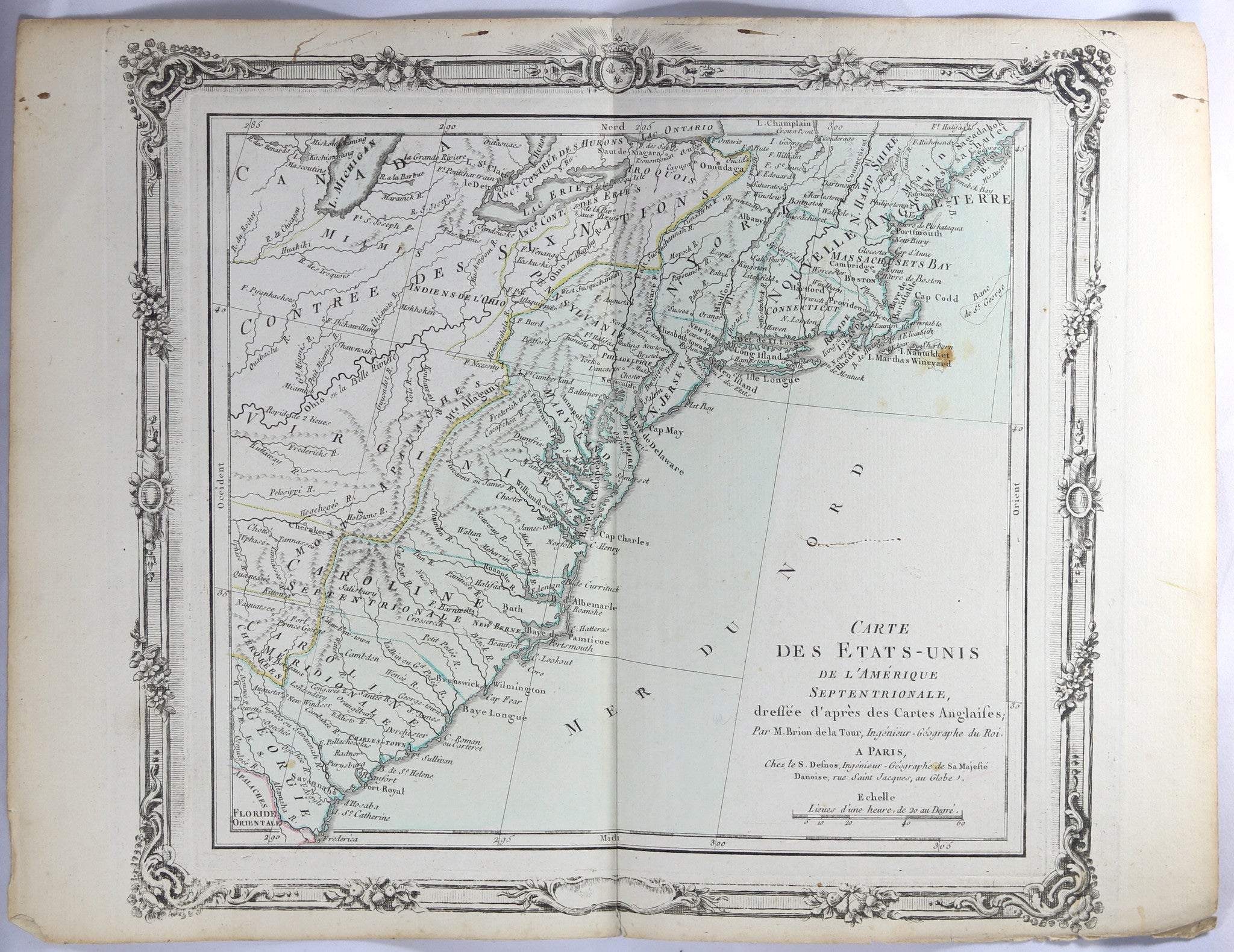
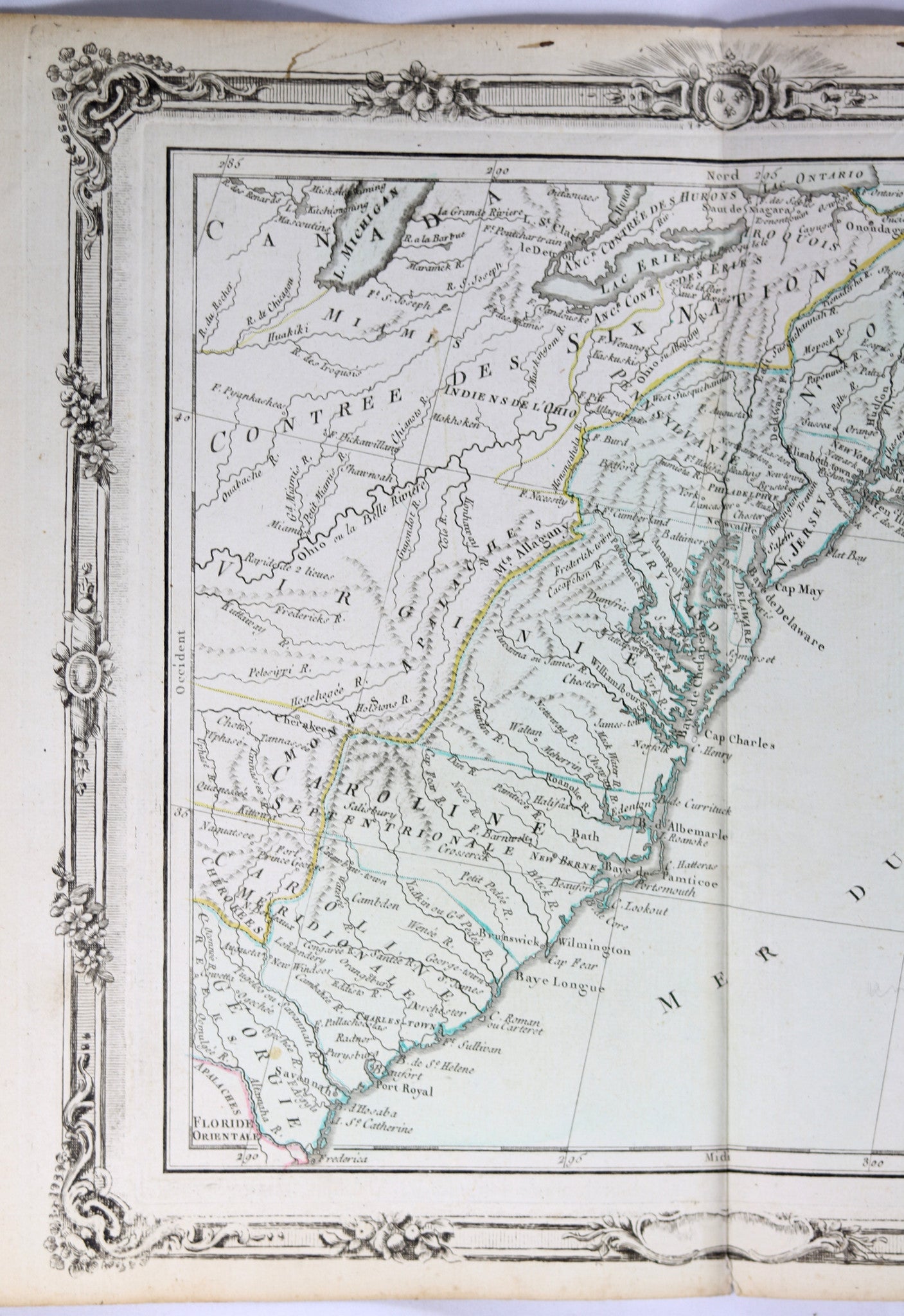
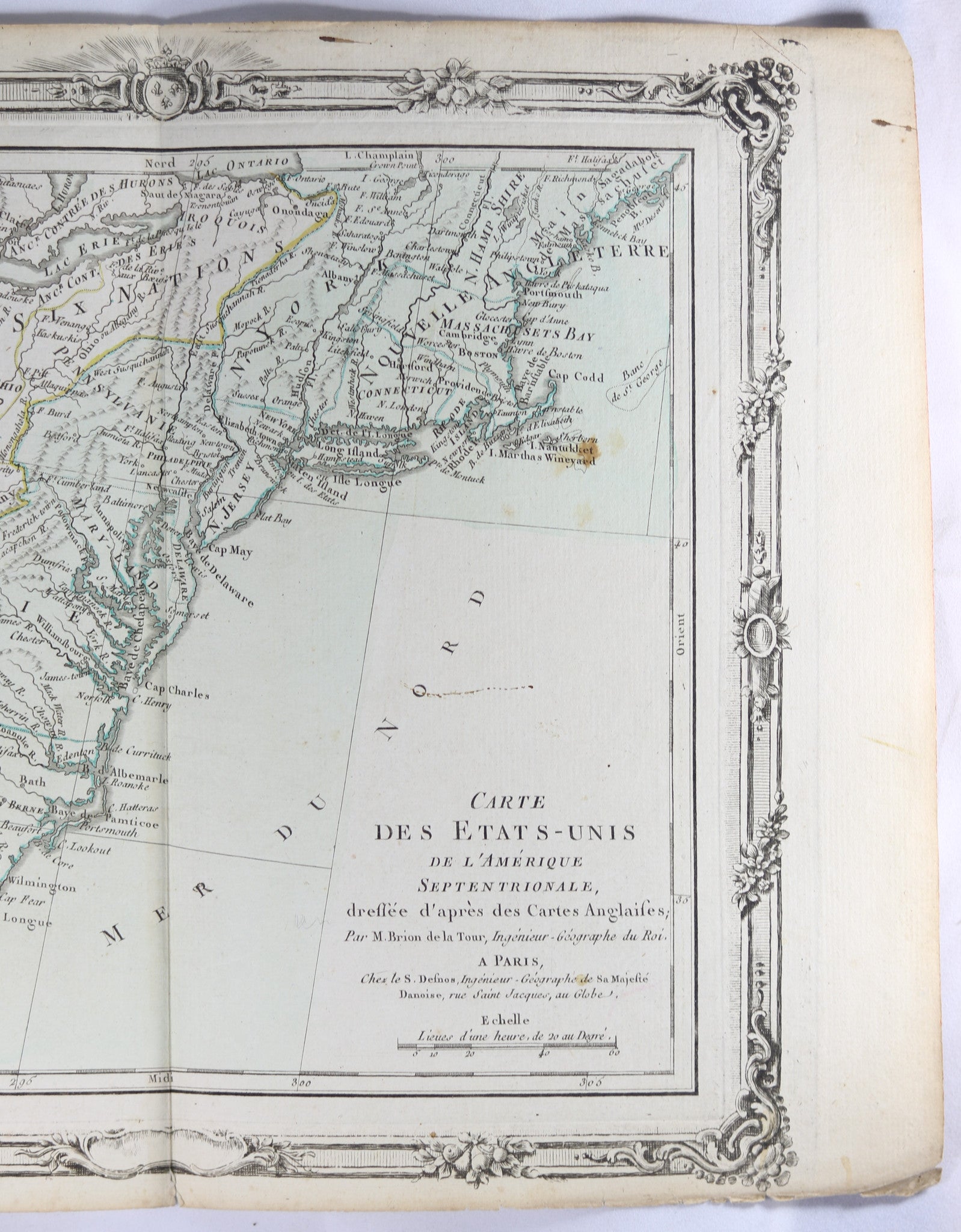
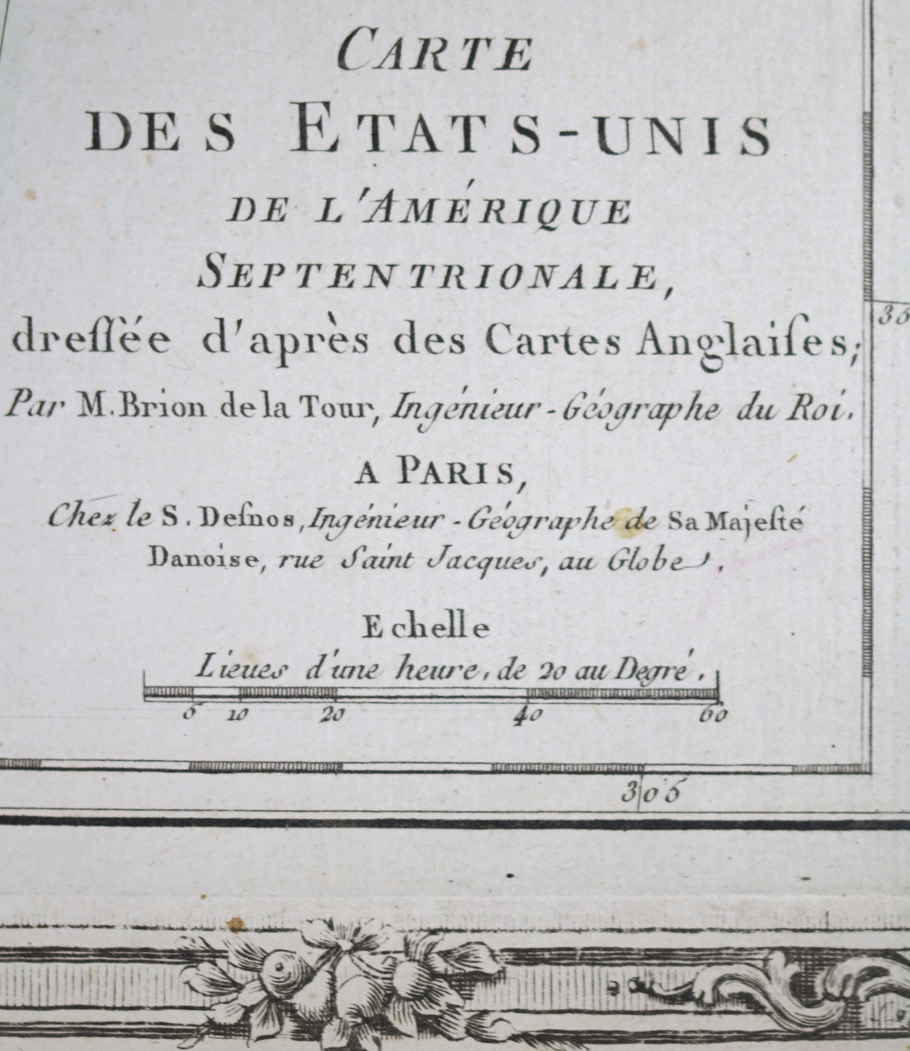
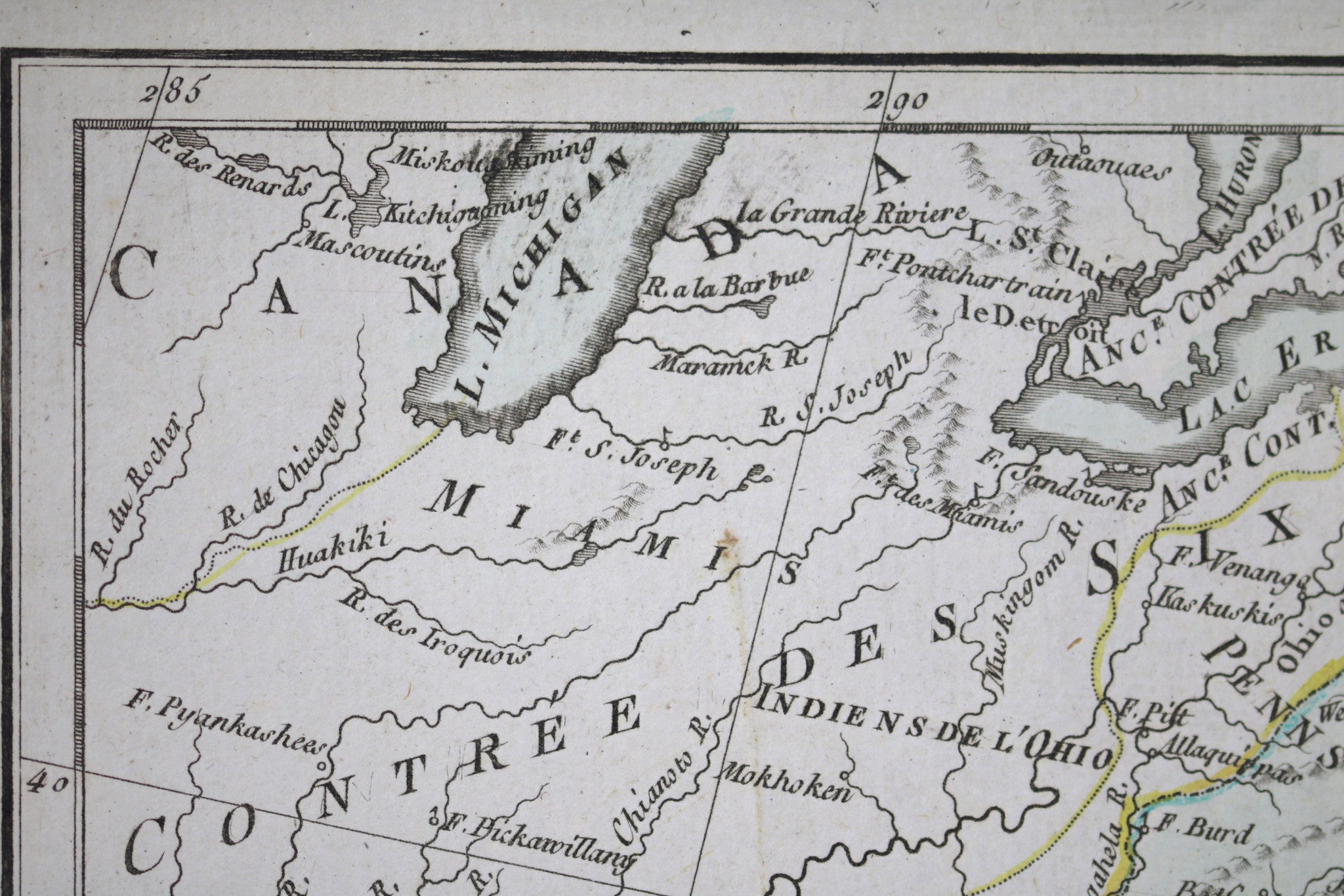
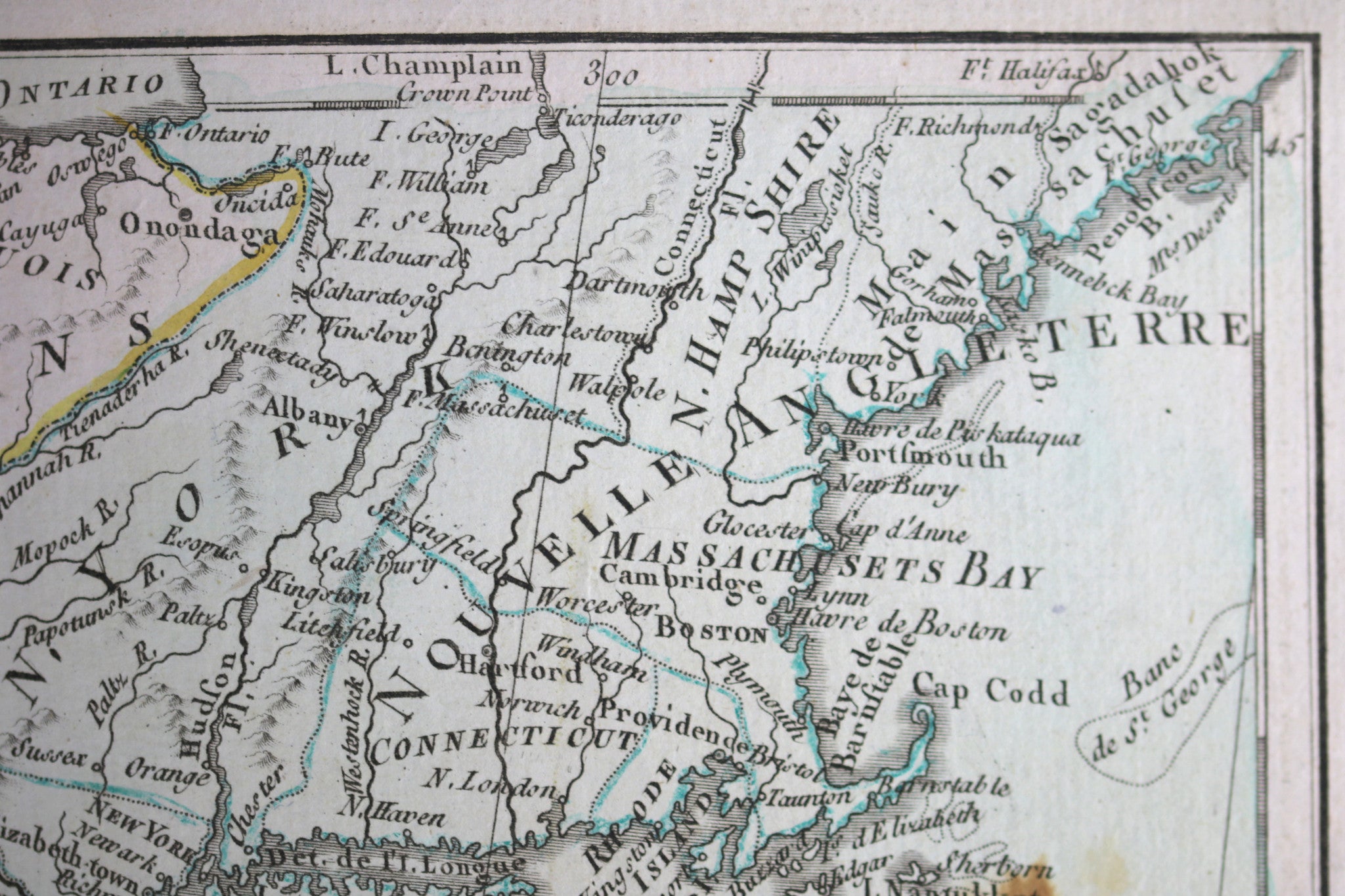
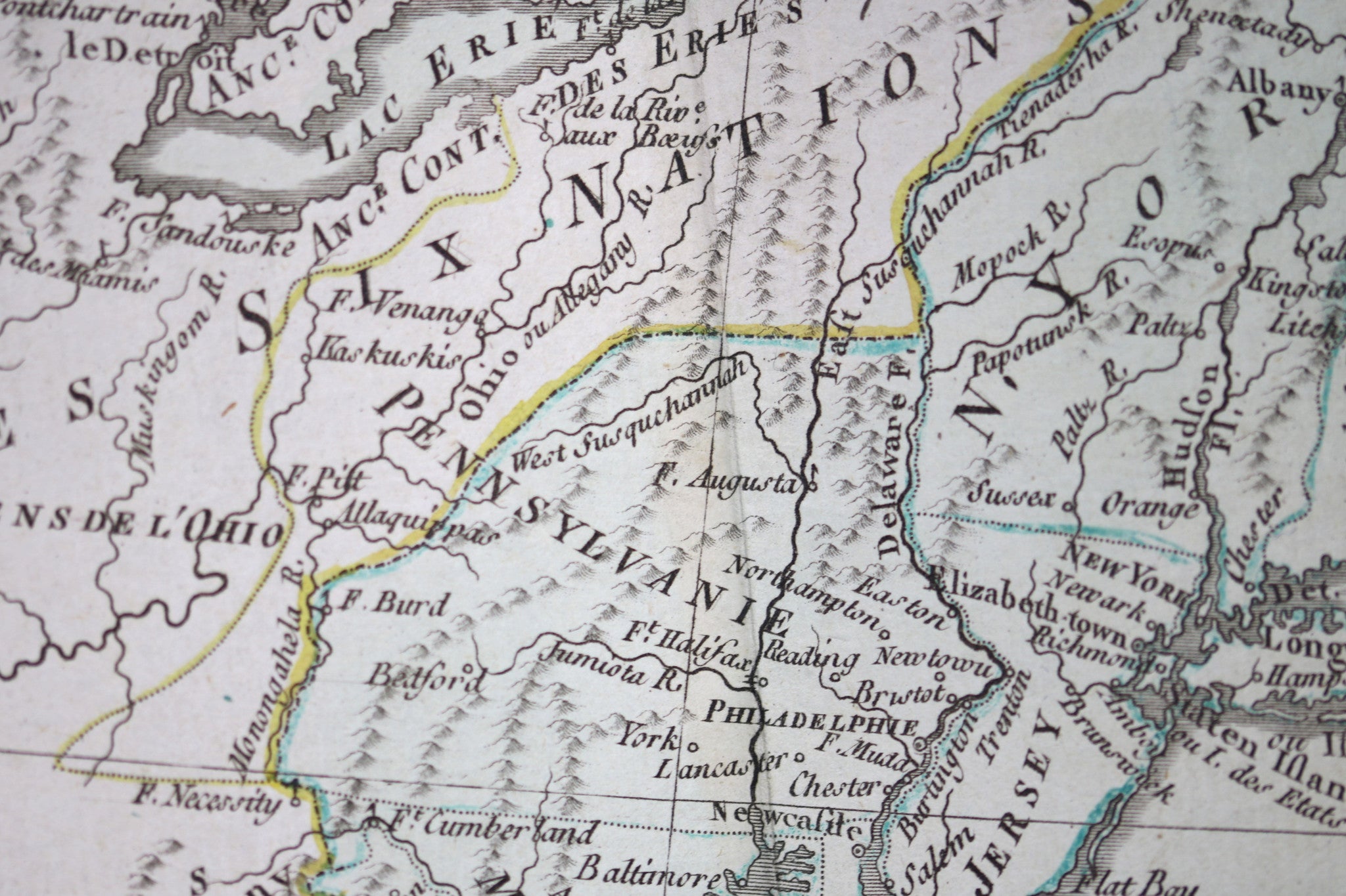
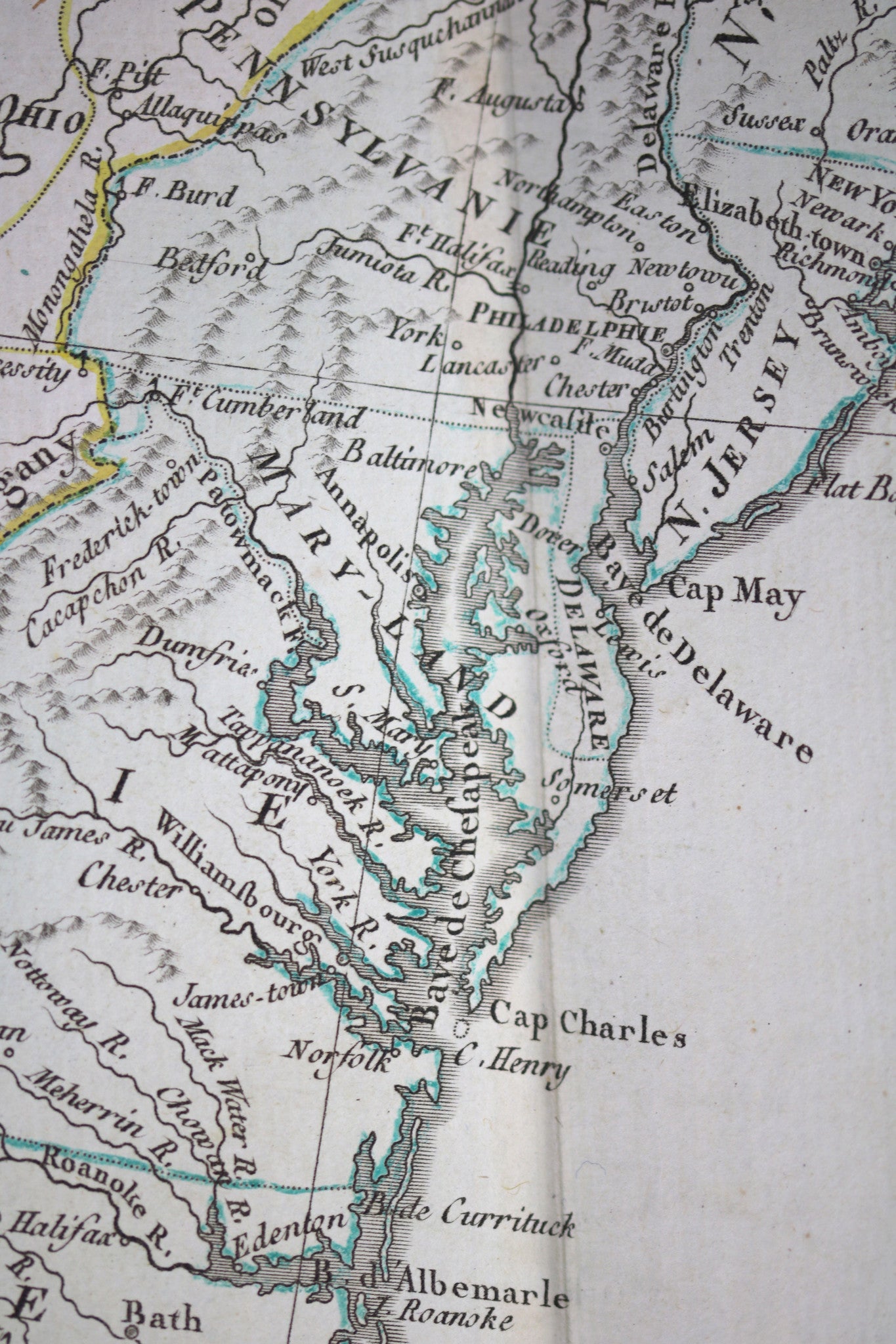
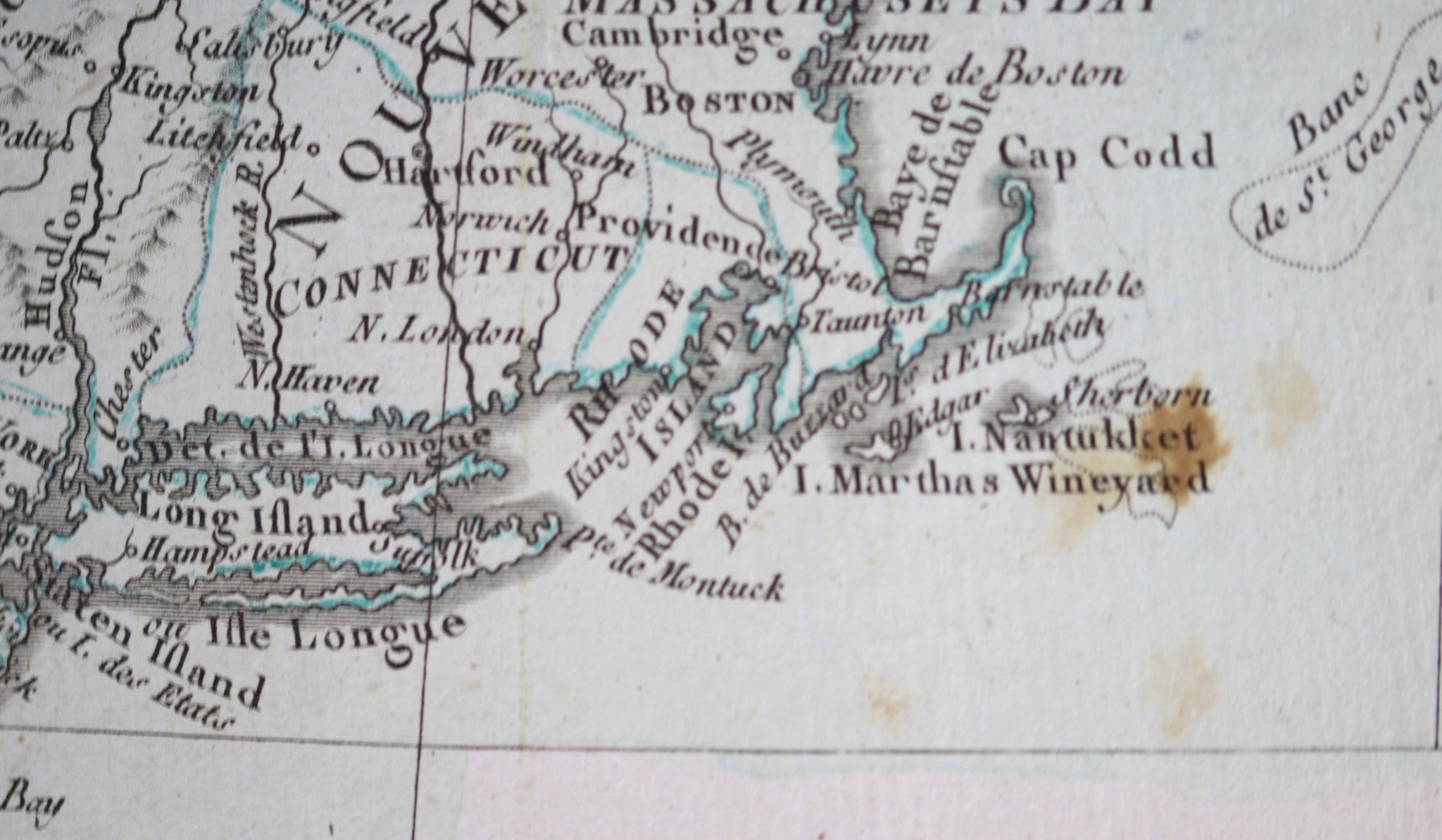
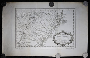
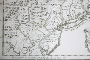
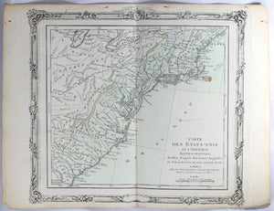
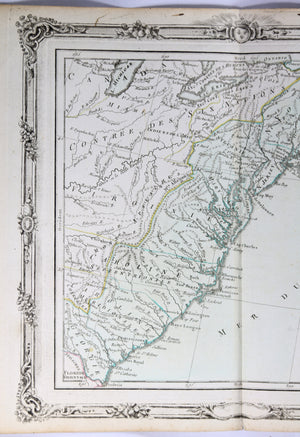
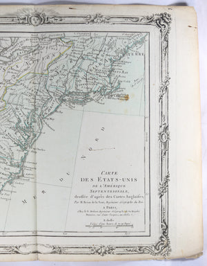
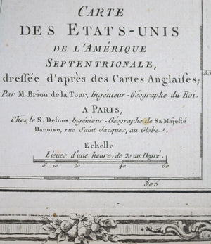
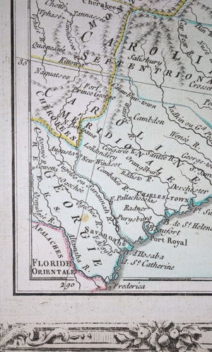
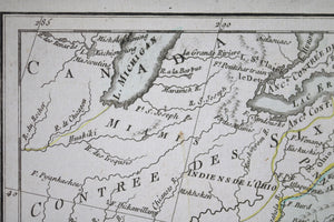
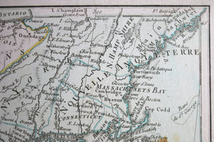
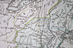
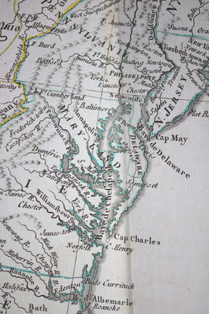
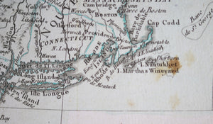
French map: Carte des États-Unis de l’Amerique Septentrionale, dressée d’après des Cartes Anglaises Par M....


$400.00 CAD
| /
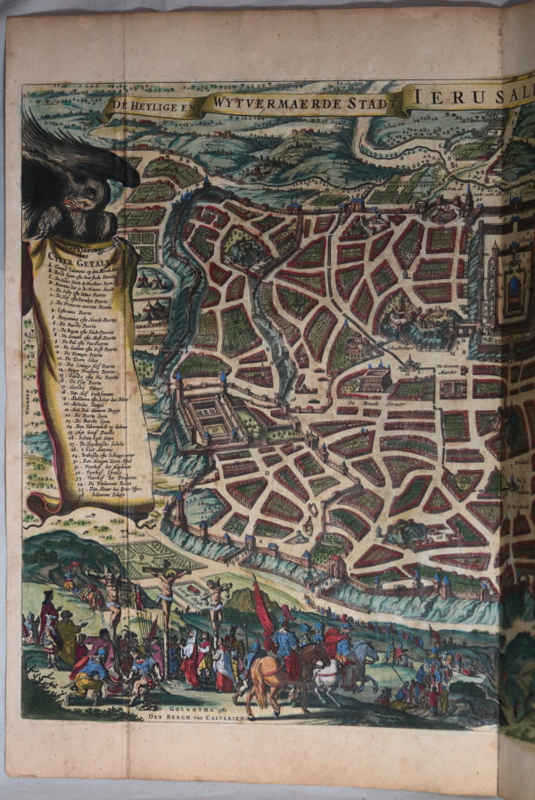
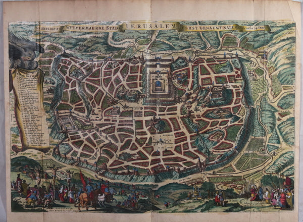
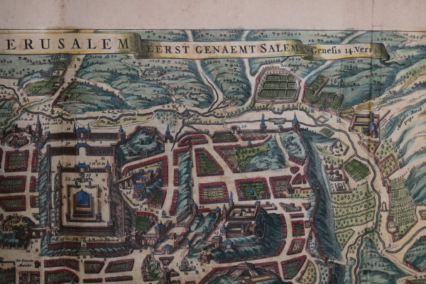
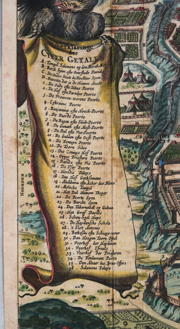
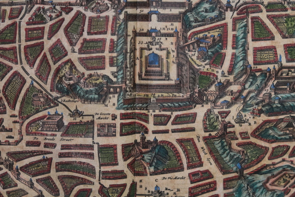
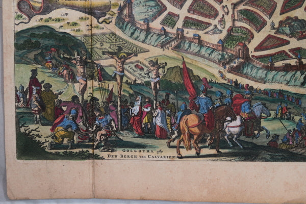
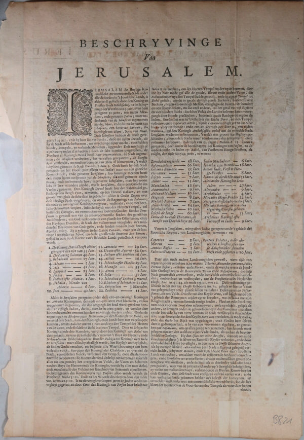
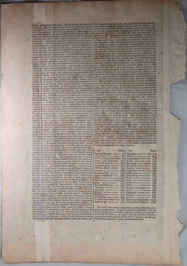
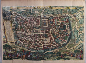
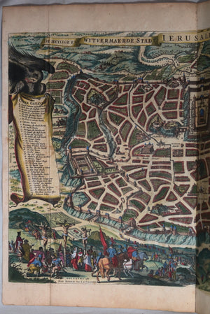
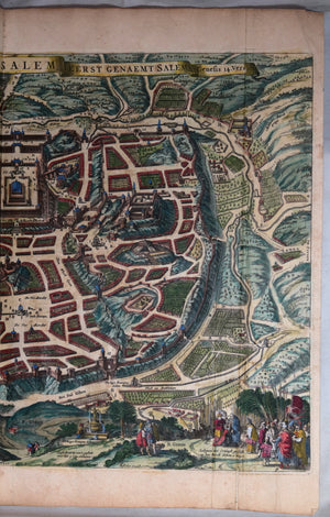
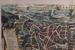
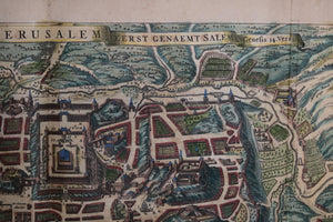
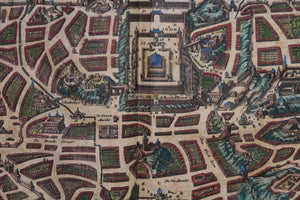
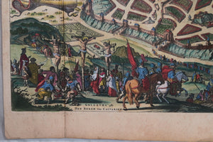
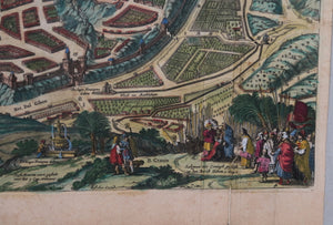
Imaginary, detailed bird's-eye view of the city, with 36 important locations from the Bible identified...


$65.00 CAD
| /
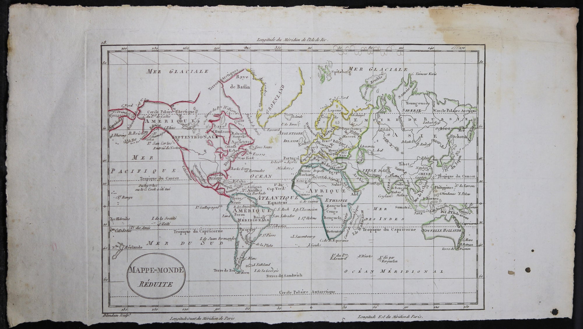
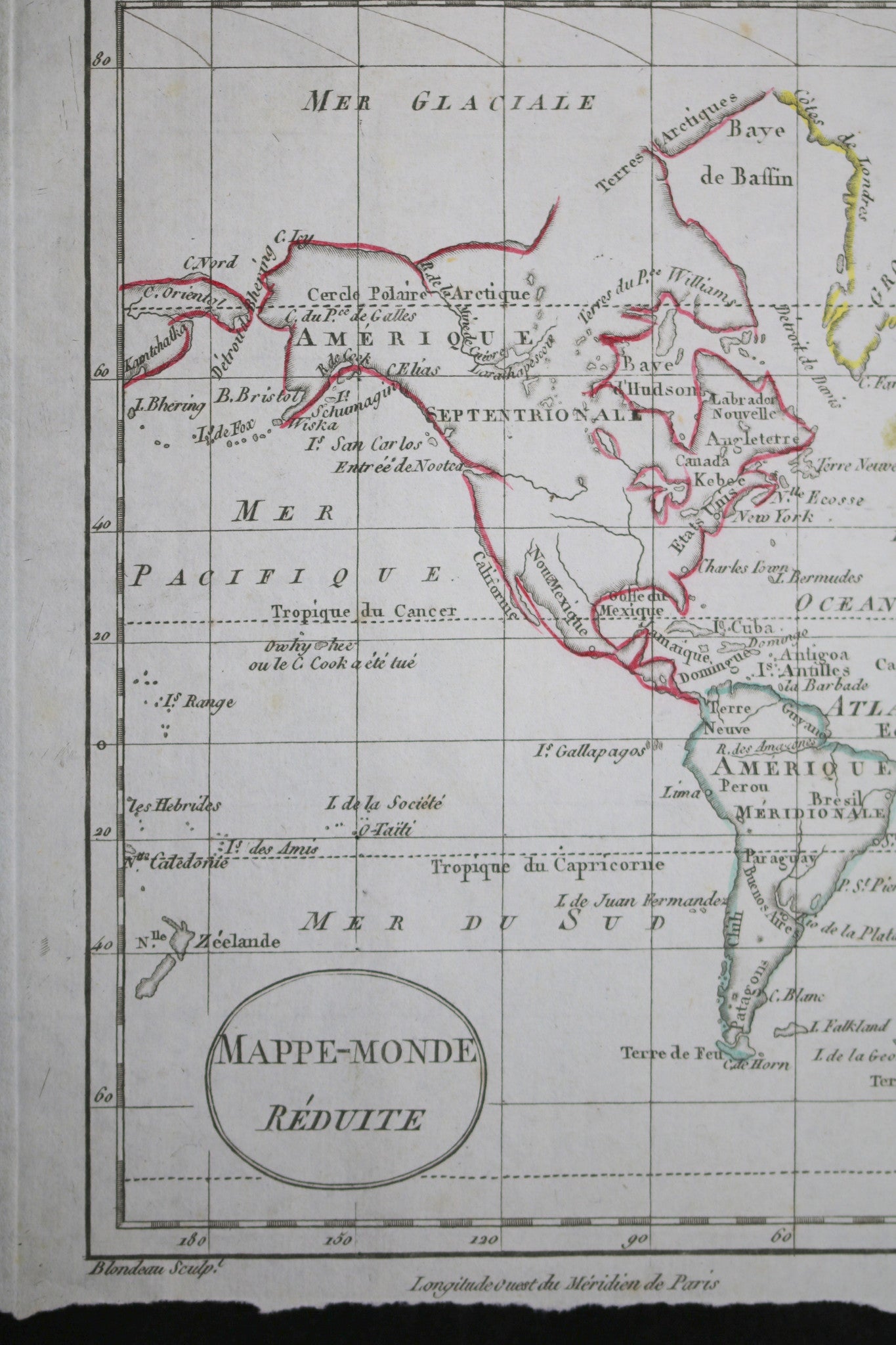
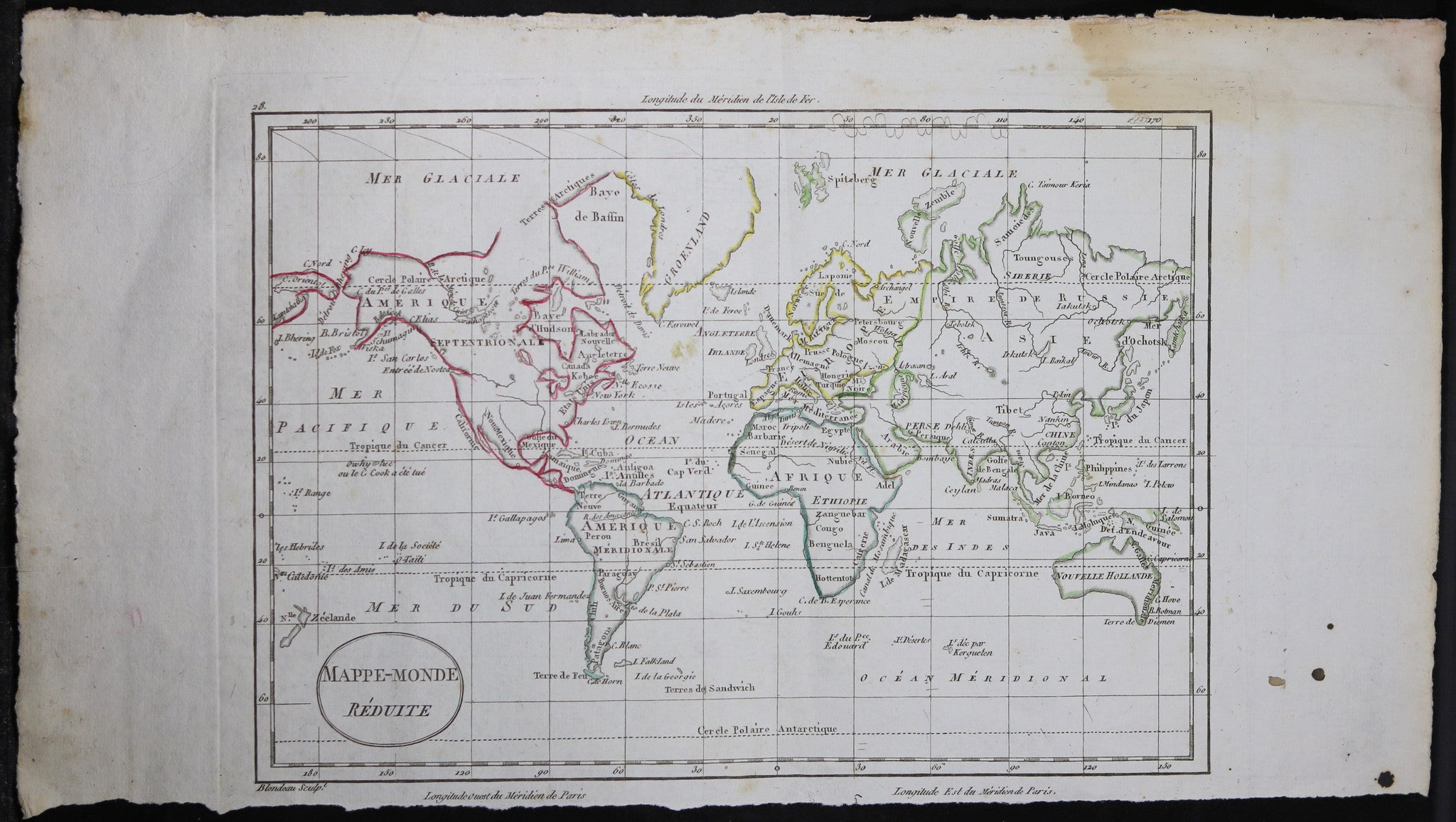
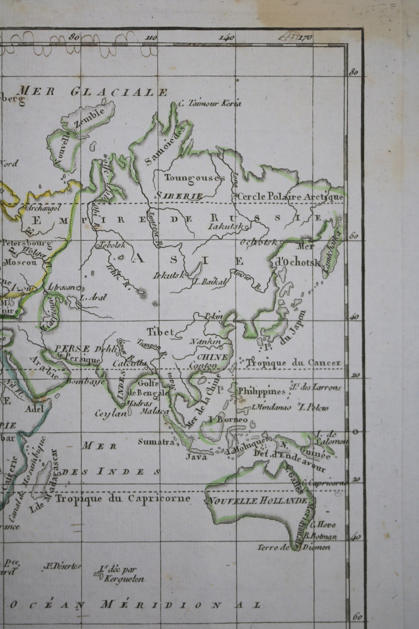
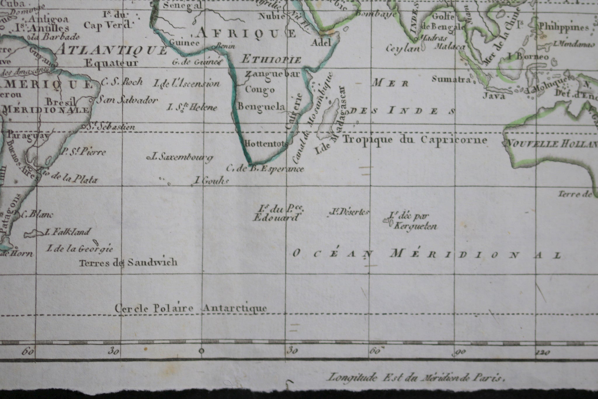
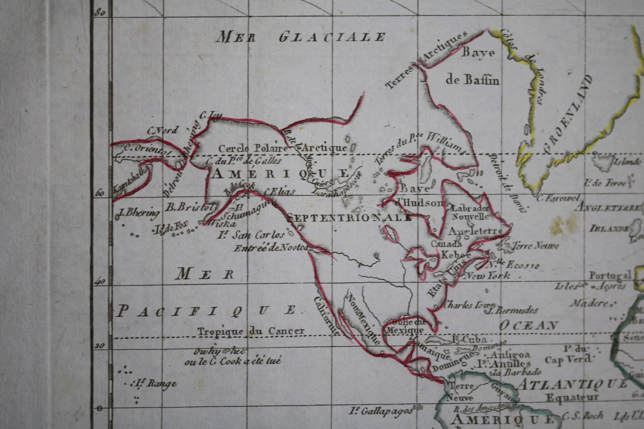
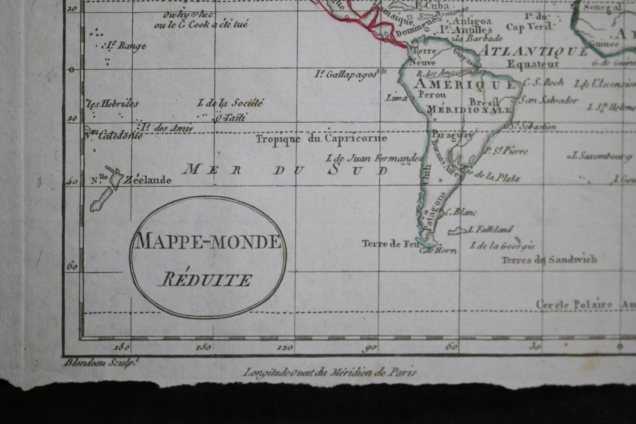
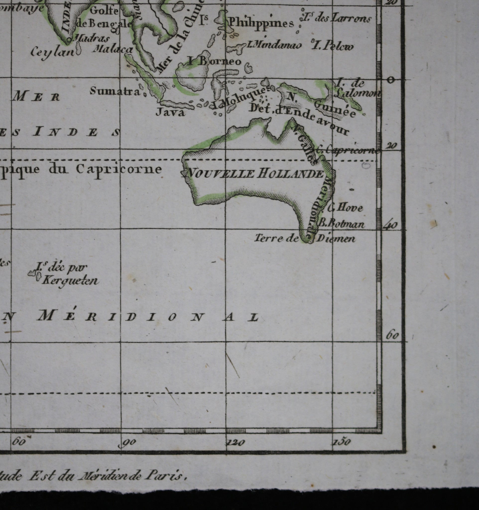
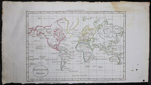
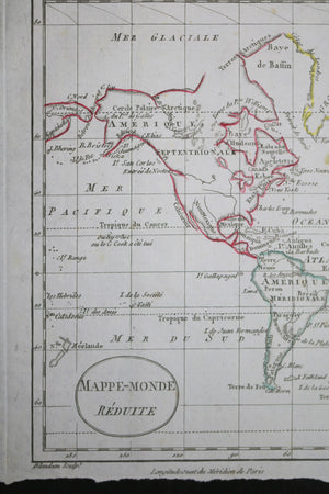
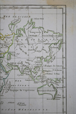
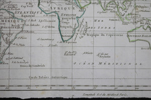
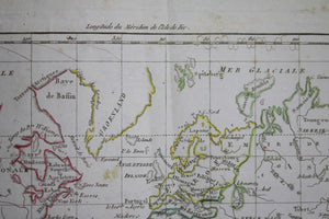
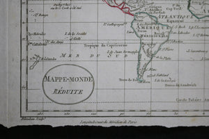
‘MAPPE-MONDE Réduite’ sculpté par Blondeau. Provient du livre ‘Atlas Universel pour la Géographie' de William...
$75.00 CAD
– Sold Out| /
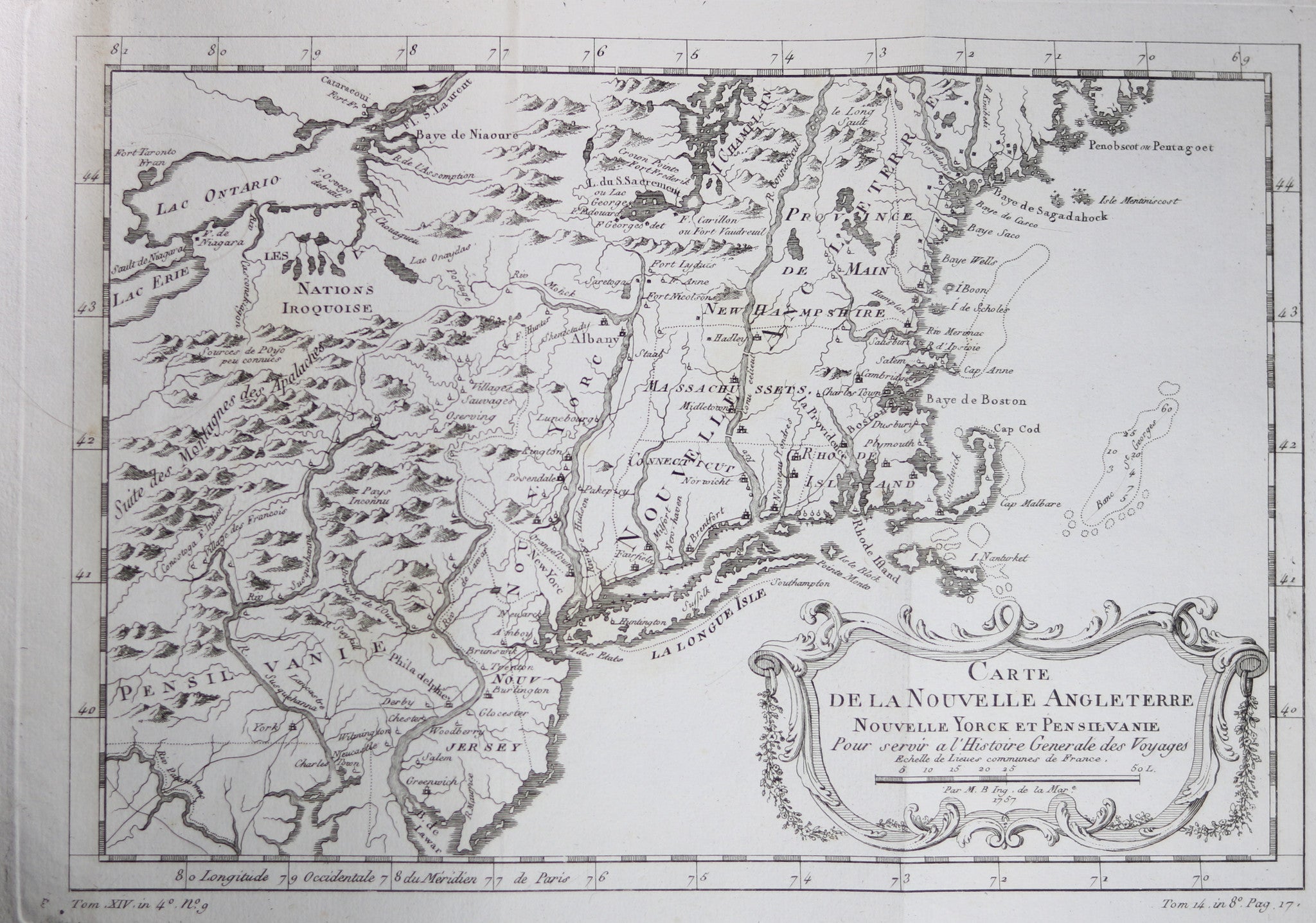
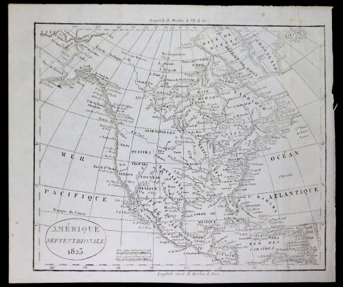
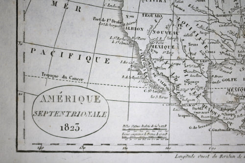
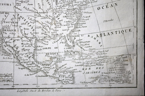
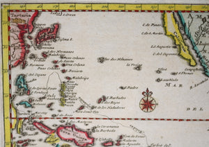
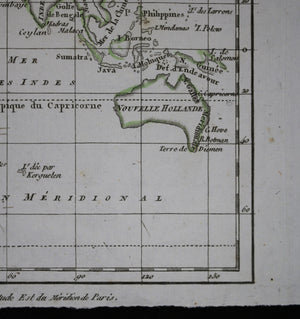
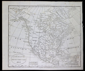
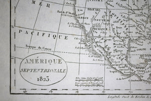
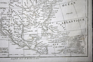
Cartouche has 'AMERIQUE SEPTENTRIONALE 1823'. Legend has distances in both English miles and French leagues....


$50.00 CAD
| /
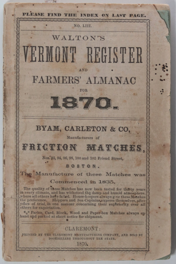
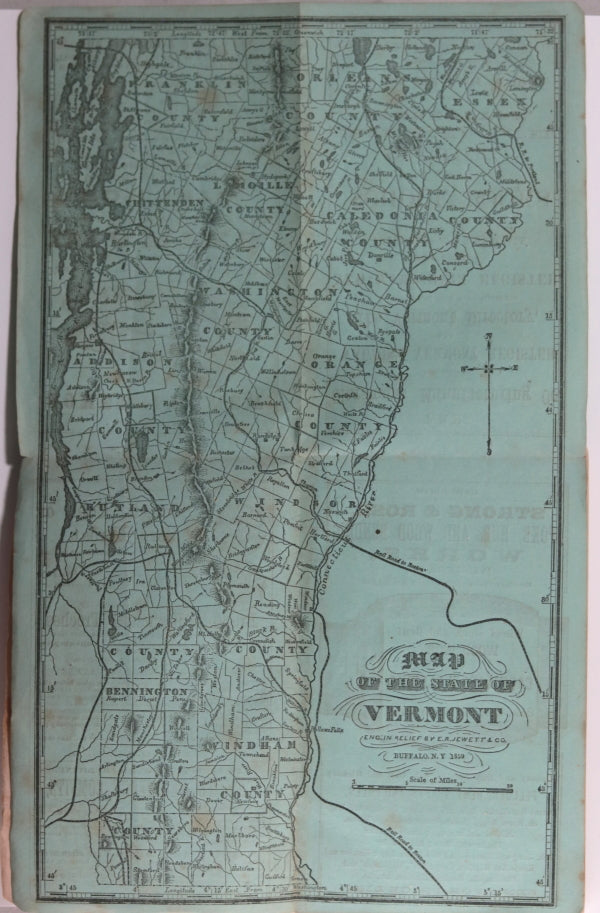
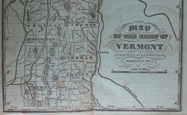
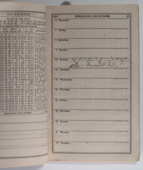
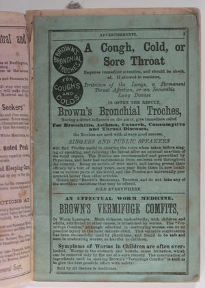
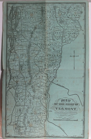
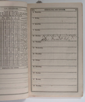
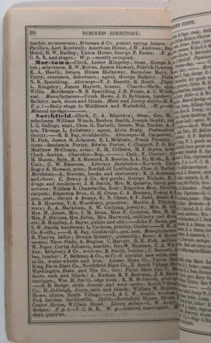
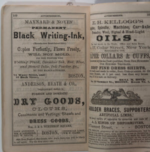
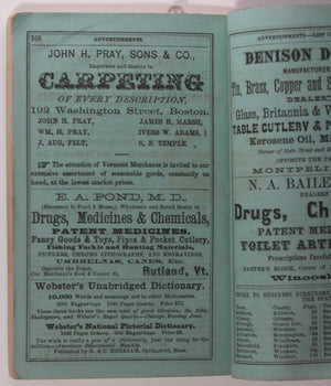
Nice early Vermont almanac with zodiac, daily sunrise/sunsets, towns of the state and their local...


$15.00 CAD
| /
Nice tourist map of Montreal from the late 1940s. Montreal Paris of the New World...


$155.00 CAD
– Sold Out| /
Woodblock map from Sebastien Munster’s Cosmographia, most likely from the 1558 German version. Titled in...