
$200.00 CAD
| /
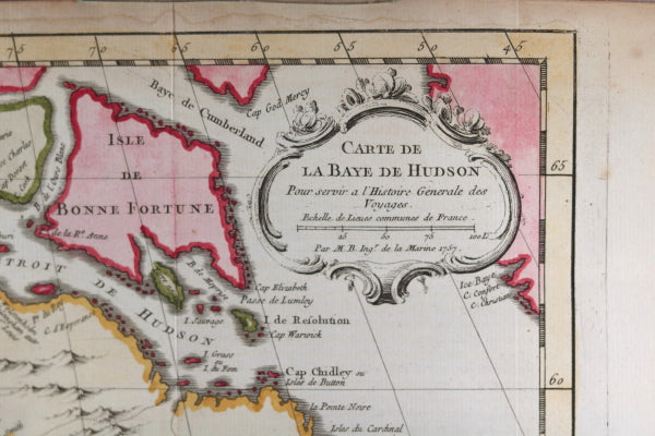
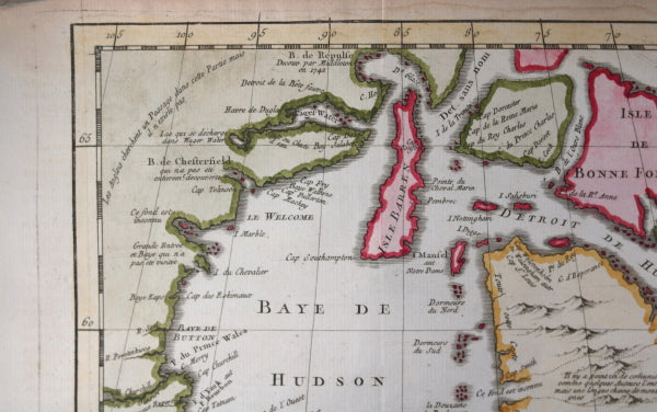
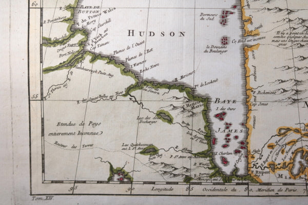
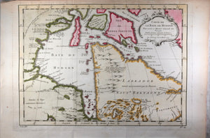
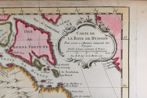
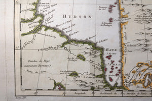
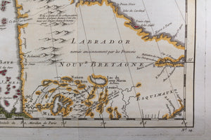
Hand-coloured map of the Hudson Bay area of Northern Canada. Shows Hudson Bay, James Bay, Labrador (previously called New Brittany by the French).
One area of Quebec labelled ‘Esquimaux’. Parts of present day Manitoba labelled ‘Land entirely Unknown’.
Created by Jacques Bellin, famous cartographer, and done for Abbé Prevost's work Histoire Générale des Voyages.
Inside decorative cartouche:
Below map, book volume # that it was inserted into, and map #:
Tom XIV No. 14
Copper-plate engraving.
Folds as issued, to fit into book: vertical and horizontal folds. Toning upper border, right edge. UL corner creased.
Map paper is rounded, was stored in tube.
25.5 x 32 cm.
Jacques Nicolas Bellin (1703 – 21 March 1772) was a French hydrographer, geographer, and member of the French intellectual group called the philosophes.
Bellin was born in Paris. He was hydrographer of France's hydrographic office, member of the Académie de Marine and of the Royal Society of London. Over a 50-year career, he produced a large number of maps of particular interest to the Ministère de la Marine. His maps of Canada and of French territories in North America (New France, Acadia, Louisiana) are particularly valuable. He died at Versailles.
Bellin contributed a number of maps to 15-vol. Histoire Generale des Voyages of Antoine François Prévost or simply known l'Abbe Prevost.
WIKIPEDIA