$250.00 CAD
| /
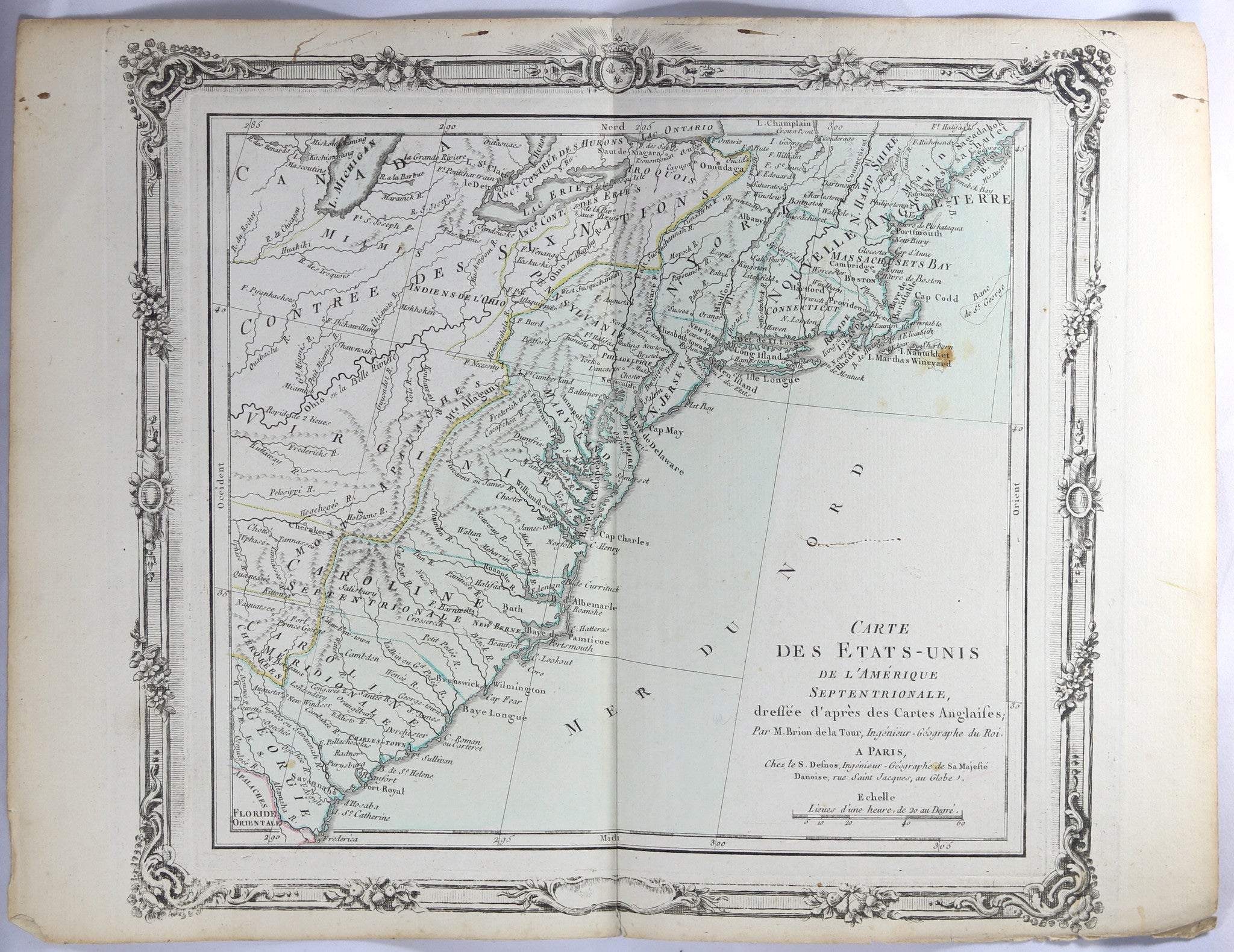
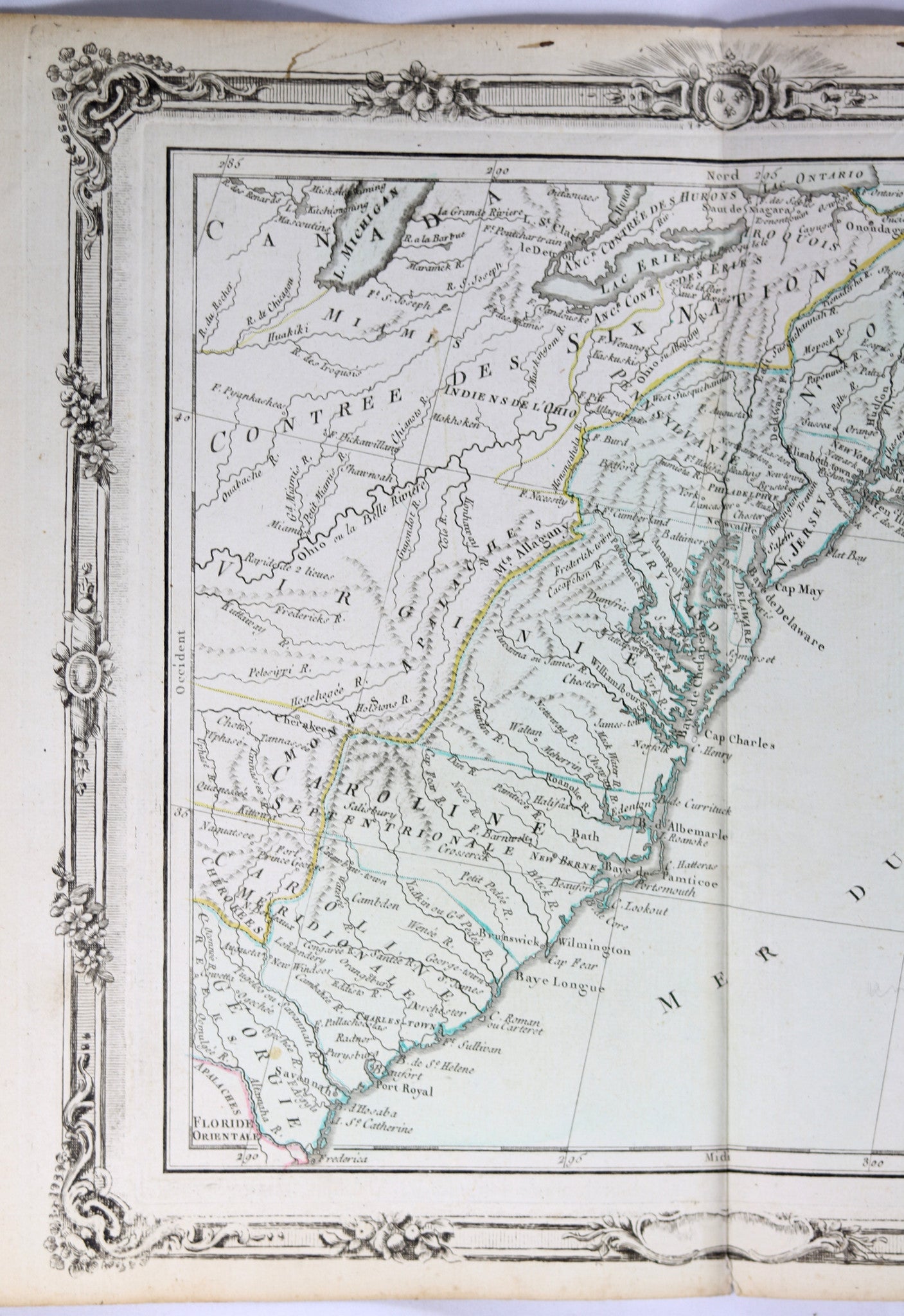
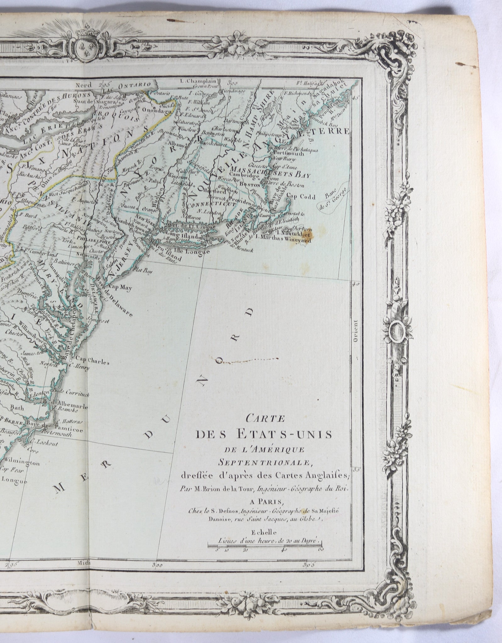
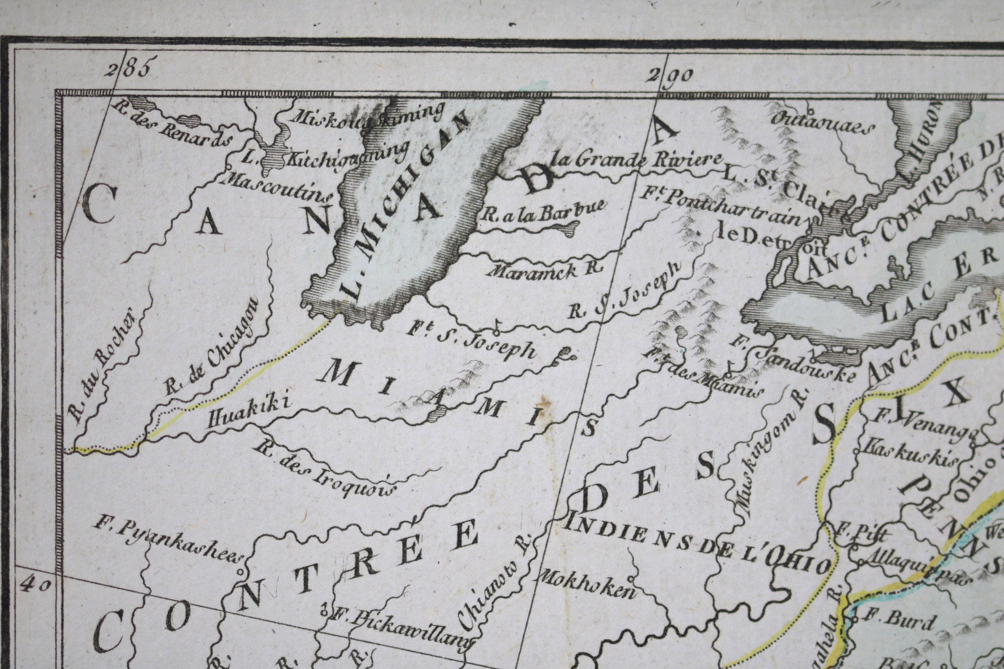
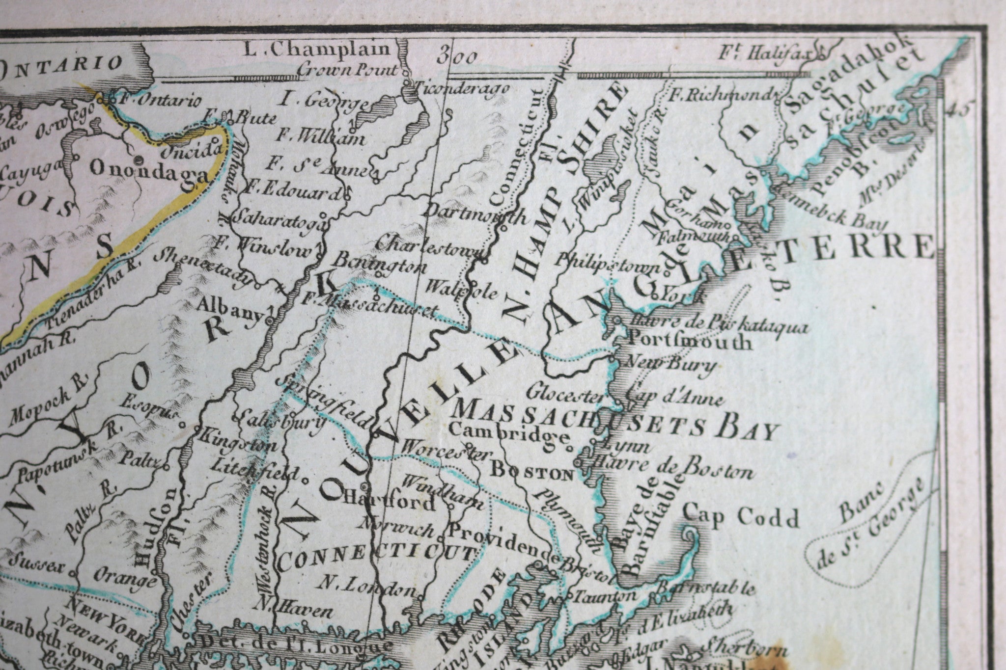
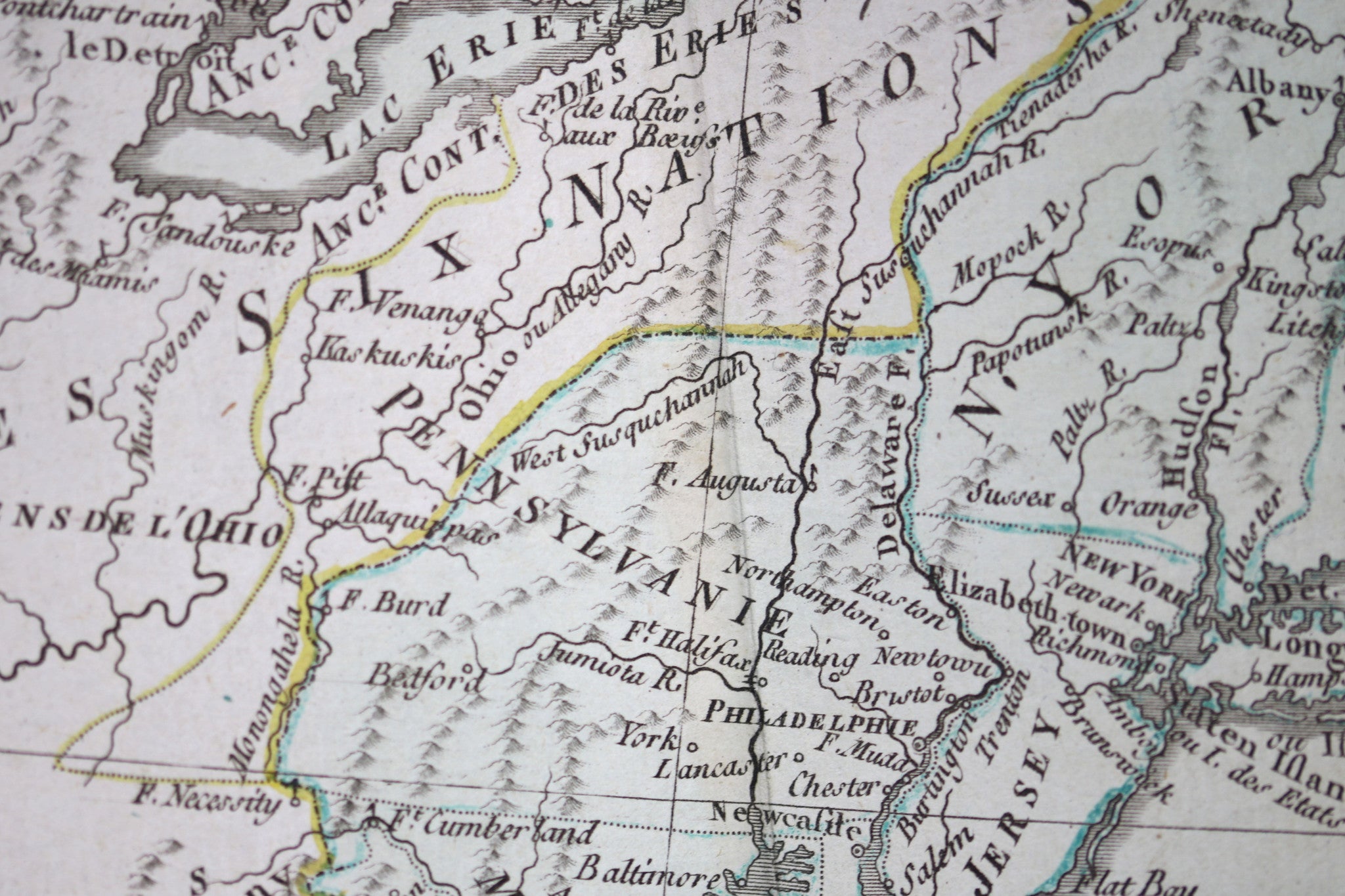
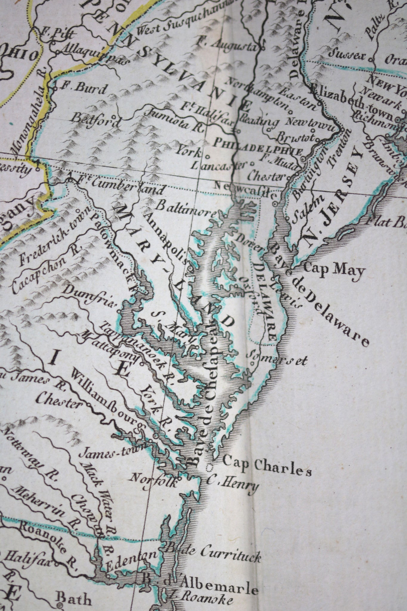
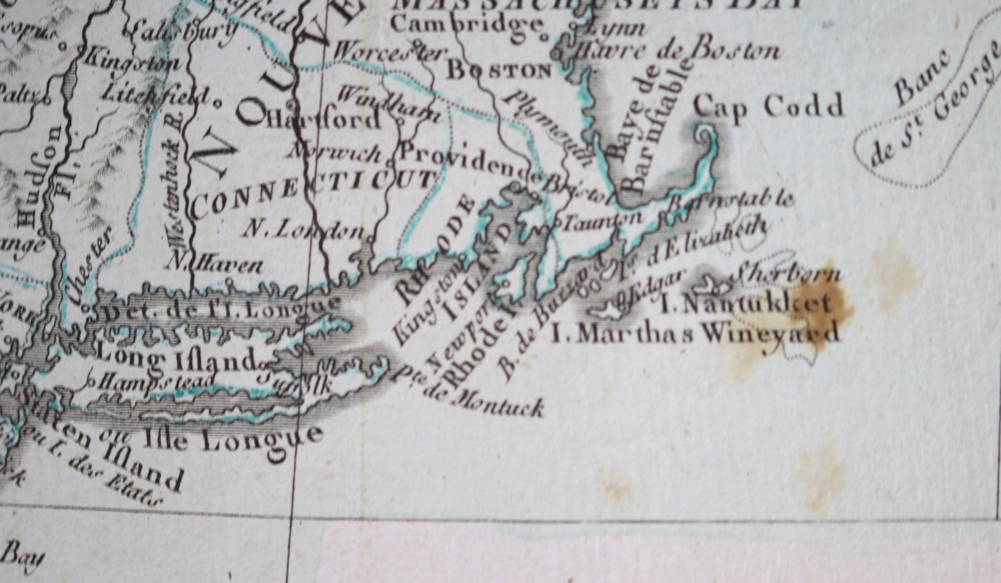
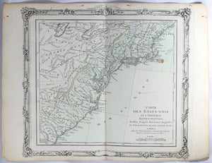
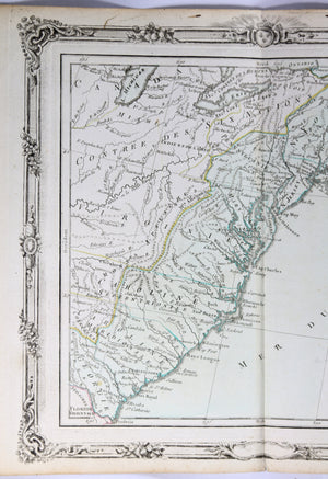
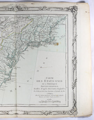
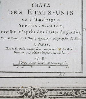
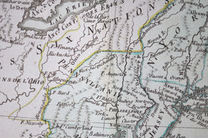
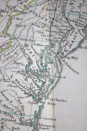
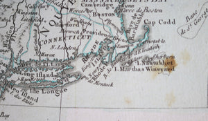
French map:
Nice hand-coloured. Border has elaborate calligraphy.
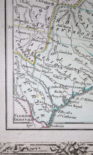
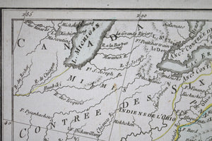
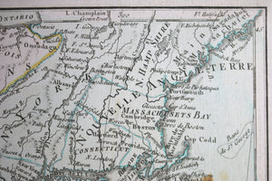
Map goes from Maine down to Georgia, and inland to Lake Michigan.
Indian tribes listed on map (Apaches, Cherokees…), forts (e.g. Fort Detroit, Fort Cumberland…).
West of Appalachians called ‘Six Nations Country’.
Condition VG+: Folded vertically. Small tear along fold at bottom. Paper yellowed along edges. Rust spot over Nantucket. Some small ink stains. Little tears along bottom border.
11.25” x 15"
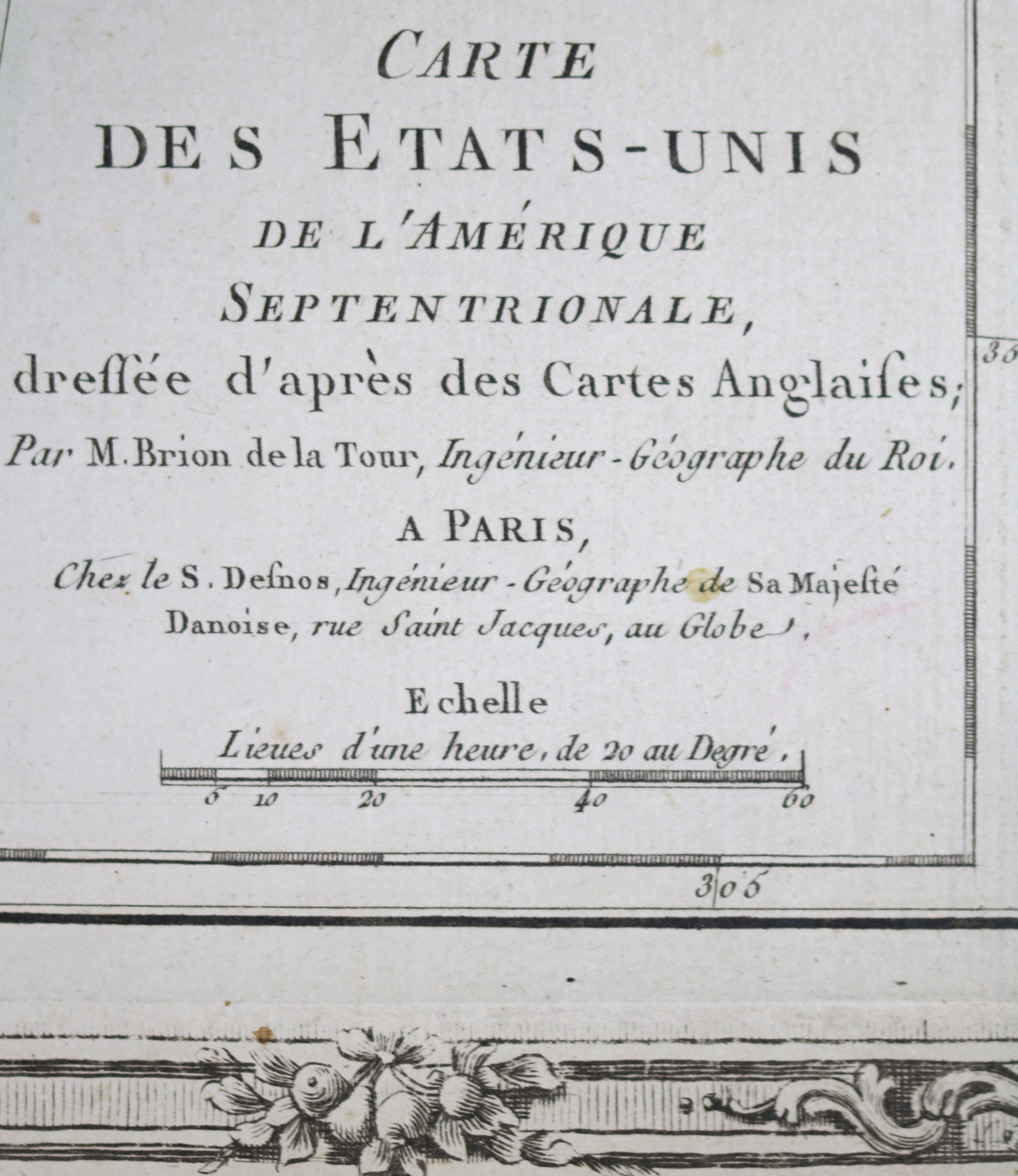
Louis Brion de la Tour (1756-1823) was the Cartographer Royal to the King of France.
There is little information about his life. His official title was "King's Engineer Geographer." Although he is a prolific geographer, very little is currently known of his life or his career. His life was spent in scientific work. However what is known is an important part of his work was done in collaboration with Louis Charles Desnos (1750-1790 to) a bookseller and geographical engineer for the globes and spheres of His Danish Majesty.