

$625.00 CAD
| /
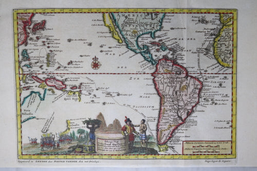
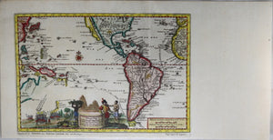
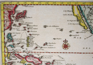
Visually appealing map illustrating the voyage of Magellan from Spain, through the Straits of Magellan and on to Southeast Asia, where he was killed, prior to the completion of the circumnavigation by his second in command.
Magellan was among the crew of the Portuguese squadron of five ships under Sequeira which sailed into Melaka on September 1, 1509, and became the first Europeans to have contact with the Malay Peninsula.
The map was used to illustrate the Dutch translations of the travel account of Diego Lopez de Sequeira.
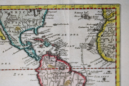
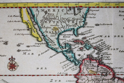
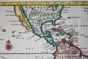
Interesting note: California was thought to be an island!
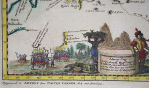
Nice image of Magellan and natives of the Pacific at the bottom. Written in the title cartouche: ‘Scheeps-Togt door Ferdinand Magellaan uit Kastilien gedaan na R. de laPlata en van daar door zyn Ontdekte Straat tot aan de Moluccas’
At bottom left, in margin: ‘Vytgevoerd te LEYDEN door PIETER VANDER Aa met Privilegie.’
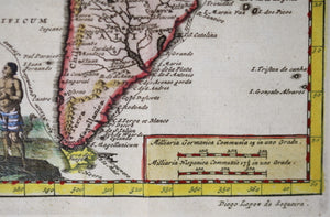
At bottom right, in margin: ’Diego Lopez de Sequeira’
Hand-colored.
Vertical fold, for insertion into volume.
Map: 6” x 8 ½”
Paper: 6 ⅞” x 13 ¼”
Pieter van der Aa (1659-1733) was a Dutch mapmaker and publisher who printed pirated editions of foreign bestsellers and illustrated books, but is best known for his voluminous output of maps and atlases.
Vander Aa was one of the most prolific compilers of information on the early explorations to America, Asia and Africa. In total, the work reached 130 narratives, which were offered in 28 8vo volumes.