

$400.00 CAD
| /
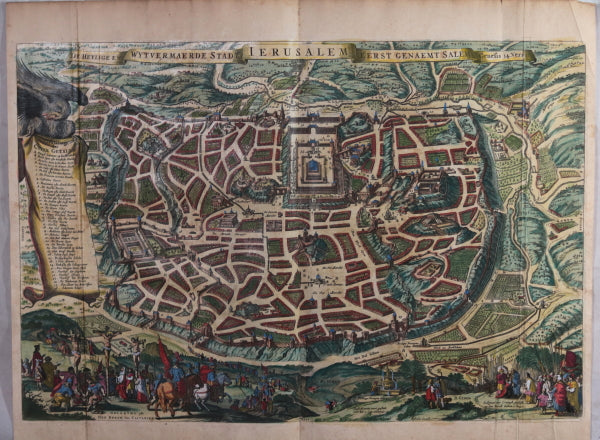
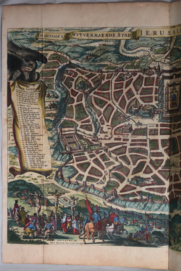
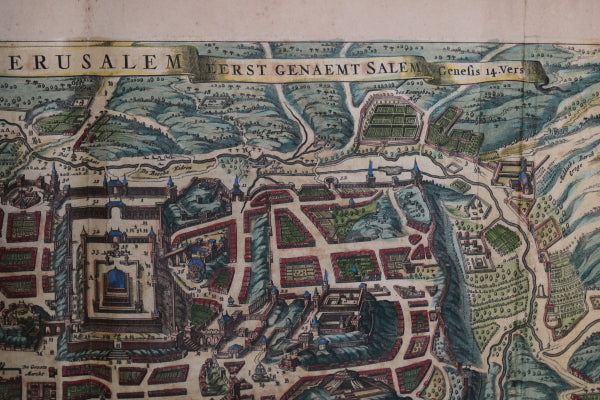
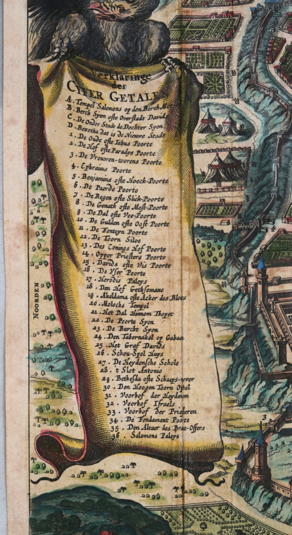
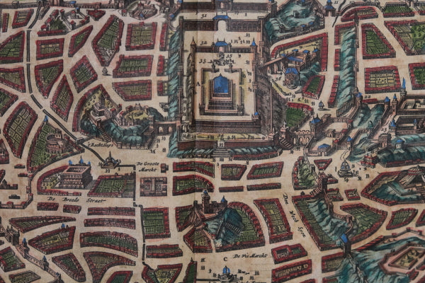
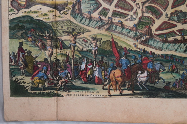
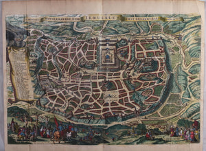
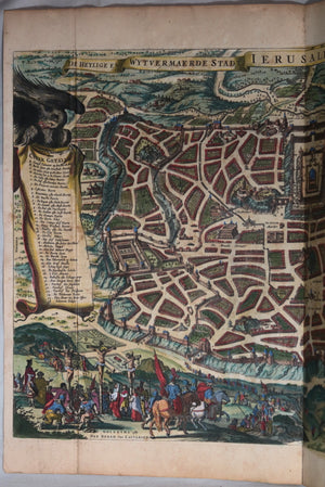
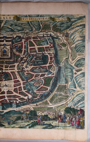
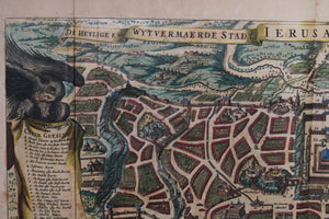
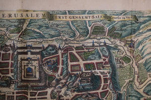
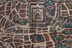
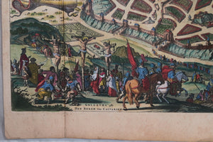
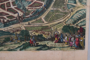
Imaginary, detailed bird's-eye view of the city, with 36 important locations from the Bible identified by name on a scrollwork legend held up by an eagle. The sites include Solomon’s Temple (upper center), the walls and gates of the city, the crucifixion at Golgotha, or Calvary (bottom left), Berch Gihon, where King Solomon was anointed by Zadok the priest (bottom right), and Herod’s Palace (far left). North is oriented towards the left.
Stated to be from 1648, but there are several later versions.
Titled: ‘De Heylige en Wytvermaerde Stadt Ierusalem Eerst Genaemt Salem Genesis 14, Vers 18’ ( 'The holy and expanded city of Jerusalem, first known as Salem, Genesis, Chapter 14, Verse 18').
At bottom ‘Visscher Excud' ('Visscher publisher').
The inscription near the base in the center explains that the map was to appear in a Bible before the book of Nehemiah, Chapter 3. Map is folded vertically for binding into the Bible.
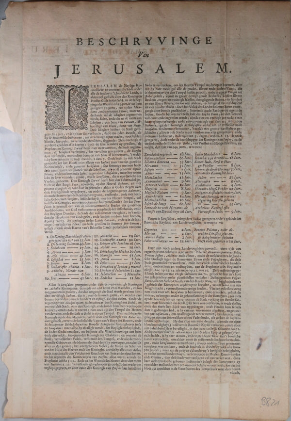
Text on back of map titled “Beschryvinge Van JERUSALEM’ ('Description of Jerusalem’).
Copper engraving, hand-coloured
Tape supporting lower left and right sides of map (on text side). Text sides toned.
15” x 19 ¼”
Visscher, his son Nicolaes, and his grandson Nicolaes II were important art and map dealers in Amsterdam for about 100 years, beginning in the early 17th century. The Visschers worked primarily as art dealers, but they were also publishers who produced individual maps and compiled atlases to order. Their works are noteworthy for their fine engraving, the accuracy of the maps, and the beautiful illustrations. Two of the leading artists who worked on Visscher maps were Abraham van den Broeck (1616‒88) and Nicolaes Berchem (1620‒83). This map was long one of the most popular views of Jerusalem to circulate in Europe.