$40.00 CAD
| /
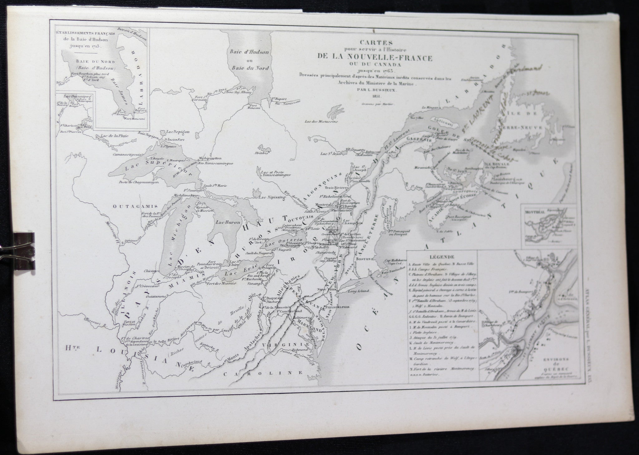
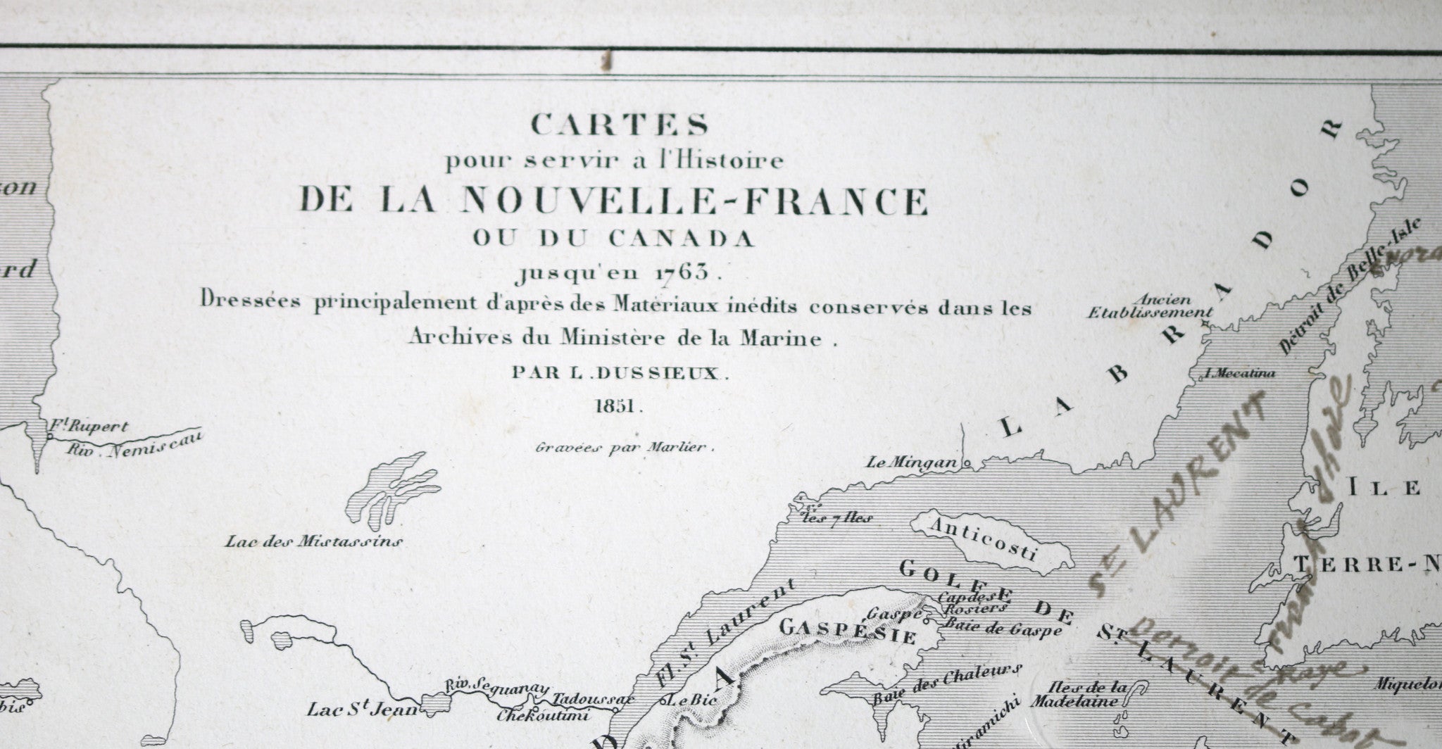
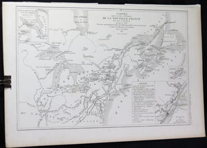
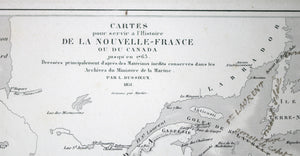
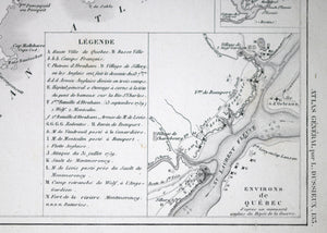
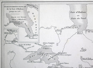
Map titled:
Maps serving to present history of New-France, or Canada, up to 1763. Created principally from unpublished materials conserved in the archives of the Ministry of the Marine. Created by L. Dussieux, engraved by Marlier.
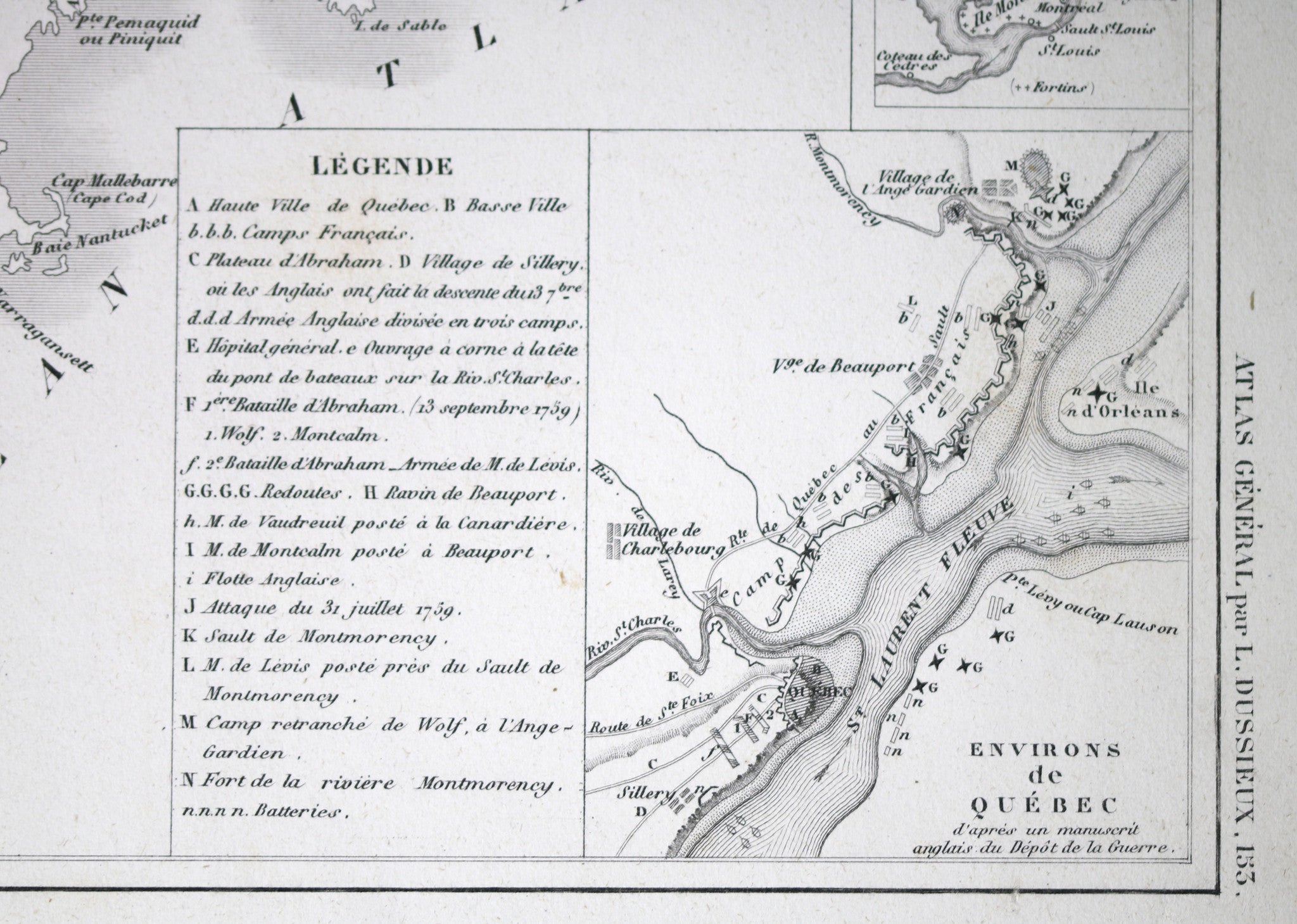
'ATLAS GENERAL par L. DUSSIEUX 153‘ from book 'Atlas General’ de Geographie Physique, Politique et Histoire' by L. Dussieux, page 153.
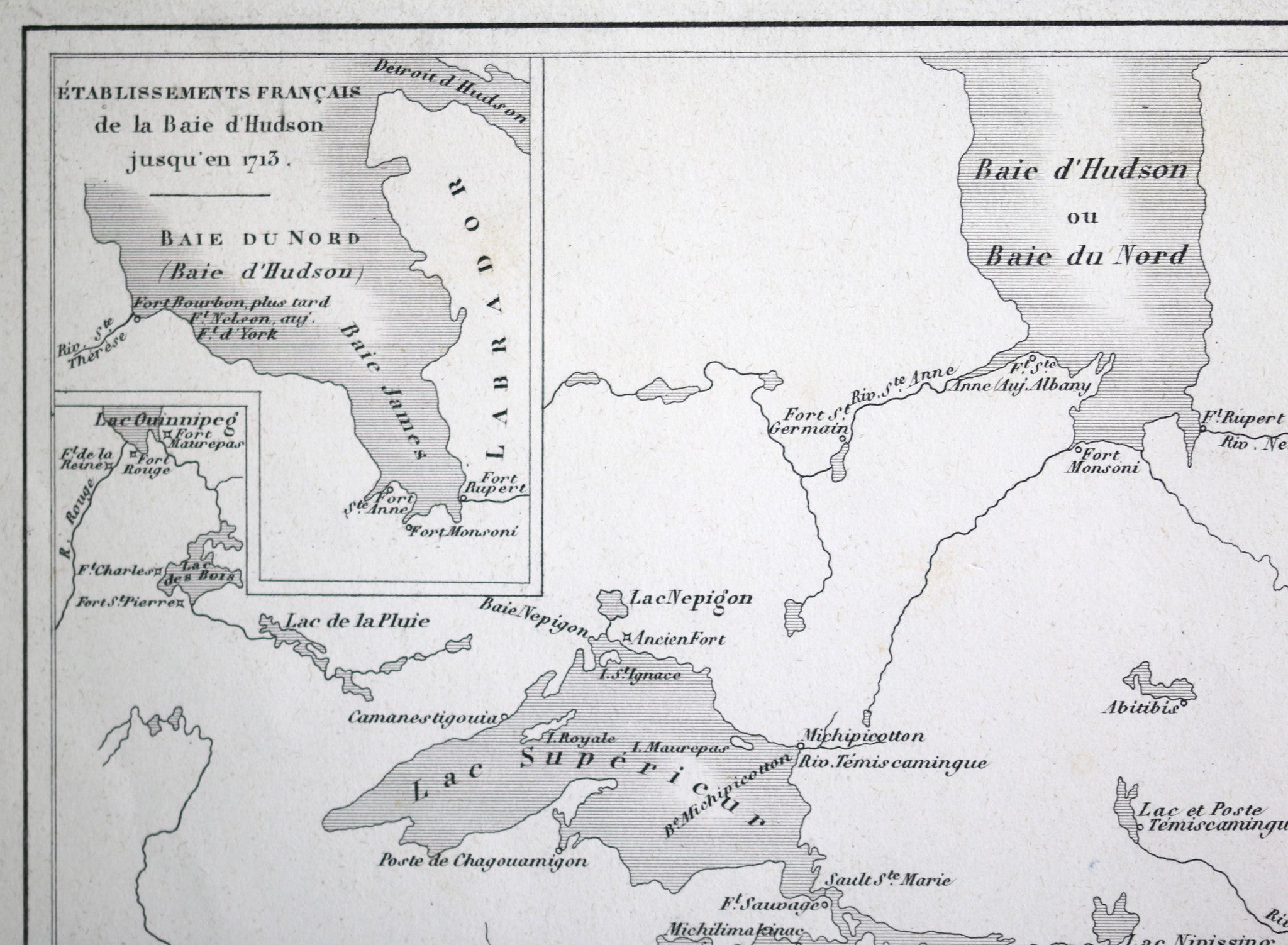
Shows Forts existing during that period, rivers, Indian tribes. Drawing LR with blow-up of Quebec City area, smaller one of Montreal area. Drawing UL with French settlements around Hudson Bay, up to 1713.
Some pen corrections and notes near Newfoundland.
Cuts on top edge where removed from book. Crease LL corner. Some yellowing along edges.
22.5 x 33.5 cm / 9” x 13.25”
Louis-Étienne Dussieux, born April 5 1815, died 11th February 1894, was a French historian and geographer.
WIKIPEDIA